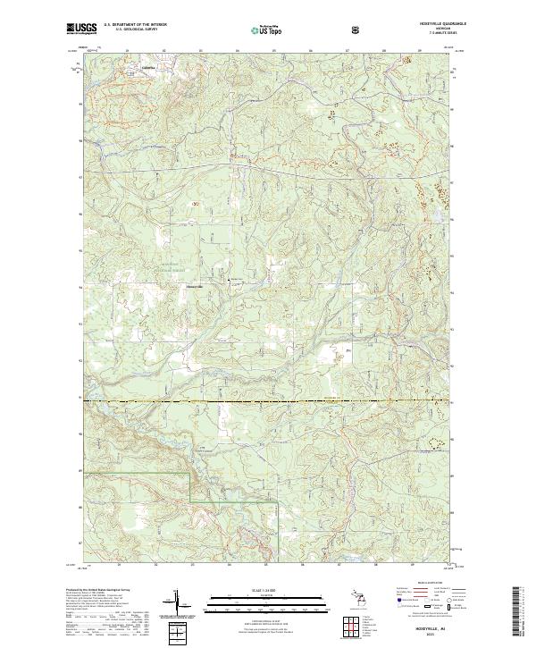
2023 Map of Hoxeyville
USGS Topo · Published 2023About this map
Hoxeyville and Caberfae serve as the primary human outposts within this heavily forested section of the Manistee National Forest. This modern topography reflects a landscape defined by recreational trail networks and conservation, particularly along the Pine Wild and Scenic River. The terrain is etched with specialized routes, from the Mackenzie Mountain Bike Trl in the north to the Lincoln Hills Motorcycle Trl and Silvercreek Pathway in the south. Local history is anchored by the Banker Cem, located just north of Hoxeyville, while the drainage of the area is managed by several tributaries including Hoxey Creek, Poplar Creek, and Silver Creek. The map illustrates the boundary between Wexford and Lake Counties, highlighting the transition from the upland forest tracts toward the designated scenic river corridor.
Find a feature on this map
47 named features on this map. Tap any name to fly to it.
Don’t see what you’re looking for? This feature index may not catch every label — zoom into the map to look around manually.
Map Details
Editions of this 2023 Hoxeyville Map
This is the sole edition of this map. No revisions or reprints were ever made.
Other maps of this area

1933 · Peacock SE
USGS Topo · 1:31,680

1933 · Luther SE
USGS Topo · 1:31,680

1933 · Peacock NE
USGS Topo · 1:31,680

1933 · Luther SW
USGS Topo · 1:31,680

1933 · Luther NW
USGS Topo · 1:31,680

1954 · Traverse City
USGS Topo · 1:250,000

1956 · Mesick
USGS Topo · 1:62,500

1957 · Copemish
USGS Topo · 1:62,500

1957 · Luther
USGS Topo · 1:62,500

1957 · Wellston
USGS Topo · 1:62,500