Old Maps of Otto, Minnesota for Hiking & Exploration
Hike through history with 11 historic maps of Otto. Explore old trails, ghost towns, and forgotten backroads — perfect for outdoor adventurers and local explorers.
- Rediscover forgotten places: Map out old mining camps, roads, and footpaths that no longer exist on modern maps.
- Layer with modern tools: Combine with LiDAR or satellite views to plan hikes through historical terrain.
- Made for exploration: Popular among hikers, overlanders, and local history lovers.
Use these maps to find adventure and explore the hidden past of Otto.
Otto, MN maps
(11)- 1919 Map of Fox
 1919 Fox1919 Print · USGSUpper Red Lake's eastern shoreline and the surrounding timbered wetlands are captured here during a period of massive drainage and reclamation. Genealogists and local historians can trace the early footprints of Waskish, Shotly, and Domaas, alongside the intricate network of Judicial Ditches that reshaped the land.
 - 1954 Map of Roseau, 1969 Print
 1954 Roseau1969 Print · USGSNorthern Minnesota's borderlands come alive in the 1950s, showing a landscape defined by timber, water, and rail. Trace family roots through old schools and cemeteries near Roseau, Warroad, and the expansive Red Lake Indian Reservation.2 unique versions available
 - 1957 Map of Roseau
 1957 Roseau1957 Print · USGSThe international border and tribal lands define Northern Minnesota in the mid-fifties, from the shores of Lake of the Woods to the Red Lake Indian Reservation. Researchers can trace the path of the Great Northern railroad and locate isolated outposts like the U S Custom House and Ponemah.
 - 1958 Map of Roseau
 1958 Roseau1958 Print · USGSNorthern Minnesota's borderlands and vast lake country are captured here in the late fifties. Researchers can trace the Canadian National rail line through Warroad or find family history in frontier settlements like Baudette, Waskish, and Shotley.
 - 1974 Map of Shotley Brook, 1976 Print
 1974 Shotley Brook1976 Print · USGSThe northeastern shores of Upper Red Lake come into sharp focus in the mid-1970s, revealing a landscape of remote state forests and small lakefront outposts. Researchers can trace the Old Indian Treaty Bdy and locate early settlements like Domaas and Otto.
 - 1977 Map of Upper Red Lake, 1978 Print
 1977 Upper Red Lake1978 Print · USGSNorthern Minnesota's massive basin and surrounding timberlands are documented here in the late seventies. Family historians and researchers can locate remote outposts like Ponemah, Waskish, and Wayland, or trace the network of fire lookouts including Pine Island Lookout Tower.
 - 2010 Map of Shotley Brook, 2010 Print
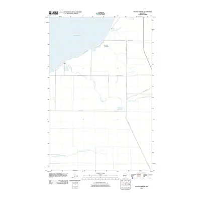 2010 Shotley Brook2010 Print · USGSCovers Otto, including Domaas, Beltrami County, and other nearby areas
 - 2013 Map of Shotley Brook, 2013 Print
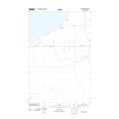 2013 Shotley Brook2013 Print · USGSCovers Otto, including Domaas, Beltrami County, and other nearby areas
 - 2016 Map of Shotley Brook, 2016 Print
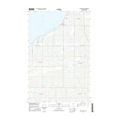 2016 Shotley Brook2016 Print · USGSCovers Otto, including Domaas, Beltrami County, and other nearby areas
 - 2019 Map of Shotley Brook, 2019 Print
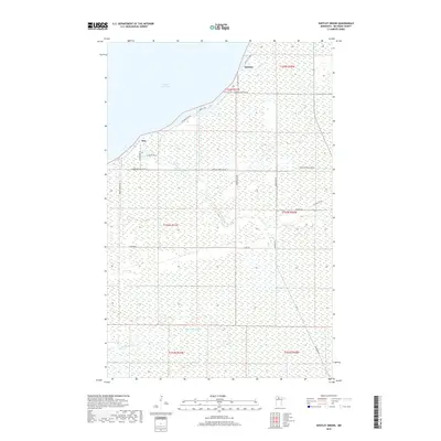 2019 Shotley Brook2019 Print · USGSCovers Otto, including Domaas, Beltrami County, and other nearby areas
 - 2022 Map of Shotley Brook, 2022 Print
 2022 Shotley Brook2022 Print · USGSThe shoreline of Upper Red Lake meets the wetlands of Beltrami County in this modern study of the northern Minnesota frontier. Genealogists and local historians can locate lakeside settlements like Domaas and Otto or trace the routes of Shotley Brook and Domaas Cr.
End of results
Showing maps 1-11 of 11
Top cities near Otto
- Kelliher historical maps
- Shooks historical maps
- Waskish historical maps
- Quiring historical maps
- Shotley historical maps
Frequently asked questions
- What are the different types of historical maps available for Otto?
- What is the oldest map of Otto?
- Where can I purchase historical maps of Otto for my home or office?
- Where can I download high-res historical maps of Otto?
- Are there historical topographic maps available for Otto?
- Is there historical aerial imagery available for Otto?
- Where are historical maps of Otto sourced from?