Old Maps of Graceville, Minnesota for Genealogy
Trace your family roots with 10 historic maps of Graceville. These high-res maps reveal old neighborhoods, homesites, landmarks, and streets — helping you uncover where your ancestors lived and how the area evolved over time.
- Explore historic neighborhoods: Identify where your relatives may have lived in the 1800s or 1900s.
- Compare maps over time: Trace the changes in streets, buildings, and landmarks for multi-generational research.
- Perfect for genealogy & ancestry research: Used by family historians and researchers to map out lineage and migration.
These maps are an incredible resource for exploring your personal connection to Graceville's past.
Graceville, MN maps
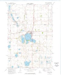
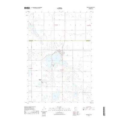
(10)- 1950 Map of Graceville
 1950 Graceville1950 Print · USGSBig Stone and Traverse counties come alive in this mid-century survey of the Minnesota prairie at the peak of its rail-and-farm economy. Local historians can trace the foundations of Graceville and identify vanished rural landmarks like Golden Rule Sch and the Trinity Sch.
 - 1953 Map of Milbank, 1958 Print
 1953 Milbank1958 Print · USGSThe tri-state border region of South Dakota, North Dakota, and Minnesota is shown here during the early fifties, a landscape defined by glacial lakes and the Sisseton Indian Reservation. Researchers can trace the legacy of the western railroads, locating old stops along the Great Northern and settlements like Milbank, Webster, and Sisseton.3 unique versions available
 - 1958 Map of Milbank
 1958 Milbank1958 Print · USGSThe northern Great Plains in the late fifties show a landscape of glacial lakes and reservation lands shaped by the Great Northern railroad. Genealogists and local historians can trace the grid of settlements from Britton to Milbank and locate landmarks like Enemy Swim Lake and the Sisseton Indian Reservation.
 - 1974 Map of Graceville, 1976 Print
 1974 Graceville1976 Print · USGSGraceville flourished as a vital rail crossroads in the 1970s, where two major lines met amidst a landscape of prairie potholes and productive farmland. Genealogists and local historians can trace the town layout near Graceville Cem, the secluded Big Stone Colony, and landmarks like Stanley Field.
 - 1985 Map of Wheaton
 1985 Wheaton1985 Print · USGSThe tri-state border region of Minnesota and the Dakotas is captured in the mid-1980s, defined by its prairie wetlands and rail-fed farming towns. Researchers can trace the Burlington Northern line through Wheaton and Graceville or locate family-named landmarks like Carlson Island.2 unique versions available
 - 2010 Map of Graceville, 2010 Print
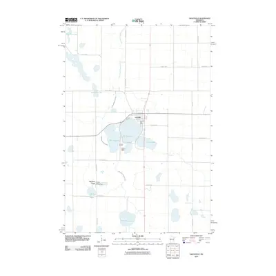 2010 Graceville2010 Print · USGSCovers Graceville, including Big Stone Hutterite Colony, Big Stone Colony, and other nearby areas
 - 2013 Map of Graceville, 2013 Print
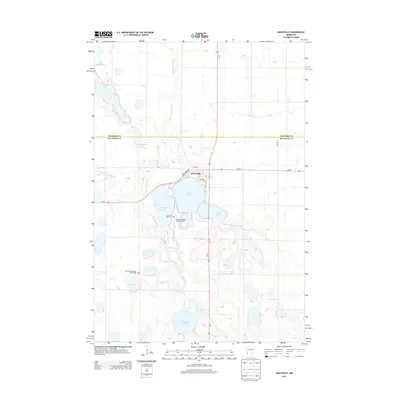 2013 Graceville2013 Print · USGSCovers Graceville, including Big Stone Hutterite Colony, Big Stone Colony, and other nearby areas
 - 2016 Map of Graceville, 2016 Print
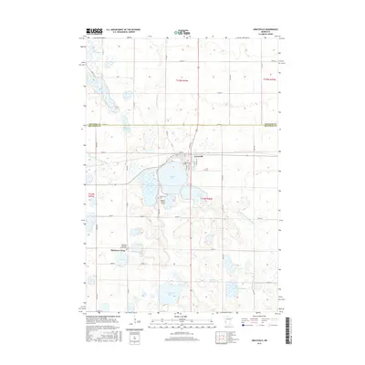 2016 Graceville2016 Print · USGSCovers Graceville, including Big Stone Hutterite Colony, Big Stone Colony, and other nearby areas
 - 2019 Map of Graceville, 2019 Print
 2019 Graceville2019 Print · USGSCovers Graceville, including Big Stone Hutterite Colony, Big Stone Colony, and other nearby areas
 - 2022 Map of Graceville, 2022 Print
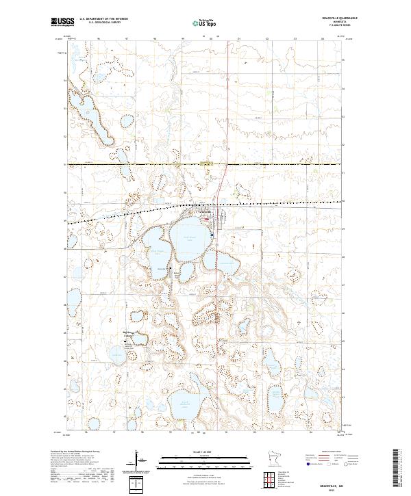 2022 Graceville2022 Print · USGSThe rural prairie of western Minnesota is shown here in the contemporary era, centered on the grid of Graceville. Genealogists and local historians can trace the town's modern layout and its proximity to Saint Marys Lake and the surrounding farmland.
End of results
Showing maps 1-10 of 10
Top cities near Graceville
Frequently asked questions
- What are the different types of historical maps available for Graceville?
- What is the oldest map of Graceville?
- Where can I purchase historical maps of Graceville for my home or office?
- Where can I download high-res historical maps of Graceville?
- Are there historical topographic maps available for Graceville?
- Is there historical aerial imagery available for Graceville?
- Where are historical maps of Graceville sourced from?