1990s Maps of New Ulm Mobile Village, New Ulm
Explore 2 historic maps of New Ulm Mobile Village from the 1990s. These maps offer a rare glimpse into what life looked like during the 1990s — showing old roads, neighborhoods, homes, and landmarks that have changed or disappeared over time.
Whether you're researching your family's past, planning a metal detecting trip, or studying how New Ulm Mobile Village's landscape evolved across the 1990s, these high-resolution maps are a powerful tool for exploring the history of this region.
- Focus on a specific era: All maps on this page are from the 1990s, giving you a focused view of this time period.
- See what’s changed: Compare century-old streets, trails, and buildings to today's modern landscape using overlays and satellite layers.
- Research with precision: Use these maps for genealogy, historical research, land use analysis, or educational projects.
- View, download, or print: Maps are fully viewable online in high resolution, and can be downloaded or printed for your own records.
Start exploring New Ulm Mobile Village's history through authentic maps from the 1990s. This is your window into the past.
New Ulm Mobile Village, New Ulm maps
(2)- 1991 Map of New Ulm
 1991 New Ulm1991 Print · USGSThe Minnesota River valley serves as the backbone for this late-century look at the agricultural heartland between New Ulm and Mankato. Researchers can trace the layout of traditional prairie towns like Sleepy Eye and Madelia or explore recreation sites at Fort Ridgely State Park.
 - 1992 Map of New Ulm, 1995 Print
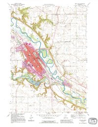 1992 New Ulm1995 Print · USGSThe river confluence at New Ulm comes into sharp focus during the 1990s, revealing a dense network of schools, churches, and civic landmarks. Researchers can trace the layout of Flandrau State Park, the Hermann Monument, and the rail-side settlement of Klossner.
End of results
Showing maps 1-2 of 2
Top cities near New Ulm Mobile Village
- New Ulm historical maps
- Lake Crystal historical maps
- Madelia historical maps
- Courtland historical maps
- Lafayette historical maps
- Hanska historical maps
See more
Frequently asked questions
- What are the different types of historical maps available for New Ulm Mobile Village?
- What is the oldest map of New Ulm Mobile Village?
- Where can I purchase historical maps of New Ulm Mobile Village for my home or office?
- Where can I download high-res historical maps of New Ulm Mobile Village?
- Are there historical topographic maps available for New Ulm Mobile Village?
- Is there historical aerial imagery available for New Ulm Mobile Village?
- Where are historical maps of New Ulm Mobile Village sourced from?