Old Maps of Remer, Minnesota for Metal Detecting
Plan your next treasure hunt with 12 historic maps of Remer. Find old homesites, ghost towns, trails, and gathering spots that may be lost to time — perfect for identifying promising metal detecting locations.
- Locate forgotten sites: Uncover places like long-lost settlements, abandoned rail lines, or gathering spots.
- Plan better hunts: Use map overlays combined with LiDAR or satellite views to narrow in on historically rich areas.
- Made for detectorists: Thousands of hobbyists use these maps to discover relics, coins, and hidden history.
Use these historic maps to boost your research and find new opportunities beneath the surface of Remer.
Remer, MN maps
(12)- 1954 Map of Hibbing, 1966 Print
 1954 Hibbing1966 Print · USGSNorthern Minnesota's Iron Range thrives during the mid-1960s, showing the industrial landscape between the Mesabi Range and the Mississippi River. Genealogists and historians can trace the rail lines of the Great Northern RR through mining hubs like Hibbing and Virginia.3 unique versions available
 - 1957 Map of Hibbing
 1957 Hibbing1957 Print · USGSNorthern Minnesota's Iron Range is shown at its industrial peak in the mid-fifties, dominated by the massive iron pits and rail corridors of the Mesabi Range. Researchers can trace the rail networks of the Duluth Missabe and Iron Range and locate mining hubs like Hibbing, Virginia, and Bovey.
 - 1958 Map of Hibbing
 1958 Hibbing1958 Print · USGSThe Mesabi Iron Range reached its mid-century height during this era, defining the landscape between Grand Rapids and Virginia. Genealogists and historians can trace the mining-town networks of Hibbing and Chisholm or locate numerous iron mines and rail spurs.
 - 1964 Map of Hibbing
 1964 Hibbing1964 Print · USGSNorthern Minnesota’s iron-rich corridor is captured here during a peak era of mid-century industrial activity. Researchers can trace the rail-to-mine connections through Mesabi Range towns like Hibbing and Virginia or locate lakefront settlements near Pokegama Lake.
 - 1971 Map of Remer, 1973 Print
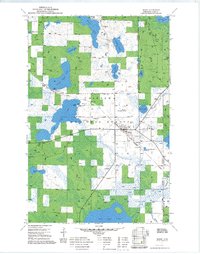 1971 Remer1973 Print · USGSRemer and the surrounding north-central Minnesota woodlands are captured here in the early 1970s as a hub for forestry and rail transport. Genealogists and historians can trace the Soo Line tracks through town, locate the Remer Municipal Airport, and explore the shorelines of Big Sand Lake and Little Sand Lake.2 unique versions available
 - 1992 Map of Pokegama Lake
 1992 Pokegama Lake1992 Print · USGSItasca County in the early nineties showcases the industrial pulse of the Iron Range and the vast waters of the north woods. Trace the rail lines of the Duluth Missabe and Iron Range Railway or locate old settlements like Wawina and Calumet.
 - 1996 Map of Remer, 1998 Print
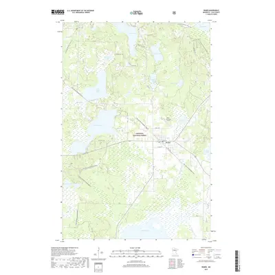
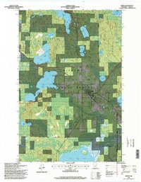 1996 Remer1998 Print · USGSRemer and the surrounding northern woods are shown in detail during the mid-nineties as the community developed within the Chippewa National Forest. Genealogists and local historians can locate the town Cemetery, Remer Municipal Airport, and numerous named waters like Wahneshin Lake.
 - 2011 Map of Remer, 2011 Print
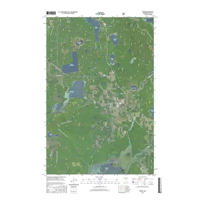
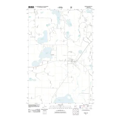 2011 Remer2011 Print · USGSCovers Remer, including Cass County, United States, and other nearby areas
 - 2013 Map of Remer, 2013 Print
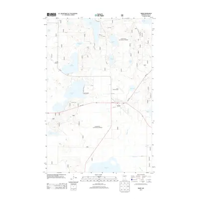 2013 Remer2013 Print · USGSCovers Remer, including Cass County, United States, and other nearby areas
 - 2016 Map of Remer, 2016 Print
 2016 Remer2016 Print · USGSCovers Remer, including Cass County, United States, and other nearby areas
 - 2019 Map of Remer, 2019 Print
 2019 Remer2019 Print · USGSCovers Remer, including Cass County, United States, and other nearby areas
 - 2022 Map of Remer, 2022 Print
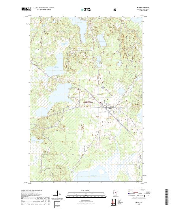 2022 Remer2022 Print · USGSRemer and the surrounding Northwoods are captured here in a period of recreational growth and forest management. Researchers can trace the town's layout and the transition of old rail lines into routes like the Soo Line Gta Snowmobile Trl near Big Sand Lake and Fairview Cem.
End of results
Showing maps 1-12 of 12
Top cities near Remer
Frequently asked questions
- What are the different types of historical maps available for Remer?
- What is the oldest map of Remer?
- Where can I purchase historical maps of Remer for my home or office?
- Where can I download high-res historical maps of Remer?
- Are there historical topographic maps available for Remer?
- Is there historical aerial imagery available for Remer?
- Where are historical maps of Remer sourced from?