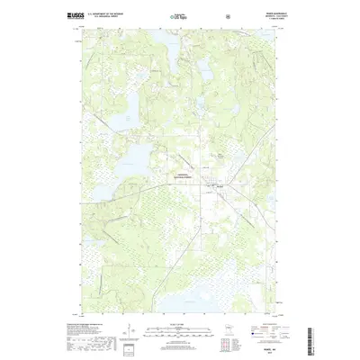
2019 Map of Remer
USGS Topo · Published 2019About this map
Remer serves as a central hub in this lake-rich portion of the Chippewa National Forest, where the intersection of water and trail systems defines the landscape. The town is situated near the Remer Municipal Airport and is surrounded by a dense network of significant water bodies, including Big Sand Lake, Grave Lake, and Folston Lake. This area of Cass County reflects a shift from early industrial use to modern recreation, as evidenced by the extensive trail systems that traverse the terrain.
Find a feature on this map
43 named features on this map. Tap any name to fly to it.
Don’t see what you’re looking for? This feature index may not catch every label — zoom into the map to look around manually.
Map Details
Editions of this 2019 Remer Map
This is the sole edition of this map. No revisions or reprints were ever made.
Other maps of this area

1953 · Duluth
USGS Topo · 1:250,000

1953 · Brainerd
USGS Topo · 1:250,000

1954 · Bemidji
USGS Topo · 1:250,000

1954 · Hibbing
USGS Topo · 1:250,000

1957 · Brainerd
USGS Topo · 1:250,000

1957 · Bemidji
USGS Topo · 1:250,000

1957 · Hibbing
USGS Topo · 1:250,000

1958 · Bemidji
USGS Topo · 1:250,000

1958 · Hibbing
USGS Topo · 1:250,000

1958 · Brainerd
USGS Topo · 1:250,000