
1957 Map of Hibbing
USGS Topo · Published 1957About this map
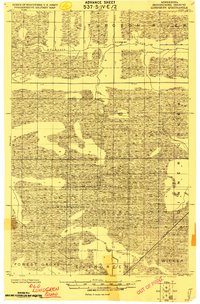
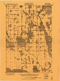
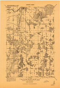
The Mesabi Range forms the industrial backbone of this Northern Minnesota landscape, where the iron mining economy is captured in its mid-century prime. Extensive mining infrastructure, including numerous iron mines and tailings ponds, defines the geography between Hibbing and Virginia. This heavy industry is balanced by the massive timber and recreational expanses of the Chippewa National Forest and Superior National Forest, which cover much of the western and eastern portions of the sheet. The transport of ore is central to the area's development, evidenced by the dense rail network of the Duluth Missabe and Iron Range and the Great Northern railroads. Beyond the industrial corridors, the map reveals a wilderness of water, from the complex shoreline of Vermilion Lake to the upper reaches of the Mississippi River near Grand Rapids. Settlements like Chisholm, Eveleth, and Keewatin are shown at a time when the Iron Range was a global center of mineral production.
Find a feature on this map
338 named features on this map. Tap any name to fly to it.
Don’t see what you’re looking for? This feature index may not catch every label — zoom into the map to look around manually.
Map Details
Editions of this 1957 Hibbing Map
This is the sole edition of this map. No revisions or reprints were ever made.
Other maps of this area

1895 · Duluth
USGS Topo · 1:62,500

1918 · Zora
USGS Topo · 1:62,500

1919 · Zora
USGS Topo · 1:62,500
1919 · Lundgren
USGS Topo · 1:62,500

1919 · Gemmell
USGS Topo · 1:62,500
1919 · Max
USGS Topo · 1:62,500

1919 · Release
USGS Topo · 1:62,500
1919 · Marcell
USGS Topo · 1:62,500

1919 · M
USGS Topo · 1:62,500

1919 · Margie
USGS Topo · 1:62,500