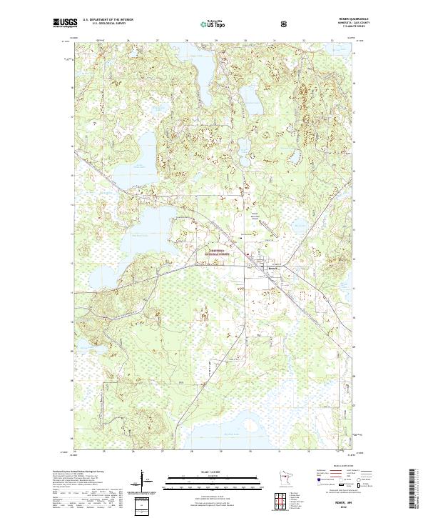
2022 Map of Remer
USGS Topo · Published 2022About this map
The settlement of Remer serves as the focal point for this survey of Cass County, positioned where the Willow River meets a network of timberlands and glacial lakes. This portion of the Chippewa National Forest is defined by an intricate hydrology, featuring large bodies of water like Big Sand Lake and Wahneshin Lake, alongside smaller basins such as Mud Lake and Knights Lake. The landscape reflects a transition from traditional transport to modern recreation, as the former railroad corridors have evolved into the Soo Line Gta Snowmobile Trl and the Lost Girl Gta Snowmobile Trl. Local infrastructure is anchored by the Remer Municipal Airport and the centrally located Fairview Cem. To the north and west, the North Country National Scenic Trl winds through the forested terrain near Bebow Lake, illustrating the area's continued value for conservation and outdoor access.
Find a feature on this map
51 named features on this map. Tap any name to fly to it.
Don’t see what you’re looking for? This feature index may not catch every label — zoom into the map to look around manually.
Map Details
Editions of this 2022 Remer Map
This is the sole edition of this map. No revisions or reprints were ever made.
Other maps of this area

1953 · Duluth
USGS Topo · 1:250,000

1953 · Brainerd
USGS Topo · 1:250,000

1954 · Bemidji
USGS Topo · 1:250,000

1954 · Hibbing
USGS Topo · 1:250,000

1957 · Brainerd
USGS Topo · 1:250,000

1957 · Bemidji
USGS Topo · 1:250,000

1957 · Hibbing
USGS Topo · 1:250,000

1958 · Bemidji
USGS Topo · 1:250,000

1958 · Hibbing
USGS Topo · 1:250,000

1958 · Brainerd
USGS Topo · 1:250,000