Old Maps of Emily, Minnesota
Explore 14 old maps of Emily, spanning from 1913 to today. These high-resolution historic maps reveal how streets, neighborhoods, landmarks, and natural features evolved over time — perfect for genealogy, metal detecting, research, and local history exploration.
What you can do with these maps:
- See how Emily changed over time: Compare historical maps to modern-day views to trace roads, homesites, rail lines & more.
- View detailed metadata: Each map includes creators, publishers, year, scale, and archive source.
- Overlay maps with satellite & LiDAR: Visualize the past alongside modern tools to explore terrain & human change.
- Trusted historical sources: Maps sourced from the USGS, Library of Congress, and other archives.
- Access maps your way: View online, download high-res files, or order prints for personal or research use.
Start exploring old maps of Emily to uncover forgotten places, hidden landmarks, and the deep history beneath your feet.
Emily, MN maps
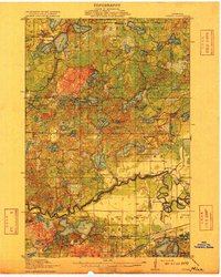
(14)- 1913 Map of Cuyuna, 1963 Print
 1913 Cuyuna1963 Print · USGSCovers Emily, including Crosby, Wolford, and other nearby areas2 unique versions available
 - 1915 Map of Cuyuna
 1915 Cuyuna1915 Print · USGSCovers Emily, including Crosby, Wolford, and other nearby areas3 unique versions available
 - 1953 Map of Duluth, 1964 Print
 1953 Duluth1964 Print · USGSCovers Emily, including Duluth, Superior, and other nearby areas2 unique versions available
 - 1953 Map of Brainerd, 1966 Print
 1953 Brainerd1966 Print · USGSCovers Emily, including Brainerd, Little Falls, and other nearby areas3 unique versions available
 - 1957 Map of Brainerd
 1957 Brainerd1957 Print · USGSCovers Emily, including Brainerd, Little Falls, and other nearby areas
 - 1958 Map of Brainerd
 1958 Brainerd1958 Print · USGSCovers Emily, including Brainerd, Little Falls, and other nearby areas
 - 1958 Map of Duluth
 1958 Duluth1958 Print · USGSCovers Emily, including Duluth, Superior, and other nearby areas
 - 1960 Map of Cross Lake, 1961 Print
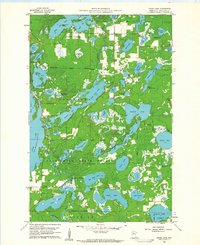 1960 Cross Lake1961 Print · USGSCovers Emily, including Fifty Lakes, Manhattan Beach, and other nearby areas4 unique versions available
 - 1965 Map of Brainerd
 1965 Brainerd1965 Print · USGSCovers Emily, including Brainerd, Little Falls, and other nearby areas
 - 1970 Map of Mitchell Lake, 1972 Print
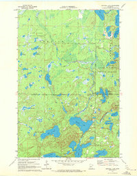 1970 Mitchell Lake1972 Print · USGSCovers Emily, including Fifty Lakes, Cass County, and other nearby areas2 unique versions available
 - 1970 Map of Roosevelt Lake, 1972 Print
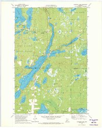 1970 Roosevelt Lake1972 Print · USGSCovers Emily, including Outing, Cass County, and other nearby areas2 unique versions available
 - 1973 Map of Emily, 1975 Print
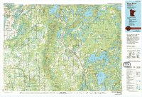
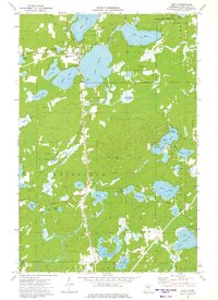 1973 Emily1975 Print · USGSCovers Emily, including Crow Wing County, United States, and other nearby areas2 unique versions available
 - 1976 Map of Pine River, 1994 Print
 1976 Pine River1994 Print · USGSCovers Emily, including Nisswa, Pequot Lakes, and other nearby areas
 - 1994 Map of Aitkin
 1994 Aitkin1994 Print · USGSCovers Emily, including Crosby, Aitkin, and other nearby areas
End of results
Showing maps 1-14 of 14
Top cities near Emily
- Breezy Point historical maps
- Mission historical maps
- Fifty Lakes historical maps
- Wabedo historical maps
- Wolford historical maps
- Inguadona historical maps
See more
Frequently asked questions
- What are the different types of historical maps available for Emily?
- What is the oldest map of Emily?
- Where can I purchase historical maps of Emily for my home or office?
- Where can I download high-res historical maps of Emily?
- Are there historical topographic maps available for Emily?
- Is there historical aerial imagery available for Emily?
- Where are historical maps of Emily sourced from?