2020s Maps of Mantorville, Minnesota
Explore 2 historic maps of Mantorville from the 2020s. These maps offer a rare glimpse into what life looked like during the 2020s — showing old roads, neighborhoods, homes, and landmarks that have changed or disappeared over time.
Whether you're researching your family's past, planning a metal detecting trip, or studying how Mantorville's landscape evolved across the 2020s, these high-resolution maps are a powerful tool for exploring the history of this region.
- Focus on a specific era: All maps on this page are from the 2020s, giving you a focused view of this time period.
- See what’s changed: Compare century-old streets, trails, and buildings to today's modern landscape using overlays and satellite layers.
- Research with precision: Use these maps for genealogy, historical research, land use analysis, or educational projects.
- View, download, or print: Maps are fully viewable online in high resolution, and can be downloaded or printed for your own records.
Start exploring Mantorville's history through authentic maps from the 2020s. This is your window into the past.
Mantorville, MN maps
(2)- 2022 Map of Dodge Center, 2022 Print
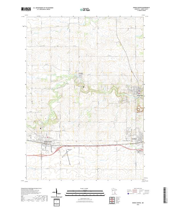 2022 Dodge Center2022 Print · USGSDodge County's central corridor comes to life in this recent survey, showcasing the growing communities of Dodge Center and Kasson. Researchers can trace local history through markers like the Dodge County Courthouse in Mantorville or find family sites at Riverside Cem.
 - 2022 Map of Byron, 2022 Print
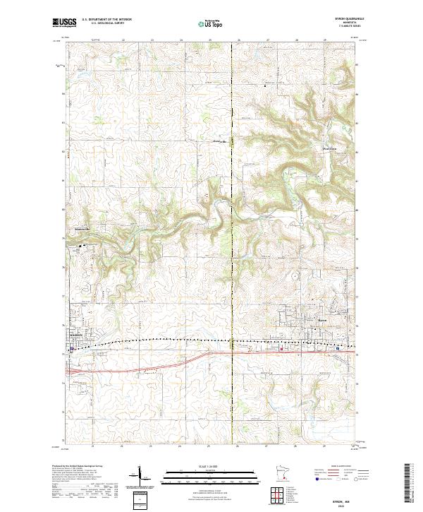 2022 Byron2022 Print · USGSDodge and Olmsted Counties meet in this detailed survey of the rural landscape near Byron and Kasson. Local researchers can trace family lands near historic Post Town or locate ancestral sites at Othello Cem and Saint Margaret Cem along the Zumbro River tributaries.
End of results
Showing maps 1-2 of 2
Top cities near Mantorville
- Rochester historical maps
- Kasson historical maps
- Byron historical maps
- Pine Island historical maps
- Zumbrota historical maps
- Dodge Center historical maps
See more
Top neighborhoods of Mantorville
Frequently asked questions
- What are the different types of historical maps available for Mantorville?
- What is the oldest map of Mantorville?
- Where can I purchase historical maps of Mantorville for my home or office?
- Where can I download high-res historical maps of Mantorville?
- Are there historical topographic maps available for Mantorville?
- Is there historical aerial imagery available for Mantorville?
- Where are historical maps of Mantorville sourced from?