1980s Maps of Freeborn County, Minnesota
Explore 14 historic maps of Freeborn County from the 1980s. These maps offer a rare glimpse into what life looked like during the 1980s — showing old roads, neighborhoods, homes, and landmarks that have changed or disappeared over time.
Whether you're researching your family's past, planning a metal detecting trip, or studying how Freeborn County's landscape evolved across the 1980s, these high-resolution maps are a powerful tool for exploring the history of this region.
- Focus on a specific era: All maps on this page are from the 1980s, giving you a focused view of this time period.
- See what’s changed: Compare century-old streets, trails, and buildings to today's modern landscape using overlays and satellite layers.
- Research with precision: Use these maps for genealogy, historical research, land use analysis, or educational projects.
- View, download, or print: Maps are fully viewable online in high resolution, and can be downloaded or printed for your own records.
Start exploring Freeborn County's history through authentic maps from the 1980s. This is your window into the past.
Freeborn County, MN maps
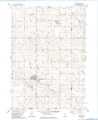
(14)- 1982 Map of Hayward, 1983 Print
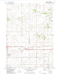 1982 Hayward1983 Print · USGSFreeborn County agriculture and transit are in focus here during the early eighties as the village of Hayward sits at a major rail and road junction. Local historians can trace family roots at Moscow Ch or locate the site of Sigsbee and Petran along the Milwaukee Chicago St Paul and Pacific line.
 - 1982 Map of London, 1983 Print
 1982 London1983 Print · USGSSouthern Minnesota prairie and borderlands are captured here in the early eighties, showing the agricultural grids of London and Myrtle. Researchers can locate several family and community landmarks like London Cem, Woodbury Cem, and the Trondhjem Ch.
 - 1982 Map of Albert Lea West, 1983 Print
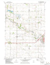
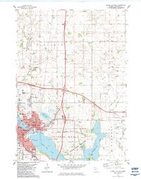
 1982 Albert Lea West1983 Print · USGSFreeborn County at the start of the 1980s shows the expansion of Albert Lea against its glacial lake backdrop. Researchers can trace local history through sites like Graceland Cemetery, the Pickerel Lake Ch, and the rural rail crossing at Armstrong.
 - 1982 Map of Emmons, 1983 Print
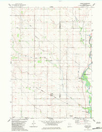
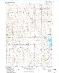
 1982 Emmons1983 Print · USGSSouthern Minnesota's prairie lake country is captured here in the early eighties, showing the deeply interconnected drainage of Freeborn County. Researchers can trace rural lineages at Brush Hill Cemetery or follow the Old RR Grade near Twin Lakes.
 - 1982 Map of Kiester, 1983 Print
 1982 Kiester1983 Print · USGSSouthern Faribault County is shown here in the early eighties as a productive agricultural region tied together by the Chicago and North Western rail line. Researchers can locate family landmarks like St Johns Cem, the community of Walters, and several local Gravel Pits.
 - 1982 Map of Austin West, 1983 Print
 1982 Austin West1983 Print · USGSThe western outskirts of Austin and the small rail stops of Freeborn County are captured here in the early 1980s. Researchers can trace family history at Fairview Cem or locate the site of the Vo-Tech Sch and the neighborhood of Austin Acres.
 - 1982 Map of Alden, 1983 Print
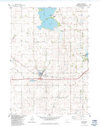 1982 Alden1983 Print · USGSAlden and the surrounding townships in the early eighties were defined by their prairie lakes and the legacy of the rail lines. Genealogists and local historians can trace the Carlston Cem, locate the old Townhall, and follow the Old Railroad Grade as it winds north of Alden.
 - 1982 Map of Wells, 1983 Print
 1982 Wells1983 Print · USGSWells and the surrounding Faribault County prairie are captured here in the early eighties as a thriving agricultural and rail corridor. Genealogists and local historians can trace the foundations of the community through St Casimir Cem, Rice Lake Cem, and the rail stops at Thistius and Baroda.
 - 1982 Map of Albert Lea East, 1983 Print
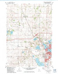
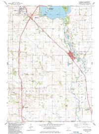
 1982 Albert Lea East1983 Print · USGSSouthern Minnesota's lakeside city of Albert Lea is shown at a peak of regional growth during the early eighties. Genealogists and local researchers can trace historic sites like Lakewood Cemetery, St Theodores Church, and the former Drive-in Theater.
 - 1982 Map of Glenville, 1983 Print
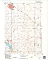
 1982 Glenville1983 Print · USGSFreeborn County and the Iowa borderlands are captured in the early eighties as a network of rail lines and river bends. Genealogists can trace family landmarks like Hillcrest Memorial Gardens, Greenwood Cem, and the historic Round Prairie Ch.
 - 1982 Map of Conger, 1983 Print
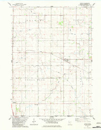
 1982 Conger1983 Print · USGSFreeborn County farming country and its intricate drainage networks are captured here in the early eighties. Genealogists can trace family roots at Schnieder Cemetery or Zion Cemetery, and locate rural landmarks like Mansfield Church and Sletten.
 - 1982 Map of Myrtle, 1983 Print
 1982 Myrtle1983 Print · USGSThe borderlands of southern Minnesota in the early eighties show a landscape of productive fields and deep-rooted community heritage. Genealogists and historians can trace family ties at the Bohemian and Danish cemeteries near Myrtle or follow the Illinois Central Gulf rail line.
 - 1985 Map of Mason City
 1985 Mason City1985 Print · USGSThe Northern Iowa and Southern Minnesota borderlands are captured here in the mid-eighties, showing a region defined by agricultural drainage and rail heritage. Genealogists and historians can trace the grid of rural townships and find local landmarks like Pilot Knob State Park, Nora Springs, and Clear Lake State Park.2 unique versions available
 - 1985 Map of Albert Lea
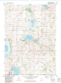
 1985 Albert Lea1985 Print · USGSSouthern Minnesota's agricultural heartland is documented here in the mid-1980s, showing a landscape defined by industrial rail lines and managed waterways. Trace the historic routes of the Chicago and North Western and explore settlements like Hollandale, New Richland, and Bricelyn.2 unique versions available
End of results
Showing maps 1-14 of 14
Top cities of Freeborn County
- Albert Lea historical maps
- Bancroft historical maps
- Clarks Grove historical maps
- Glenville historical maps
- Alden historical maps
- Moscow historical maps
See more
Frequently asked questions
- What are the different types of historical maps available for Freeborn County?
- What is the oldest map of Freeborn County?
- Where can I purchase historical maps of Freeborn County for my home or office?
- Where can I download high-res historical maps of Freeborn County?
- Are there historical topographic maps available for Freeborn County?
- Is there historical aerial imagery available for Freeborn County?
- Where are historical maps of Freeborn County sourced from?