2020s Maps of Freeborn County, Minnesota
Explore 24 historic maps of Freeborn County from the 2020s. These maps offer a rare glimpse into what life looked like during the 2020s — showing old roads, neighborhoods, homes, and landmarks that have changed or disappeared over time.
Whether you're researching your family's past, planning a metal detecting trip, or studying how Freeborn County's landscape evolved across the 2020s, these high-resolution maps are a powerful tool for exploring the history of this region.
- Focus on a specific era: All maps on this page are from the 2020s, giving you a focused view of this time period.
- See what’s changed: Compare century-old streets, trails, and buildings to today's modern landscape using overlays and satellite layers.
- Research with precision: Use these maps for genealogy, historical research, land use analysis, or educational projects.
- View, download, or print: Maps are fully viewable online in high resolution, and can be downloaded or printed for your own records.
Start exploring Freeborn County's history through authentic maps from the 2020s. This is your window into the past.
Freeborn County, MN maps
(24)- 2022 Map of Hartland, 2022 Print
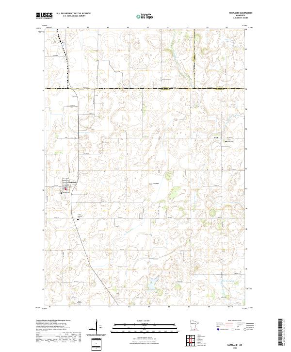 2022 Hartland2022 Print · USGSFreeborn County farming and water management are the focus of this recent survey of the Minnesota prairie. Researchers can locate family plots at Saint Aldens Cem or West Freeborn Cem and trace the drainage of the Mule Lakebed.
 - 2022 Map of Wells, 2022 Print
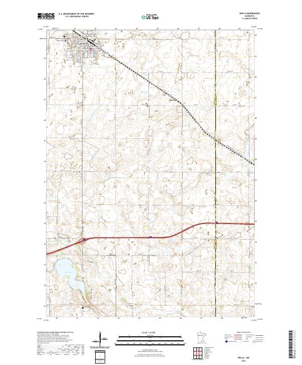 2022 Wells2022 Print · USGSThe agricultural heartland of southern Minnesota is documented here in the early twenty-first century, centered on the rail-aligned town of Wells. Genealogists and local historians can trace family plots at Rosehill Cem or explore the drainage of Rice Lake and the E Br Blue Earth River.
 - 2022 Map of Matawan, 2022 Print
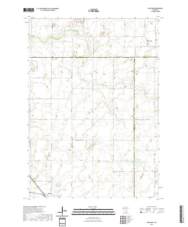 2022 Matawan2022 Print · USGSThe Faribault County borderlands come into focus in the early 2020s, showing a landscape defined by the Cobb River and rural township grids. Researchers can trace family sites near Matawan, the Saint Paul Evangelical Church Cem, and the outskirts of Wells.
 - 2022 Map of Hollandale, 2022 Print
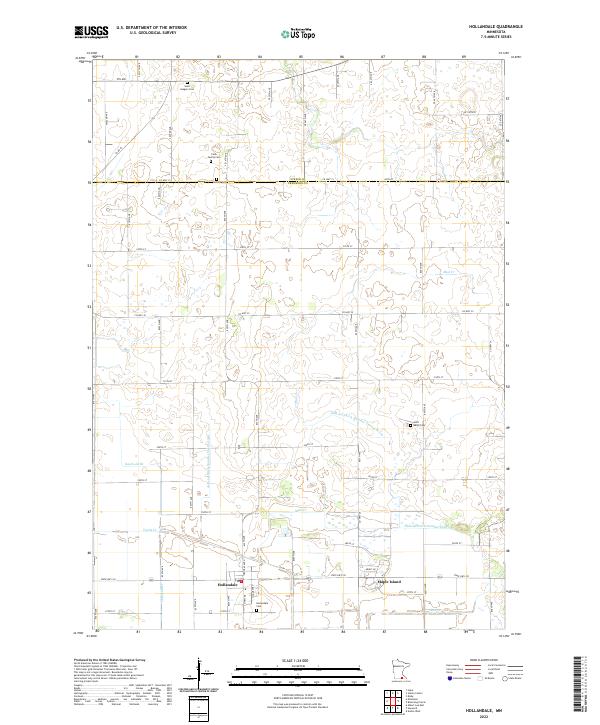 2022 Hollandale2022 Print · USGSFreeborn County farming communities and complex drainage networks are showcased here in the early 2020s. Genealogists can locate family landmarks such as Clark Family Cem and Summit Cem while tracing waterways like Knotvold Br and Mud Cr.
 - 2022 Map of Albert Lea West, 2022 Print
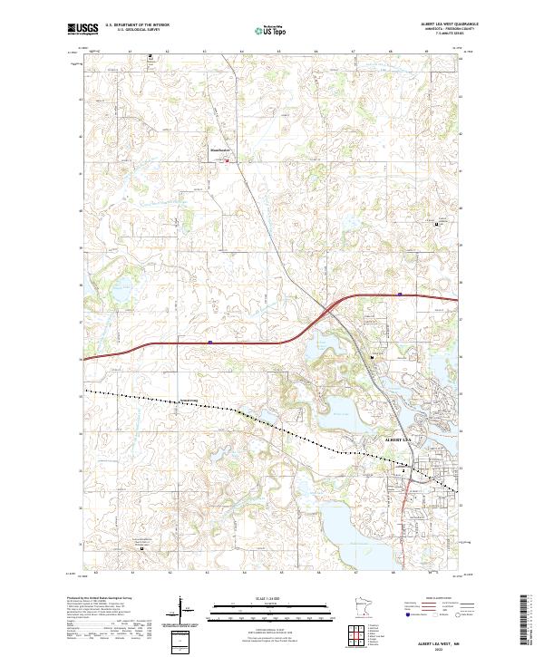 2022 Albert Lea West2022 Print · USGSFreeborn County is shown in the early twenty-first century, revealing the established agricultural and water management patterns around Albert Lea. Genealogists and local historians can trace family locations near Graceland Cem, Manchester, and the Concordia Lutheran Church.
 - 2022 Map of Kiester, 2022 Print
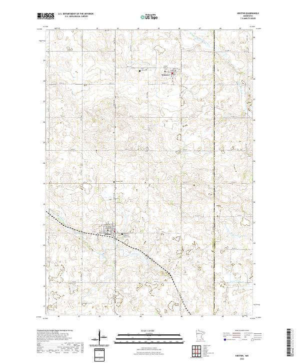 2022 Kiester2022 Print · USGSFaribault and Freeborn Counties are captured in this recent survey of rural Minnesota's farming heartland. Family historians can locate several local burial sites, including Fairview Cem and Saint Johns Cem, alongside the engineered waters of Judicial Ditch Number Twentyfive.
 - 2022 Map of Austin West, 2022 Print
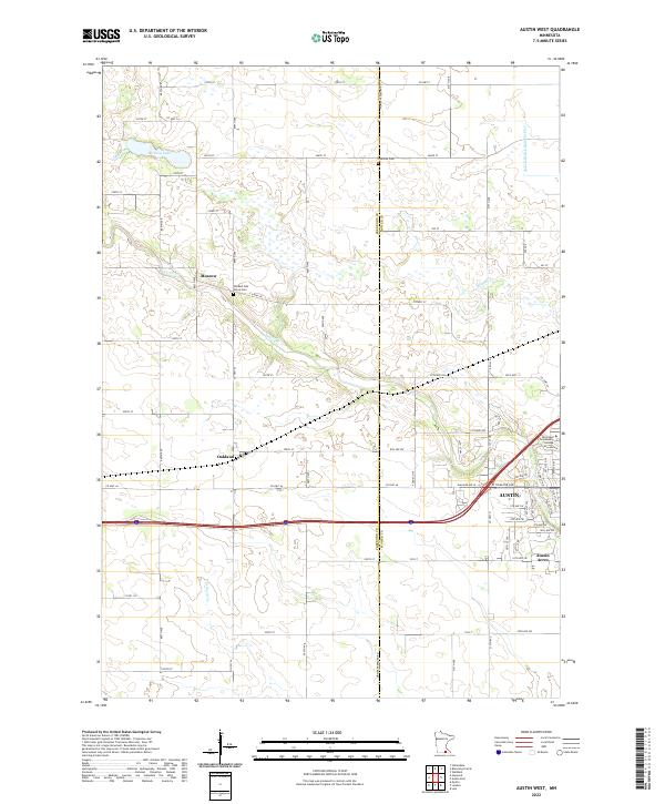 2022 Austin West2022 Print · USGSThe western outskirts of Austin and the surrounding Freeborn County prairie are captured here in the early twenty-first century. Genealogists and local historians can pinpoint Old Red Oak Grove Cem, trace the path of Turtle Cr, or locate the rural crossroads of Moscow.
 - 2022 Map of Ellendale, 2022 Print
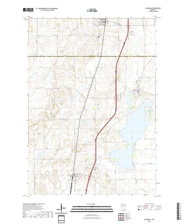 2022 Ellendale2022 Print · USGSSouthern Minnesota prairie life is centered on the waters of Geneva Lake in this 2022 survey. Genealogists can locate family sites near Clarks Grove Cem, Geneva Cem, and the settlements of Ellendale and Geneva.
 - 2022 Map of London, 2022 Print
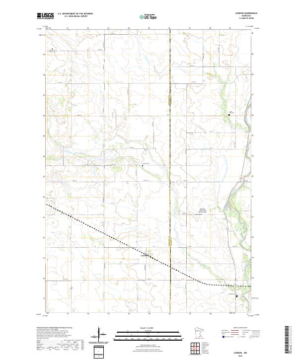 2022 London2022 Print · USGSThe Freeborn and Mower County border comes alive in this contemporary survey of the London area. Genealogists and local historians can locate several rural burial sites, such as the Kennevan Family Cem, and trace the path of the Cedar River.
 - 2022 Map of Myrtle, 2022 Print
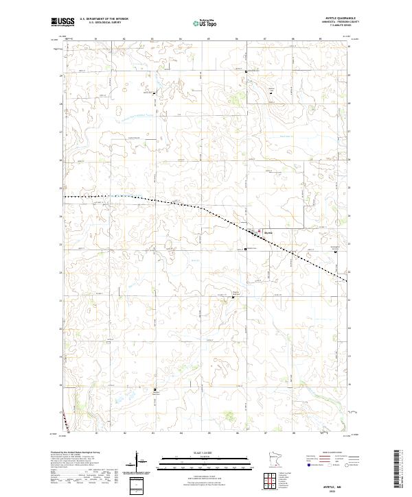 2022 Myrtle2022 Print · USGSThe rural landscape of Freeborn County is revealed here through its intricate drainage networks and ancestral burial sites. Genealogists can trace family footprints at the Bohemian Cem, Danish Cem, or the namesake settlement of Myrtle.
 - 2022 Map of Blooming Prairie, 2022 Print
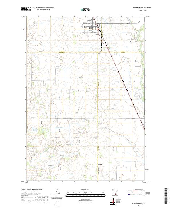 2022 Blooming Prairie2022 Print · USGSSouthern Minnesota's agricultural heartland is documented here in the early 2020s, centered on the border of four counties. Genealogists can trace family footprints at First Lutheran Cem, Red Oak Grove Cem, and the quiet crossroads of Corning.
 - 2022 Map of Glenville, 2022 Print
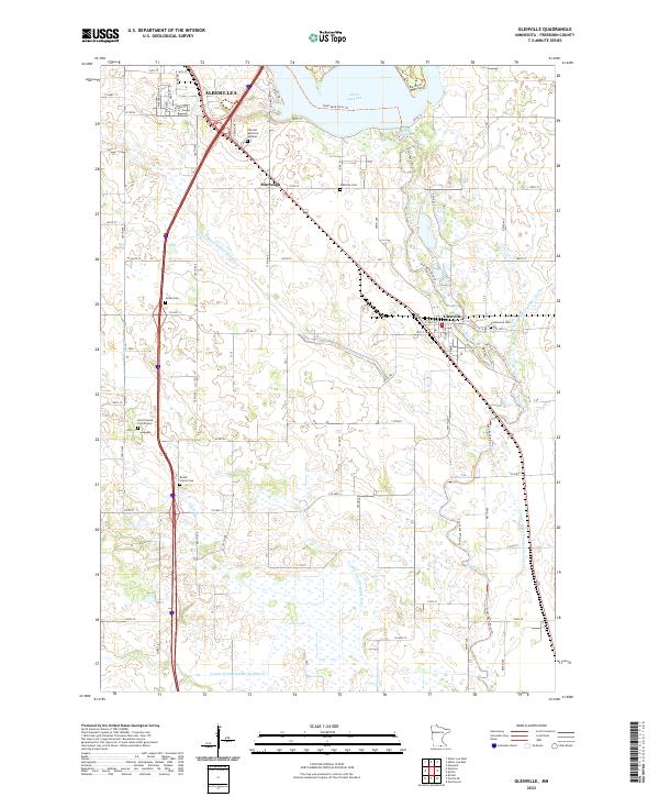 2022 Glenville2022 Print · USGSSouthern Minnesota in the 2020s remains defined by its managed waterways and quiet rural crossroads. Researchers can trace family history through numerous burial sites like Hillcrest Memorial Gardens or explore the settlement of Glenville along the Shell Rock River.
 - 2022 Map of Hayward, 2022 Print
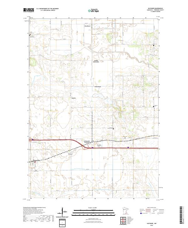 2022 Hayward2022 Print · USGSFreeborn County's fertile farm country and drainage networks are documented here in the early twenty-first century. Researchers can locate numerous local burial grounds like Hillside Cem and Fairview Cem or trace rural sidings such as Petran and Sigsbee.
 - 2022 Map of Emmons, 2022 Print
 2022 Emmons2022 Print · USGSFreeborn County, Minnesota, is mapped here in the early 2020s, showing a prairie landscape shaped by glacial lakes and a complex drainage network. Researchers can locate local landmarks like Bear Lake Concordia Lutheran Cem and Saint James Cem, or trace the engineered paths of Judicial Ditch Number Nine through the farms.
 - 2022 Map of Conger, 2022 Print
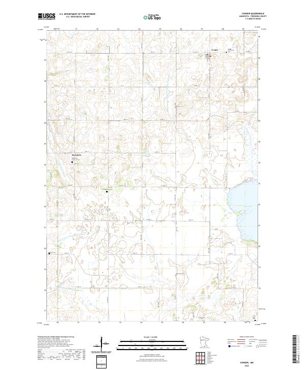 2022 Conger2022 Print · USGSSouthern Minnesota farmland and the community of Conger appear here in the early twenty-first century. Researchers can trace rural family legacies through numerous sites including Mansfield Lutheran Cem, Zion Cem, and Lime Creek Cem.
 - 2022 Map of Freeborn, 2022 Print
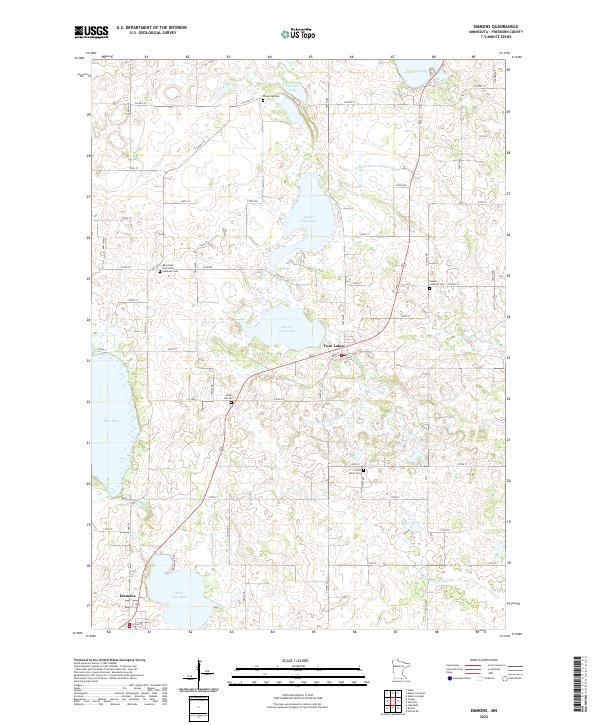
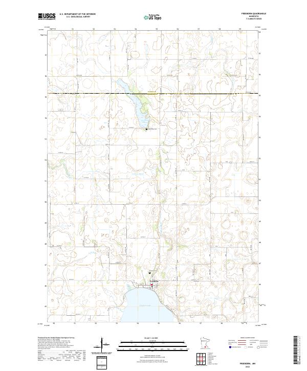 2022 Freeborn2022 Print · USGSFreeborn and the surrounding townships are mapped here in the early twenty-first century, showing a landscape defined by prairie lakes and agricultural drainage. Researchers can locate Freeborn Cem, the rural Seven Day Cem, and trace the winding course of the Cobb River.
 - 2022 Map of Alden, 2022 Print
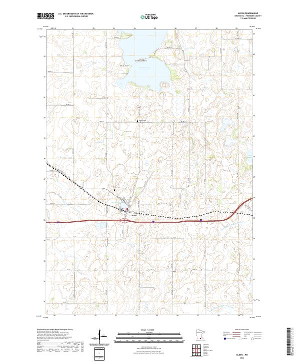 2022 Alden2022 Print · USGSThe agricultural heart of Freeborn County is revealed in this modern survey of the area surrounding Alden. Genealogists and local historians can pinpoint the Carlston Cem, trace the course of the Cobb River, and explore the shoreline of Freeborn Lake.
 - 2022 Map of Albert Lea East, 2022 Print
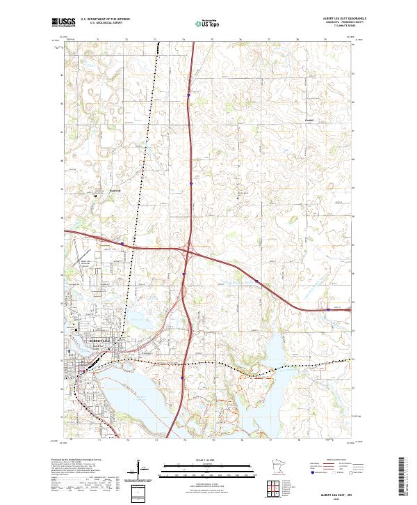 2022 Albert Lea East2022 Print · USGSFreeborn County settlement and infrastructure are captured in this recent survey of the region surrounding Albert Lea and Hayward. Researchers can locate several burial grounds and civic landmarks, including the Freeborn County Poor Farm Cem and Katherine Island in Fountain Lake.
 - 2022 Map of Northwood, 2022 Print
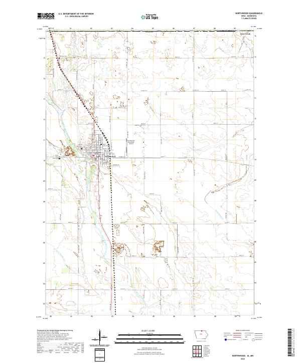 2022 Northwood2022 Print · USGSThe Iowa-Minnesota border region is captured here in the early twenty-first century, centered on the Worth County seat. Researchers can locate specific family burial sites like the Seater Family Plot or trace the riverbank path of the Shell Rock River through town.
 - 2022 Map of Carpenter, 2022 Print
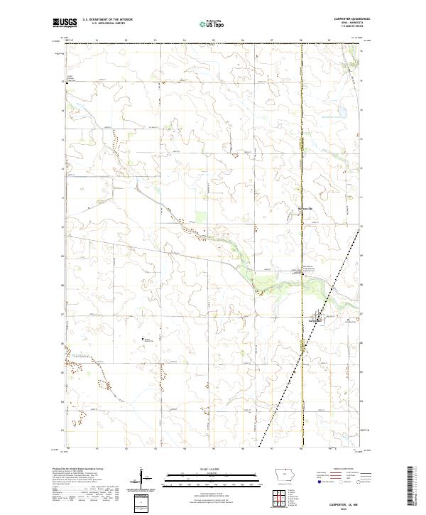 2022 Carpenter2022 Print · USGSWorth and Mitchell counties appear in this contemporary survey of northern Iowa's agricultural heartland. Genealogists can trace family heritage at the Birdsal Family Plot, Newburg Cem, and the Lutheran communities of Meltonville and Carpenter.
 - 2022 Map of Vinje, 2022 Print
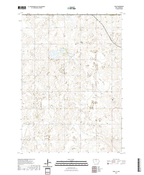 2022 Vinje2022 Print · USGSWinnebago County at the Minnesota border is captured here in the early twenty-first century, showcasing a landscape of enduring farmsteads and prairie drainage. Genealogists can locate family sites near Vinje or trace local history through Bethel Cem and Holmes Chapel Cem.
 - 2022 Map of Lake Mills, 2022 Print
 2022 Lake Mills2022 Print · USGSNorthern Winnebago County comes into focus in this recent survey, capturing the agricultural grid surrounding Lake Mills. Researchers can trace local heritage through numerous sites like Sunnyside Cem, the settlement of Scarville, and the banks of Rice Lake.
 - 2022 Map of Bristol, 2022 Print
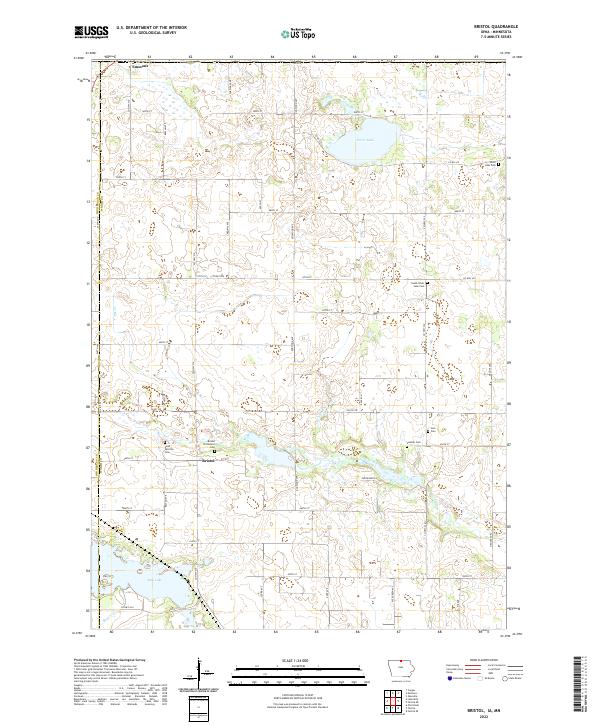 2022 Bristol2022 Print · USGSNorthern Iowa's farm country and glacial lakes come into focus in this recent survey. Genealogists can trace family roots at Saint Patricks Cem, Somber Cem, and Bristol Protestant Cem near the historic settlement of Bristol.
 - 2022 Map of Fertile NE, 2022 Print
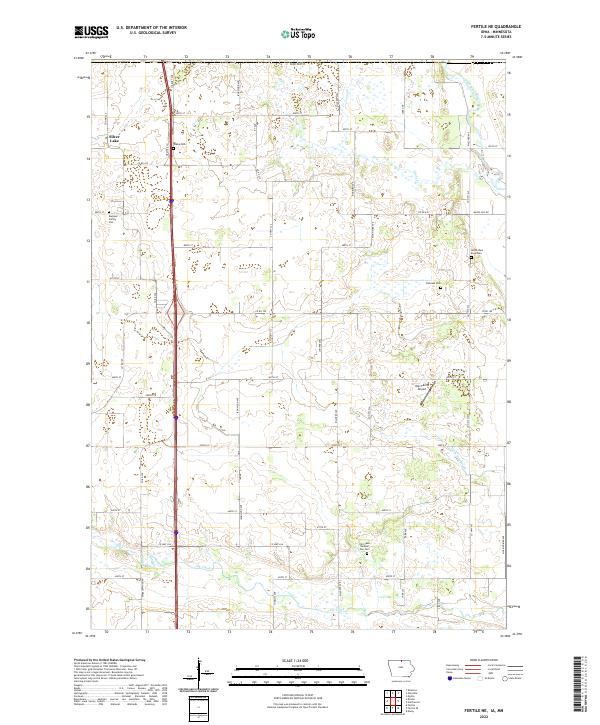 2022 Fertile NE2022 Print · USGSIn the early twenty-first century, this corner of North Iowa maintains its traditional farming character along the Shell Rock River. Genealogists can locate several local burial sites, including Towne Cem, North Shell Rock Cem, and the private Rugland Family Plot.
End of results
Showing maps 1-24 of 24
Top cities of Freeborn County
- Albert Lea historical maps
- Bancroft historical maps
- Clarks Grove historical maps
- Glenville historical maps
- Alden historical maps
- Moscow historical maps
See more
Frequently asked questions
- What are the different types of historical maps available for Freeborn County?
- What is the oldest map of Freeborn County?
- Where can I purchase historical maps of Freeborn County for my home or office?
- Where can I download high-res historical maps of Freeborn County?
- Are there historical topographic maps available for Freeborn County?
- Is there historical aerial imagery available for Freeborn County?
- Where are historical maps of Freeborn County sourced from?