Old Maps of New London, Minnesota for Hiking & Exploration
Hike through history with 10 historic maps of New London. Explore old trails, ghost towns, and forgotten backroads — perfect for outdoor adventurers and local explorers.
- Rediscover forgotten places: Map out old mining camps, roads, and footpaths that no longer exist on modern maps.
- Layer with modern tools: Combine with LiDAR or satellite views to plan hikes through historical terrain.
- Made for exploration: Popular among hikers, overlanders, and local history lovers.
Use these maps to find adventure and explore the hidden past of New London.
New London, MN maps
(10)- 1953 Map of Saint Cloud, 1968 Print
 1953 Saint Cloud1968 Print · USGSCentral Minnesota's lake country and the Mississippi River valley are caught in a period of steady mid-century growth. Researchers can trace historic rail lines, old granite works, and local landmarks like St. Johns University, Camp Ripley, and the shores of Lake Minnewaska.3 unique versions available
 - 1957 Map of Saint Cloud
 1957 Saint Cloud1957 Print · USGSCentral Minnesota's lake country and rail corridors are meticulously detailed in the mid-1950s. Genealogists and researchers can trace the growth of towns like Alexandria, Willmar, and Saint Cloud along the Great Northern railroad line.
 - 1958 Map of Saint Cloud
 1958 Saint Cloud1958 Print · USGSCentral Minnesota in the mid-1950s shows a landscape of growing regional hubs and hundreds of glacial lakes connected by an extensive rail network. Genealogists and historians can trace the early footprints of Saint Cloud, Alexandria, and Willmar along the Great Northern Railway.
 - 1967 Map of New London, 1969 Print
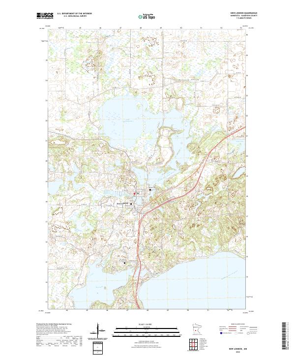
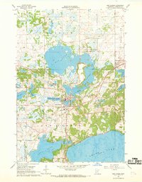 1967 New London1969 Print · USGSKandiyohi County was a land of water and wildlife in the late 1960s, centered on the river-fed village of New London. Researchers can trace the local economy and community through the National Fish Hatchery, the Great Northern rail line, and historic sites like Grace Ch.
 - 1986 Map of Litchfield
 1986 Litchfield1986 Print · USGSCentral Minnesota in the mid-eighties was a landscape of conservation and transport, where the Burlington Northern rail line connected thriving lake towns. Genealogists and historians can trace old townships and landmarks like St Nicholas, Forest City, and School House Lake.2 unique versions available
 - 2010 Map of New London, 2010 Print
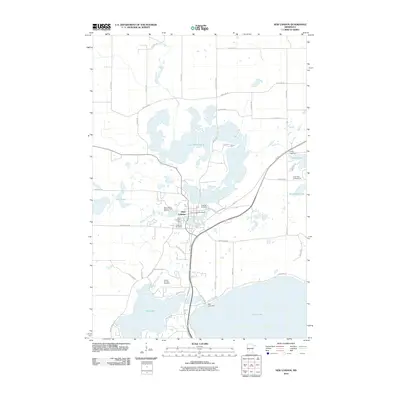 2010 New London2010 Print · USGSCovers New London, including Kandiyohi County, United States, and other nearby areas
 - 2013 Map of New London, 2013 Print
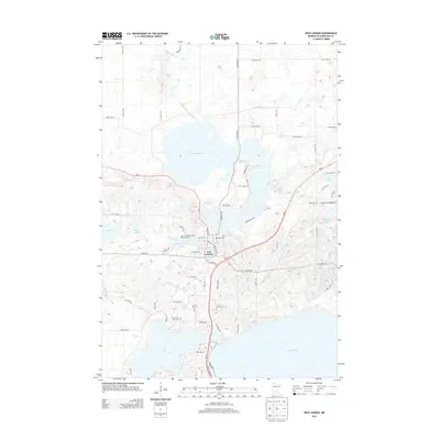 2013 New London2013 Print · USGSCovers New London, including Kandiyohi County, United States, and other nearby areas
 - 2016 Map of New London, 2016 Print
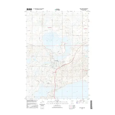 2016 New London2016 Print · USGSCovers New London, including Kandiyohi County, United States, and other nearby areas
 - 2019 Map of New London, 2019 Print
 2019 New London2019 Print · USGSCovers New London, including Kandiyohi County, United States, and other nearby areas
 - 2022 Map of New London, 2022 Print
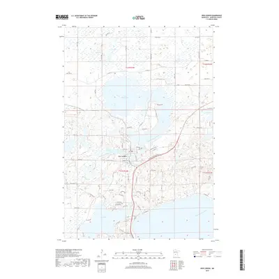
 2022 New London2022 Print · USGSKandiyohi County lake country and the village of New London are documented in this recent survey. Genealogists can locate family sites near Lebanon Cem or Oak Hill Cem, while following the Middle Fork Crow River through its glacial valley.
End of results
Showing maps 1-10 of 10
Top cities near New London
- Willmar historical maps
- Paynesville historical maps
- Spicer historical maps
- Atwater historical maps
- Belgrade historical maps
- Brooten historical maps
See more
Frequently asked questions
- What are the different types of historical maps available for New London?
- What is the oldest map of New London?
- Where can I purchase historical maps of New London for my home or office?
- Where can I download high-res historical maps of New London?
- Are there historical topographic maps available for New London?
- Is there historical aerial imagery available for New London?
- Where are historical maps of New London sourced from?