2020s Maps of Lynd, Minnesota
Explore 2 historic maps of Lynd from the 2020s. These maps offer a rare glimpse into what life looked like during the 2020s — showing old roads, neighborhoods, homes, and landmarks that have changed or disappeared over time.
Whether you're researching your family's past, planning a metal detecting trip, or studying how Lynd's landscape evolved across the 2020s, these high-resolution maps are a powerful tool for exploring the history of this region.
- Focus on a specific era: All maps on this page are from the 2020s, giving you a focused view of this time period.
- See what’s changed: Compare century-old streets, trails, and buildings to today's modern landscape using overlays and satellite layers.
- Research with precision: Use these maps for genealogy, historical research, land use analysis, or educational projects.
- View, download, or print: Maps are fully viewable online in high resolution, and can be downloaded or printed for your own records.
Start exploring Lynd's history through authentic maps from the 2020s. This is your window into the past.
Lynd, MN maps
(2)- 2022 Map of Marshall, 2022 Print
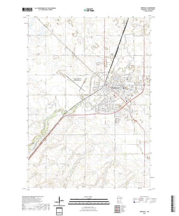 2022 Marshall2022 Print · USGSThe city of Marshall and the nearby community of Lynd are captured here in the early 2020s amidst the agricultural plains of Lyon County. Researchers can trace local heritage at Marshall Cem or follow the path of the Redwood River past the Lyon County Government Center.
 - 2022 Map of Lynd, 2022 Print
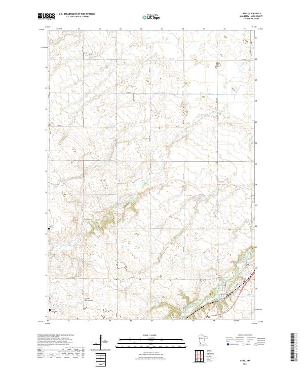 2022 Lynd2022 Print · USGSLyon County at the edge of the Coteau des Prairies shows a landscape defined by the Redwood River and a precise grid of rural section roads. Researchers can locate the Zion Cem and Island Lake Cem or trace the early street plan of Lynd.
End of results
Showing maps 1-2 of 2
Top cities near Lynd
- Marshall historical maps
- Minneota historical maps
- Cottonwood historical maps
- Balaton historical maps
- Ghent historical maps
- Russell historical maps
See more
Top neighborhoods of Lynd
Frequently asked questions
- What are the different types of historical maps available for Lynd?
- What is the oldest map of Lynd?
- Where can I purchase historical maps of Lynd for my home or office?
- Where can I download high-res historical maps of Lynd?
- Are there historical topographic maps available for Lynd?
- Is there historical aerial imagery available for Lynd?
- Where are historical maps of Lynd sourced from?