2020s Maps of Mahnomen County, Minnesota
Explore 16 historic maps of Mahnomen County from the 2020s. These maps offer a rare glimpse into what life looked like during the 2020s — showing old roads, neighborhoods, homes, and landmarks that have changed or disappeared over time.
Whether you're researching your family's past, planning a metal detecting trip, or studying how Mahnomen County's landscape evolved across the 2020s, these high-resolution maps are a powerful tool for exploring the history of this region.
- Focus on a specific era: All maps on this page are from the 2020s, giving you a focused view of this time period.
- See what’s changed: Compare century-old streets, trails, and buildings to today's modern landscape using overlays and satellite layers.
- Research with precision: Use these maps for genealogy, historical research, land use analysis, or educational projects.
- View, download, or print: Maps are fully viewable online in high resolution, and can be downloaded or printed for your own records.
Start exploring Mahnomen County's history through authentic maps from the 2020s. This is your window into the past.
Mahnomen County, MN maps
(16)- 2022 Map of Faith, 2022 Print
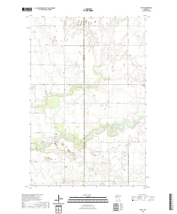 2022 Faith2022 Print · USGSThe borderlands of Norman and Mahnomen counties are captured here in the early twenty-first century, centered on the small community of Faith. Genealogists and local historians can trace the landscape around the Saint Olaf Lutheran Cem and the natural meanders of the Wild Rice River and Spring Cr.
 - 2022 Map of Faith NE, 2022 Print
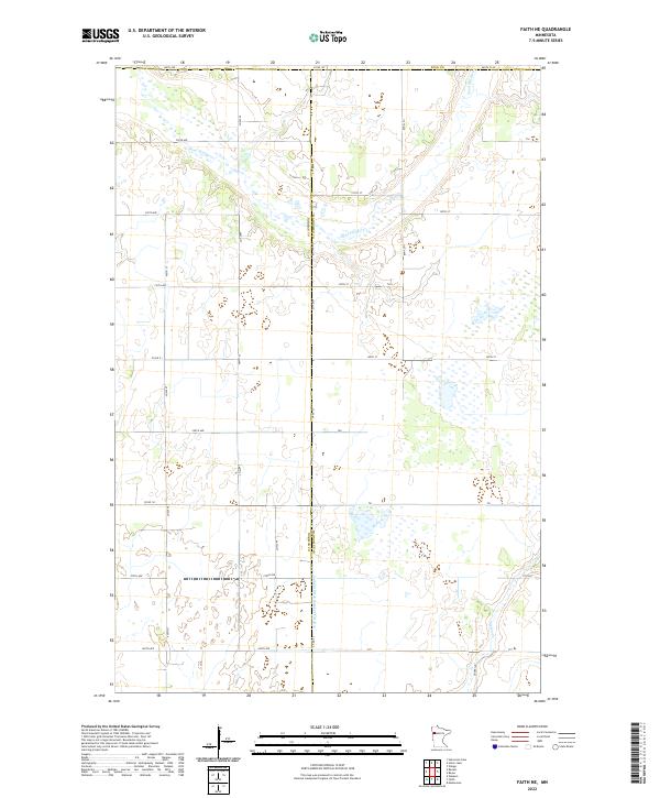 2022 Faith NE2022 Print · USGSNorthwestern Minnesota's prairie landscape is captured here at the junction of three counties during the early 2020s. Genealogists and researchers can trace the rural grid between Sand Hill River and the engineered waters of Judicial Ditch Number Fiftyfive.
 - 2022 Map of Ebro, 2022 Print
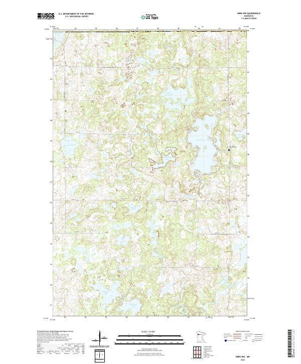
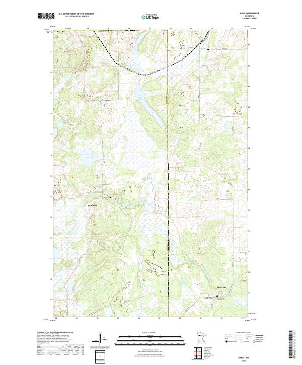 2022 Ebro2022 Print · USGSThe borderlands of Mahnomen and Clearwater counties come into focus during this modern era of wetland and river conservation. Genealogists can locate Pine Bend Cem, Holiness Cem, and the small settlements of Ebro and Jack Pine.
 - 2022 Map of Flom NE, 2022 Print
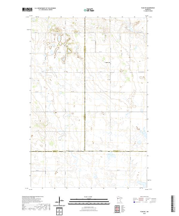 2022 Flom NE2022 Print · USGSThe intersection of Mahnomen, Norman, and Becker counties is captured here in the early 2020s, showing a landscape of scattered wetlands and section-line roads. Genealogists and land researchers can trace property boundaries along CO RD 31 or near the shores of Apple Lake.
 - 2022 Map of Bejou, 2022 Print
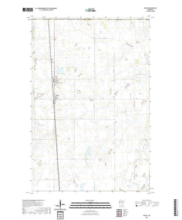 2022 Bejou2022 Print · USGSThe village of Bejou and the surrounding Mahnomen County farmsteads are shown here in the early twenty-first century. Researchers can locate family sites near Bejou Cem and Immaculate Conception Catholic Cem or trace the drainage of Marsh Cr.
 - 2022 Map of North Twin Lake, 2022 Print
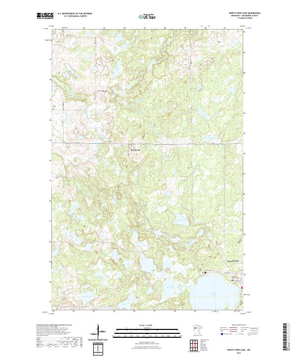 2022 North Twin Lake2022 Print · USGSNaytahwaush and the surrounding lake country of Mahnomen County are captured here in the early twenty-first century. Genealogists and local researchers can locate Samuel Memorial Cem, The Ranch, and the winding course of the Wild Rice River.
 - 2022 Map of Roy Lake, 2022 Print
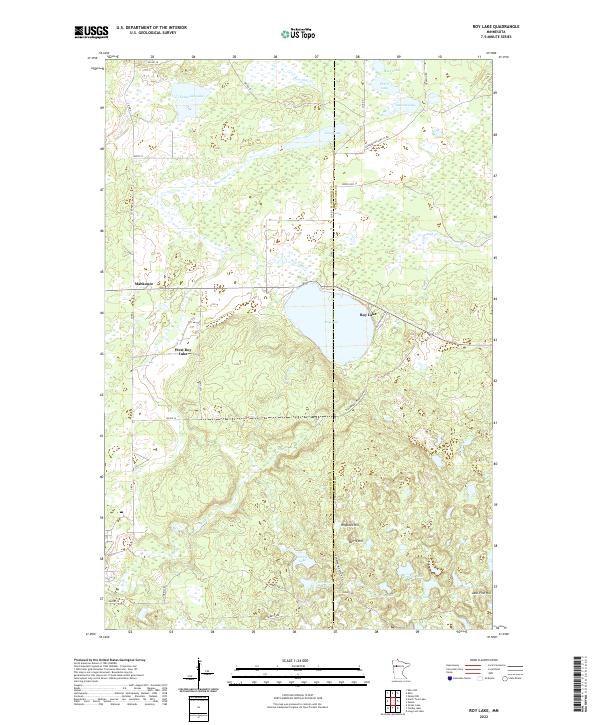 2022 Roy Lake2022 Print · USGSMahnomen and Clearwater counties are captured in this contemporary look at the northern Minnesota lake country. Genealogists and outdoor historians can trace the rural routes around Mahkonce, Roy Lake, and landmarks like Hogback Hill or Norris Hill.
 - 2022 Map of Ogema NE, 2022 Print
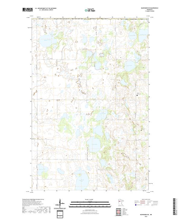
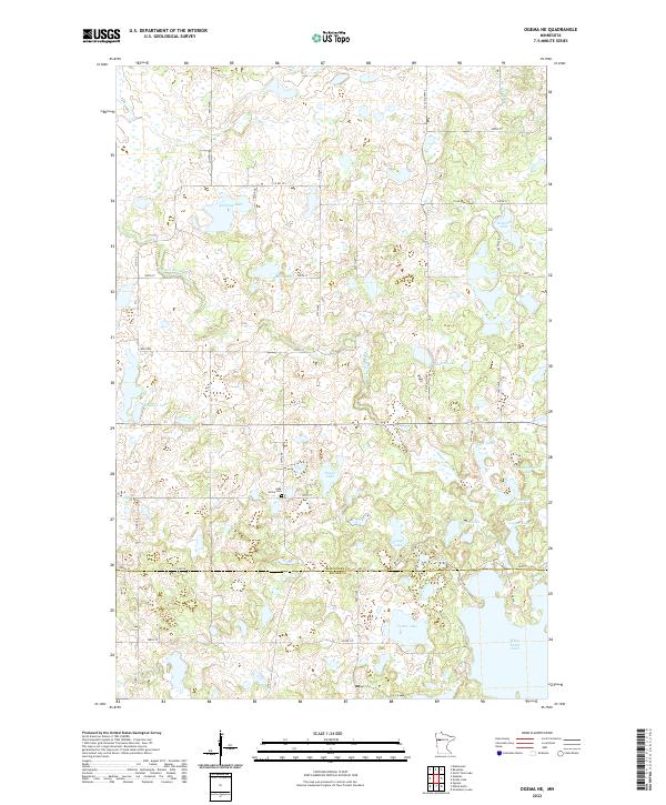 2022 Ogema NE2022 Print · USGSMahnomen and Becker Counties are shown in the early twenty-first century, revealing a landscape defined by an intricate network of glacial lakes and prairie wetlands. Genealogists can locate Lake Grove Cem and trace family-named landmarks like Nemec Lake and Quallen Lake.
 - 2022 Map of Mahnomen, 2022 Print
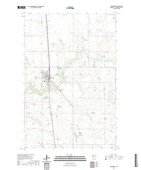 2022 Mahnomen2022 Print · USGSMahnomen and the surrounding White Earth Reservation lands are captured here in the early 2020s. Researchers can locate specific family sites near Riverside Cem or trace the civic footprint of the Mahnomen County Courthouse.
 - 2022 Map of Fosston SE, 2022 Print
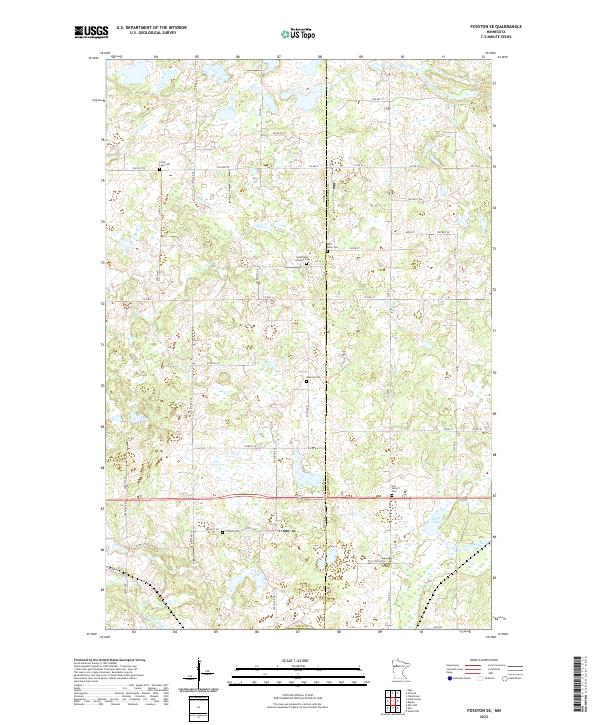 2022 Fosston SE2022 Print · USGSThe rural border of Polk and Clearwater counties comes into focus in this recent survey, showcasing a landscape defined by meandering rivers and glacial lakes. Genealogists can locate several historic burial sites, including Oakland Cem, Fridhem Cem, and Our Savior's Cem.
 - 2022 Map of Mahnomen NE, 2022 Print
 2022 Mahnomen NE2022 Print · USGSThe prairie and wetland landscape of Mahnomen County is revealed in this modern survey of the lake-studded plains east of the Red River Valley. Local researchers can locate family sites near North Duane Cem or trace the drainage of Marsh Creek and Beaulieu Lake.
 - 2022 Map of Snider Lake, 2022 Print
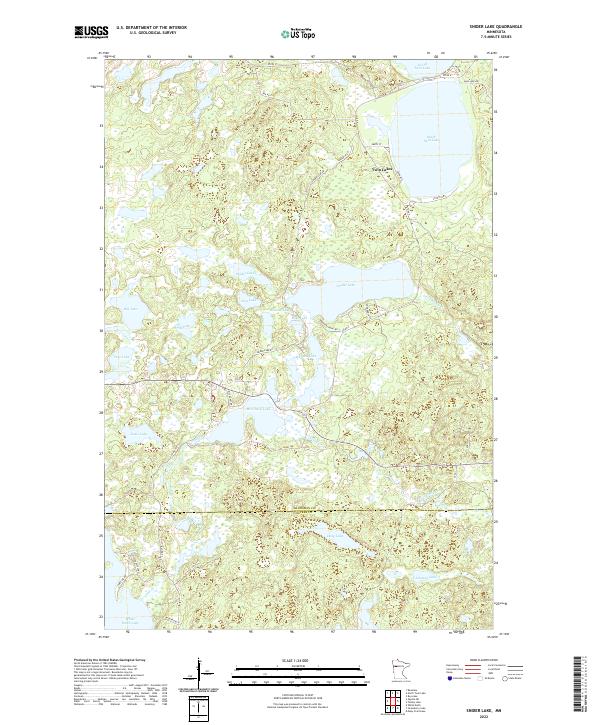 2022 Snider Lake2022 Print · USGSMahnomen County and the northern edge of Becker County are captured here in a detailed modern survey of the White Earth Reservation. Trace the lake-strewn landscape around Twin Lakes and identify access points for Snider Lake, McCraney Lake, and Gull Creek.
 - 2022 Map of Waubun, 2022 Print
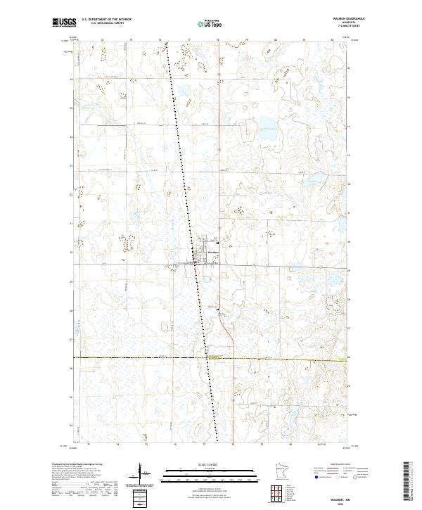 2022 Waubun2022 Print · USGSThe township of Waubun and its surrounding lake country are mapped here in the early 2020s. Researchers can locate family sites near Saint Anns Cem or trace the drainage of the White Earth River and Spring Cr across the Mahnomen and Becker county line.
 - 2022 Map of Tulaby Lake, 2022 Print
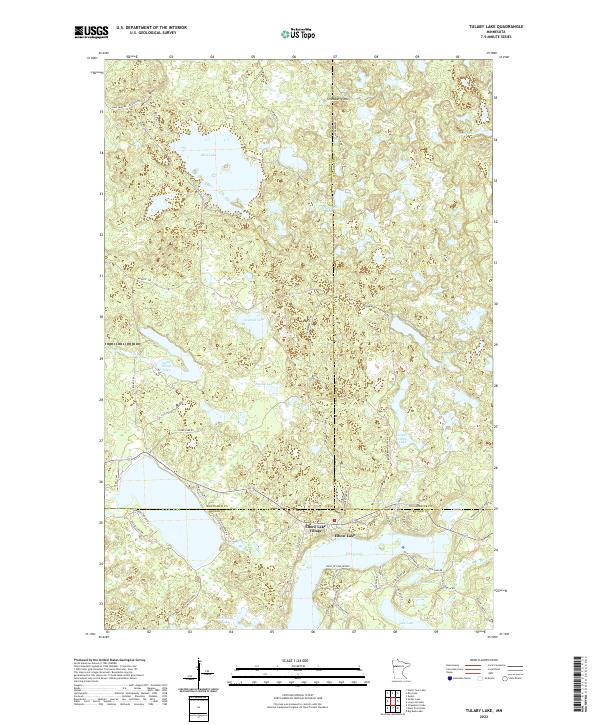 2022 Tulaby Lake2022 Print · USGSThe lake-dotted borders of Mahnomen, Clearwater, and Becker counties are captured here in the early twenty-first century. Researchers can trace lakeside developments near Elbow Lake Village or explore the wooded terrain surrounding Strawberry Mtn and Tulaby Lake.
 - 2022 Map of Beaulieu, 2022 Print
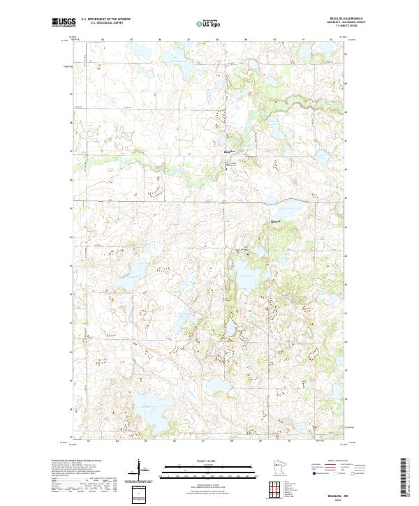 2022 Beaulieu2022 Print · USGSMahnomen County comes into focus in this recent survey of the lake-dotted prairie and woodland transition. Researchers can locate family roots at Saint Joseph's Catholic Cem or trace the winding course of the Wild Rice River near Beaulieu.
 - 2022 Map of Ebro NW, 2022 Print
 2022 Ebro NW2022 Print · USGSMahnomen County is a landscape of glacial waters and quiet backroads in the early twenty-first century. Genealogists and local researchers can locate the Saint Agnes Catholic Cemetery and trace the drainage of the Wild Rice River through basins like Island Lake and Wakefield Lake.
End of results
Showing maps 1-16 of 16
Top cities of Mahnomen County
Frequently asked questions
- What are the different types of historical maps available for Mahnomen County?
- What is the oldest map of Mahnomen County?
- Where can I purchase historical maps of Mahnomen County for my home or office?
- Where can I download high-res historical maps of Mahnomen County?
- Are there historical topographic maps available for Mahnomen County?
- Is there historical aerial imagery available for Mahnomen County?
- Where are historical maps of Mahnomen County sourced from?