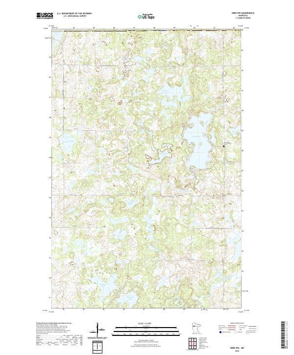
2022 Map of Ebro NW
USGS Topo · Published 2022About this map
Glacial lake basins and marshy lowlands dominate this portion of Mahnomen County, where the terrain is defined by a dense network of water bodies. The northeastern corner of the map is anchored by the large Island Lake, which is fed and drained by Island Lake Creek. Near the eastern shore of the lake, the Saint Agnes Catholic Cemetery serves as a localized landmark for genealogists and family researchers. To the south, the Wild Rice River meanders through the landscape, flanked by smaller basins such as Wakefield Lake and Snetsinger Lake. The presence of numerous named bodies like Sugar Bush Lake, Matt Ayers Lake, and Skunk Lake illustrates the post-glacial topography typical of this region, while a geometric grid of county roads, including Co RD 1 and Co ST Aid HWY 4, provides the primary modern access to these remote wetlands.
Find a feature on this map
32 named features on this map. Tap any name to fly to it.
Don’t see what you’re looking for? This feature index may not catch every label — zoom into the map to look around manually.
Map Details
Editions of this 2022 Ebro NW Map
This is the sole edition of this map. No revisions or reprints were ever made.
Other maps of this area

1919 · Fosston
USGS Topo · 1:62,500

1954 · Bemidji
USGS Topo · 1:250,000

1957 · Bemidji
USGS Topo · 1:250,000

1958 · Bemidji
USGS Topo · 1:250,000

1969 · North Twin Lake
USGS Topo · 1:24,000

1969 · Ebro
USGS Topo · 1:24,000

1969 · Roy Lake
USGS Topo · 1:24,000

1969 · Fosston SE
USGS Topo · 1:24,000

1969 · Fosston East
USGS Topo · 1:24,000

1969 · Fosston West
USGS Topo · 1:24,000