
1969 Map of Fosston West
USGS Topo · Published 1971About this map
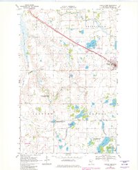
The Fosston area in the late 1960s was a landscape defined by an extensive drainage network and a burgeoning aviation and recreation infrastructure. The Burlington Northern railroad cuts a straight diagonal through the terrain, passing the Fosston Municipal Airport and a specialized Seaplane Facility on Ouff Lake. Local entertainment and community life are marked by the Drive-in Theater and the Fairground on the edge of town, while the surrounding rural landscape is dotted with ancestral markers like Landsverk Cem and Sand Hill Ch Cem. A significant portion of the land is dedicated to conservation, including the Lavoi State Wildlife Management Area and Castor State Wildlife Management Area. The numerous county ditches, such as County Ditch No 55, illustrate the concerted effort to manage the hydrology of this lake-studded region for agriculture and wildlife.
Find a feature on this map
35 named features on this map. Tap any name to fly to it.
Don’t see what you’re looking for? This feature index may not catch every label — zoom into the map to look around manually.
Map Details
Editions of this 1969 Fosston West Map
2 editions found
Other maps of this area

1919 · Fosston
USGS Topo · 1:62,500

1954 · Bemidji
USGS Topo · 1:250,000

1957 · Bemidji
USGS Topo · 1:250,000

1958 · Bemidji
USGS Topo · 1:250,000

1969 · Olga
USGS Topo · 1:24,000

1969 · Mc Intosh NE
USGS Topo · 1:24,000

1969 · Fosston East
USGS Topo · 1:24,000
1969 · Mc Intosh
USGS Topo · 1:24,000
1969 · Winger
USGS Topo · 1:24,000
1969 · Ebro NW
USGS Topo · 1:24,000