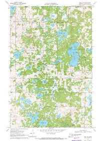
1969 Map of Ebro NW
USGS Topo · Published 1971About this map
The White Earth Indian Reservation Boundary cuts across this lake-strewn landscape in northwestern Minnesota, where the water table dominates the geography. The map shows a transition from the prairie edge into a dense network of glacial wetlands and water bodies, including the irregular shores of Island Lake and the elongated Sugar Bush Lake. Local land use is reflected in the conservation of the Budde Meadow State Wildlife Management Area, which preserves the complex marshland south of Annawaush Lake. To the east, the Wild Rice River winds through the township of Clover, while the northern reaches in Heier are dotted with family-named features like Simonson Lake and Matt Ayers Lake. Human settlement is centered around landmarks such as St Agnes Ch and a nearby Cem, indicating the established rural communities that relied on the Pine Bend Road for access to this waterfowl-rich terrain.
Find a feature on this map
23 named features on this map. Tap any name to fly to it.
Don’t see what you’re looking for? This feature index may not catch every label — zoom into the map to look around manually.
Map Details
Editions of this 1969 Ebro NW Map
This is the sole edition of this map. No revisions or reprints were ever made.
Other maps of this area

1919 · Fosston
USGS Topo · 1:62,500

1954 · Bemidji
USGS Topo · 1:250,000

1957 · Bemidji
USGS Topo · 1:250,000

1958 · Bemidji
USGS Topo · 1:250,000

1969 · North Twin Lake
USGS Topo · 1:24,000

1969 · Ebro
USGS Topo · 1:24,000

1969 · Roy Lake
USGS Topo · 1:24,000

1969 · Fosston SE
USGS Topo · 1:24,000

1969 · Fosston East
USGS Topo · 1:24,000

1969 · Fosston West
USGS Topo · 1:24,000