
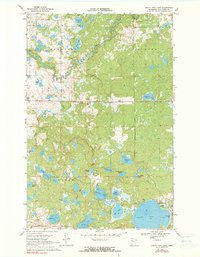
1969 Map of North Twin Lake
USGS Topo · Published 1971About this map
The Wild Rice River meanders through the townships of Beaulieu, Clover, and La Garde in this late 1960s survey. The landscape is defined by an intricate network of wetlands and water bodies, including Long Lake, Lizzard Lake, and the expansive North Twin Lake. Near the southeastern shore of the larger lake, the settlement of Naytahwaush serves as a local focal point, characterized by its residential clusters and the Nursing Home.
Find a feature on this map
34 named features on this map. Tap any name to fly to it.
Don’t see what you’re looking for? This feature index may not catch every label — zoom into the map to look around manually.
Map Details
Editions of this 1969 North Twin Lake Map
2 editions found
Other maps of this area

1954 · Bemidji
USGS Topo · 1:250,000

1957 · Bemidji
USGS Topo · 1:250,000

1958 · Bemidji
USGS Topo · 1:250,000

1969 · Ebro
USGS Topo · 1:24,000

1969 · Roy Lake
USGS Topo · 1:24,000

1969 · Tulaby Lake
USGS Topo · 1:24,000
1969 · Ogema NE
USGS Topo · 1:24,000

1969 · Snider Lake
USGS Topo · 1:24,000
1969 · Ebro NW
USGS Topo · 1:24,000
1969 · Mahnomen NE
USGS Topo · 1:24,000