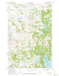
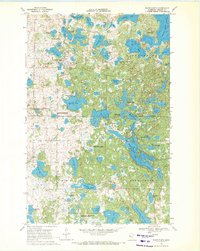
1969 Map of Ogema NE
USGS Topo · Published 1971About this map
White Earth Lake and the winding course of the White Earth River dominate this 1969 landscape within the White Earth Indian Reservation. The map documents a period of conservation-focused land management, marked by several sections of the National Wildlife Management Area and the White Earth State Wildlife Management Area. Human activity is centered around scattered rural structures, including the Lake Grove Ch and a local Townhall, alongside small-scale clearings like Poodle Park.
Find a feature on this map
36 named features on this map. Tap any name to fly to it.
Don’t see what you’re looking for? This feature index may not catch every label — zoom into the map to look around manually.
Map Details
Editions of this 1969 Ogema NE Map
This is the sole edition of this map. No revisions or reprints were ever made.
Other maps of this area

1954 · Bemidji
USGS Topo · 1:250,000

1957 · Bemidji
USGS Topo · 1:250,000

1958 · Bemidji
USGS Topo · 1:250,000

1969 · North Twin Lake
USGS Topo · 1:24,000
1969 · Waubun
USGS Topo · 1:24,000
1969 · Ogema
USGS Topo · 1:24,000
1969 · Strawberry Lake
USGS Topo · 1:24,000

1969 · Snider Lake
USGS Topo · 1:24,000
1969 · White Earth
USGS Topo · 1:24,000
1969 · Beaulieu
USGS Topo · 1:24,000