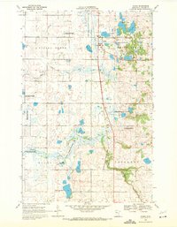
1969 Map of Ogema
USGS Topo · Published 1971About this map
The settlement of Ogema stands as the primary hub of this 1960s landscape, situated along the vital corridor of the Soo Line railroad. This region of Becker County is characterized by a dense network of glacial prairie potholes and larger water bodies, including Sand Lake, Rat Farm Lake, and the distinctly named Trotterchaud Lake to the south. The area reflects a strong commitment to conservation and public land use, with several designated territories such as the Spring Creek State Wildlife Management Area and the Biparta State Wildlife Management Area protecting the wetlands.
Find a feature on this map
29 named features on this map. Tap any name to fly to it.
Don’t see what you’re looking for? This feature index may not catch every label — zoom into the map to look around manually.
Map Details
Editions of this 1969 Ogema Map
This is the sole edition of this map. No revisions or reprints were ever made.
Other maps of this area

1918 · Flom
USGS Topo · 1:62,500

1952 · Grand Forks
USGS Topo · 1:250,000

1953 · Fargo
USGS Topo · 1:250,000

1953 · Brainerd
USGS Topo · 1:250,000

1954 · Bemidji
USGS Topo · 1:250,000

1956 · Fargo
USGS Topo · 1:250,000

1956 · Grand Forks
USGS Topo · 1:250,000

1957 · Brainerd
USGS Topo · 1:250,000

1957 · Bemidji
USGS Topo · 1:250,000

1958 · Bemidji
USGS Topo · 1:250,000