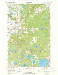
1969 Map of North Twin Lake
USGS Topo · Published 1990About this map
Naytahwaush sits at the center of this 1960s landscape, serving as a primary settlement within the White Earth Indian Reservation. The village is anchored by the Samuel Memorial Cem and an Indian Cem, providing a detailed look at the community's layout before later modern developments. The surrounding terrain is defined by a complex glacial aquatic system, where the Wild Rice River and Schimmelhorn Creek wind through a dense network of lakes and marshes, including Long Lake and Swanson Lake.
Find a feature on this map
35 named features on this map. Tap any name to fly to it.
Don’t see what you’re looking for? This feature index may not catch every label — zoom into the map to look around manually.
Map Details
Editions of this 1969 North Twin Lake Map
2 editions found
Other maps of this area

1954 · Bemidji
USGS Topo · 1:250,000

1957 · Bemidji
USGS Topo · 1:250,000

1958 · Bemidji
USGS Topo · 1:250,000

1969 · North Twin Lake
USGS Topo · 1:24,000

1969 · Ebro
USGS Topo · 1:24,000

1969 · Roy Lake
USGS Topo · 1:24,000

1969 · Tulaby Lake
USGS Topo · 1:24,000
1969 · Ogema NE
USGS Topo · 1:24,000

1969 · Snider Lake
USGS Topo · 1:24,000
1969 · Ebro NW
USGS Topo · 1:24,000