1900s (20th Century) Maps of Mahnomen County, Minnesota
Explore 27 historic maps of Mahnomen County from the 1900s (20th Century). These maps offer a rare glimpse into what life looked like during the 1900s — showing old roads, neighborhoods, homes, and landmarks that have changed or disappeared over time.
Whether you're researching your family's past, planning a metal detecting trip, or studying how Mahnomen County's landscape evolved across the 1900s, these high-resolution maps are a powerful tool for exploring the history of this region.
- Focus on a specific era: All maps on this page are from the 1900s, giving you a focused view of this time period.
- See what’s changed: Compare century-old streets, trails, and buildings to today's modern landscape using overlays and satellite layers.
- Research with precision: Use these maps for genealogy, historical research, land use analysis, or educational projects.
- View, download, or print: Maps are fully viewable online in high resolution, and can be downloaded or printed for your own records.
Start exploring Mahnomen County's history through authentic maps from the 1900s. This is your window into the past.
Mahnomen County, MN maps
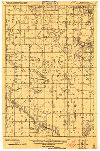
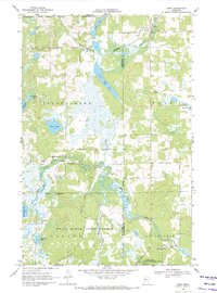
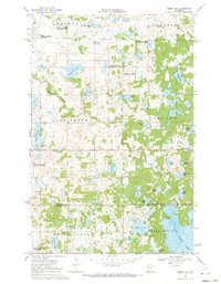
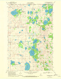
(27)- 1918 Map of Flom
 1918 Flom1918 Print · USGSNorthwestern Minnesota's farming townships are captured here at the close of the First World War. Researchers can trace rural school districts and family church sites near Fossum, Flom P.O., and along the South Branch Wild Rice River.
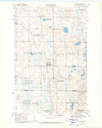
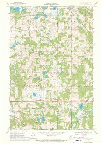
 - 1919 Map of Fosston
 1919 Fosston1919 Print · USGSNorthwest Minnesota at the end of the Great War shows a landscape being actively reshaped by drainage ditches and railroad expansion. Genealogists can trace family footprints in Fosston, Lengby, and Gonvick, or locate rural landmarks like Turtle Lake 30 and Cross Lake.
 - 1952 Map of Grand Forks, 1967 Print
 1952 Grand Forks1967 Print · USGSThe Red River Valley in the early fifties is shown here at the height of its rail-and-river agricultural economy. Researchers can locate small-town landmarks like the Pleasant View School, the Immanuel Lutheran Church, and trace the path of the Soo Line Railroad.3 unique versions available
 - 1954 Map of Bemidji, 1966 Print
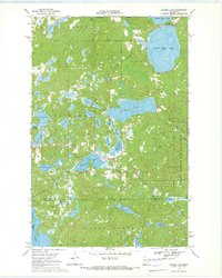
 1954 Bemidji1966 Print · USGSNorthern Minnesota's lake country and timberlands are captured here at a mid-century peak of rail and road expansion. Genealogists and historians can trace family roots through numerous small settlements like Mahnomen, Clearbrook, and Walker, while locating local landmarks such as White Earth Church.4 unique versions available
 - 1956 Map of Grand Forks
 1956 Grand Forks1956 Print · USGSThe Red River Valley in the mid-fifties is captured here as a thriving corridor of grain elevators and rail-linked towns along the North Dakota and Minnesota border. Researchers can trace historic church sites like Immanuel Lutheran Church, vanished rail stops at Tilde Junction, and the boundaries of the White Earth Indian Reservation.
 - 1957 Map of Bemidji
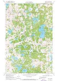
 1957 Bemidji1957 Print · USGSNorthern Minnesota in the mid-fifties is defined by its massive lake systems and the sprawling timberlands of the Chippewa National Forest. Genealogists and researchers can trace old rail lines like the Great Northern RR and locate settlements such as Moberg, Naytahwaush, and Lake Itasca.
 - 1958 Map of Bemidji
 1958 Bemidji1958 Print · USGSNorthern Minnesota in the late fifties is a vast landscape of tribal lands and timber forests tied together by rail. Genealogists and researchers can trace old rail stops and lakeside communities from Walker to Fosston, or explore the source of the Mississippi at Lake Itasca.
 - 1966 Map of Grand Forks
 1966 Grand Forks1966 Print · USGSThe Red River Valley in the mid-sixties shows a landscape shaped by rail-line commerce and complex water management. Genealogists and historians can trace rail-side towns like Emerado and Hunter or locate rural landmarks like the Pleasant View Church.
 - 1966 Map of Flom NE, 1967 Print
 1966 Flom NE1967 Print · USGSNorthwestern Minnesota in the mid-sixties reveals a landscape of transition along the White Earth Indian Reservation Boundary. Genealogists and local historians can trace rural roads to a community Townhall or locate family lands near Apple Lake and Spring Creek.
 - 1966 Map of Faith, 1967 Print
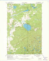
 1966 Faith1967 Print · USGSThe rural borderlands of Norman and Mahnomen counties are captured here in the 1960s, bisected by the White Earth Indian Reservation Boundary. Genealogists can trace family footprints near the St Olaf Ch, a local Cem, and the settlement of Faith.
 - 1966 Map of Faith NE, 1967 Print
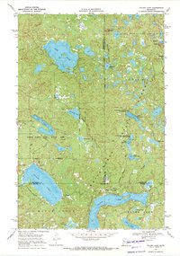
 1966 Faith NE1967 Print · USGSNorthwestern Minnesota in the mid-1960s reveals a transition between managed prairie and conservation lands. Researchers can trace the White Earth Indian Reservation Boundary alongside regional landmarks like Bear Park and Bejou.
 - 1969 Map of North Twin Lake, 1971 Print
 1969 North Twin Lake1971 Print · USGSThe Mahnomen County lake country is captured here in the late sixties, showcasing the community of Naytahwaush and its surrounding wetlands. Genealogists and researchers can locate the Indian Cem, Samuel Memorial Cem, and landmarks along North Twin Lake.2 unique versions available
 - 1969 Map of Ebro, 1971 Print
 1969 Ebro1971 Print · USGSThe transition from the lake country to the timbered reaches of the White Earth State Forest is captured here in the late sixties. Genealogists and local historians can locate the Holiness Cem, trace the Burlington Northern line through Ebro, and find the riverside settlement of Pine Bend.
 - 1969 Map of Waubun, 1971 Print
 1969 Waubun1971 Print · USGSThe White Earth Indian Reservation in the late sixties reveals a landscape of prairie wetlands and township settlements. Local historians can locate St Anns Cem, trace the waters of Waubun Lake, and explore the grid of Waubun and its surrounding wildlife management areas.
 - 1969 Map of Roy Lake, 1971 Print
 1969 Roy Lake1971 Print · USGSThe White Earth Indian Reservation in the late sixties reveals a landscape defined by deep woods and a dense network of glacial lakes. Local historians can trace the foundations of Naytahwaush and Mahkonce, or locate landmarks like the Cem. and Townhall.
 - 1969 Map of Tulaby Lake, 1971 Print
 1969 Tulaby Lake1971 Print · USGSThe White Earth Indian Reservation in the late sixties is a dense mosaic of glacial lakes and state-managed timberlands. Researchers can locate the small community at Elbow Lake Village or trace routes past St Frances Cabrini Ch and Strawberry Mountain.2 unique versions available
 - 1969 Map of Ogema NE, 1971 Print
 1969 Ogema NE1971 Print · USGSMahnomen and Becker counties are captured in the late sixties within the White Earth Indian Reservation. Genealogists and local historians can trace family-named landmarks like Kersting Lake, find the Lake Grove Ch, and locate the community Townhall.
 - 1969 Map of Fosston SE, 1971 Print
 1969 Fosston SE1971 Print · USGSNorthwestern Minnesota in the late sixties reveals a landscape of winding rivers and rural townships at the edge of the Red Lake Indian Reservation Boundary. Genealogists can trace family roots at St Peter Cem and Freedom Cem, or follow the industrial path of the BURLINGTON NORTHERN railroad.
 - 1969 Map of Snider Lake, 1971 Print
 1969 Snider Lake1971 Print · USGSThe White Earth Indian Reservation in the late sixties is shown here as a landscape of dense forest and deep glacial lakes. Researchers can locate the Tulaby Lookout Tower, a lakeside Cem, and forest trails near Snider Lake.2 unique versions available
 - 1969 Map of Ebro NW, 1971 Print
 1969 Ebro NW1971 Print · USGSThe White Earth Indian Reservation boundary meets Mahnomen County in this late 1960s landscape of glacial lakes and wetlands. Researchers can trace rural landmarks like St Agnes Ch, the Budde Meadow State Wildlife Management Area, and local waters such as Annawaush Lake.
 - 1969 Map of Bejou, 1972 Print
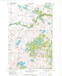
 1969 Bejou1972 Print · USGSMahnomen County was a landscape of rail-connected prairie and conservation tracts in the late sixties. Genealogists and local historians can locate the Bejou Cem, the village of Bejou along the SOO LINE, and the outlying Townhall.
 - 1969 Map of Mahnomen NE, 1972 Print
 1969 Mahnomen NE1972 Print · USGSThe Mahnomen and Polk County line during the late sixties shows a landscape defined by conservation and glacial lakes. Genealogists and historians can trace the Duane Cem, the local Townhall, and the White Earth Indian Reservation Boundary.
 - 1969 Map of Beaulieu, 1972 Print
 1969 Beaulieu1972 Print · USGSThe Mahnomen County lake country is captured here in the late sixties, showcasing the transition between local township life and vast wildlife preserves. Genealogists and local historians can locate Beaulieu, the St Josephs Ch, and family landmarks near Edwin Lake or Sandy Lake.
 - 1969 Map of Mahnomen, 1972 Print
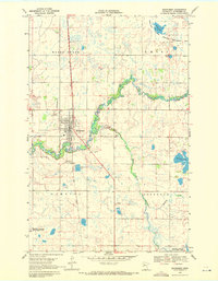 1969 Mahnomen1972 Print · USGSMahnomen and the surrounding reservation lands are captured here in the late sixties as the regional rail and river network shaped the local economy. Researchers can locate several burial sites like Riverside Cem and St Michaels Cem, or trace the winding path of the Wild Rice River.
 - 1984 Map of Ada, 1985 Print
 1984 Ada1985 Print · USGSThe Red River Valley's agricultural heartland is documented here in the mid-1980s, showcasing the extensive network of drainage ditches and rail lines that powered the region. Genealogists and local historians can trace family locations near Ada, Fertile, and along the Burlington Northern line.2 unique versions available
Showing maps 1-25 of 27
Top cities of Mahnomen County
Frequently asked questions
- What are the different types of historical maps available for Mahnomen County?
- What is the oldest map of Mahnomen County?
- Where can I purchase historical maps of Mahnomen County for my home or office?
- Where can I download high-res historical maps of Mahnomen County?
- Are there historical topographic maps available for Mahnomen County?
- Is there historical aerial imagery available for Mahnomen County?
- Where are historical maps of Mahnomen County sourced from?