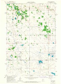
1966 Map of Flom NE
USGS Topo · Published 1967About this map
The White Earth Indian Reservation Boundary bisects this landscape, marking a significant jurisdictional line through the glacial terrain of northwestern Minnesota. During the mid-1960s, this area at the intersection of Norman, Mahnomen, and Becker counties was characterized by scattered wetlands and dedicated conservation zones. The map illustrates a network of protected lands, including the Moccasin State Wildlife Management Area, the Coburn State Wildlife Management Area, and the Waubun State Wildlife Management Area.
Find a feature on this map
20 named features on this map. Tap any name to fly to it.
Don’t see what you’re looking for? This feature index may not catch every label — zoom into the map to look around manually.
Map Details
Editions of this 1966 Flom NE Map
This is the sole edition of this map. No revisions or reprints were ever made.
Other maps of this area

1918 · Flom
USGS Topo · 1:62,500

1952 · Grand Forks
USGS Topo · 1:250,000

1954 · Bemidji
USGS Topo · 1:250,000

1956 · Grand Forks
USGS Topo · 1:250,000

1957 · Bemidji
USGS Topo · 1:250,000

1958 · Bemidji
USGS Topo · 1:250,000

1965 · Waukon
USGS Topo · 1:24,000

1966 · Flom
USGS Topo · 1:24,000

1966 · Grand Forks
USGS Topo · 1:250,000
1966 · Tilde Lake
USGS Topo · 1:24,000