Old Maps of Norman County, Minnesota
Explore 136 old maps of Norman County, spanning from 1918 to today. These high-resolution historic maps reveal how streets, neighborhoods, landmarks, and natural features evolved over time — perfect for genealogy, metal detecting, research, and local history exploration.
What you can do with these maps:
- See how Norman County changed over time: Compare historical maps to modern-day views to trace roads, homesites, rail lines & more.
- View detailed metadata: Each map includes creators, publishers, year, scale, and archive source.
- Overlay maps with satellite & LiDAR: Visualize the past alongside modern tools to explore terrain & human change.
- Trusted historical sources: Maps sourced from the USGS, Library of Congress, and other archives.
- Access maps your way: View online, download high-res files, or order prints for personal or research use.
Start exploring old maps of Norman County to uncover forgotten places, hidden landmarks, and the deep history beneath your feet.
Norman County, MN maps
(136)- 1918 Map of Hendrum
 1918 Hendrum1918 Print · USGSThe Red River Valley borderlands are captured here just before the end of the Great War, showing the vital rail and river corridor between North Dakota and Minnesota. Researchers can trace the early footprints of Shelly Station, Halstad Station, and Hendrum Station along the Great Northern railroad.
 - 1918 Map of Twin Valley
 1918 Twin Valley1918 Print · USGSNorman County is captured during the Great War era as a burgeoning agricultural district defined by the railroad and the river. Genealogists can trace the specific locations of family-owned farms near Twin Valley, Gary, and rural landmarks like the Betcher School or Cem. Church.
 - 1918 Map of Flom
 1918 Flom1918 Print · USGSNorthwestern Minnesota's farming townships are captured here at the close of the First World War. Researchers can trace rural school districts and family church sites near Fossum, Flom P.O., and along the South Branch Wild Rice River.
 - 1918 Map of Ulen
 1918 Ulen1918 Print · USGSClay and Norman counties at the end of the Great War show a landscape being reshaped by the Northern Pacific railroad and drainage works. Researchers can trace rural school locations, cemeteries, and early settlements like Ulen and Syre among the prairie townships.2 unique versions available
 - 1924 Map of Ada, 1944 Print
 1924 Ada1944 Print · USGSNorman County agricultural life is captured here in the mid-1920s, centered on the railroad towns of the Red River Valley. Researchers can trace the importance of the Great Northern rail line and identify specific local landmarks like the Ada Courthouse Tower, Lockhart Elevator, and the Fair Grounds.
 - 1952 Map of Grand Forks, 1967 Print
 1952 Grand Forks1967 Print · USGSThe Red River Valley in the early fifties is shown here at the height of its rail-and-river agricultural economy. Researchers can locate small-town landmarks like the Pleasant View School, the Immanuel Lutheran Church, and trace the path of the Soo Line Railroad.3 unique versions available
 - 1956 Map of Grand Forks
 1956 Grand Forks1956 Print · USGSThe Red River Valley in the mid-fifties is captured here as a thriving corridor of grain elevators and rail-linked towns along the North Dakota and Minnesota border. Researchers can trace historic church sites like Immanuel Lutheran Church, vanished rail stops at Tilde Junction, and the boundaries of the White Earth Indian Reservation.
 - 1963 Map of Shelly, 1964 Print
 1963 Shelly1964 Print · USGSThe fertile Red River Valley is captured here in the early 1960s, showing the agricultural landscape of Norman County and the Minnesota border. Researchers can trace rural life through the presence of the Herberg Sch, Shelly Cem, and the Great Northern rail line.2 unique versions available
 - 1963 Map of Perley, 1964 Print
 1963 Perley1964 Print · USGSThe Red River Valley at the Minnesota border comes into focus during the early sixties, showing the tight meanders of the Red River and Wild Rice River. Trace local history through the Great Northern rail stops, Perley townsite, and Kirkebo Cem.2 unique versions available
 - 1963 Map of Halstad, 1964 Print
 1963 Halstad1964 Print · USGSThe Red River Valley in the early 1960s is defined here by its winding river border and thriving rail towns. Genealogists can trace family roots through several local landmarks like Pontoppidan Ch, Quincy Cem, and Immanuel Cem.
 - 1965 Map of Lockhart, 1966 Print
 1965 Lockhart1966 Print · USGSThe Red River Valley prairie in the mid-sixties is captured here as a grid of industrial farming and rail transit. Genealogists can trace the rural landscape of Lockhart and the Great Northern line near the Immanuel Ch and local Cem.
 - 1965 Map of Anthony, 1966 Print
 1965 Anthony1966 Print · USGSNorman County farm country is captured here in the mid-sixties, showing the engineered landscape of the Red River Valley. Researchers can locate the Concordia Ch Cem and trace the complex network of waterways like Marsh River and State Ditch No 68.
 - 1965 Map of Ada NW, 1966 Print
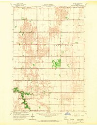 1965 Ada NW1966 Print · USGSNorthwestern Minnesota's agricultural heartland is captured in the mid-sixties, showing the intricate grid of township life and drainage. Trace family land between Bethany Ch and the Marsh River or locate the old Townhall in Good Hope.
 - 1965 Map of Waukon, 1967 Print
 1965 Waukon1967 Print · USGSNorman County farm country is captured here in the mid-1960s, showing a landscape defined by the winding Wild Rice River and the grid of township roads. Genealogists can locate family sites near St Petri Ch, Immanuel Cem, and the small settlement of Waukon.
 - 1965 Map of Twin Valley SW, 1967 Print
 1965 Twin Valley SW1967 Print · USGSNorman County was a landscape of structured prairie and river bottomlands in the mid-sixties. Genealogists and local historians can locate St Johns Ch, trace the oxbows of Gilbertsons Slough, and find the Skandinavia Cem and West Wild Rice Cem.
 - 1965 Map of Twin Valley, 1967 Print
 1965 Twin Valley1967 Print · USGSNorthwestern Minnesota farm country is centered here in the mid-1960s, where the winding Wild Rice River cuts through the plains. Genealogists can trace the rural layouts of Twin Valley and Gary along the Northern Pacific rail line.2 unique versions available
 - 1965 Map of Syre, 1967 Print
 1965 Syre1967 Print · USGSNorthwestern Minnesota's agricultural landscape is captured in the mid-sixties, centered on the Northern Pacific railroad. Genealogists and local historians can trace the settlement of Syre, locate a rural Cem, or identify the township Townhall.
 - 1965 Map of Twin Valley NW, 1967 Print
 1965 Twin Valley NW1967 Print · USGSNorthwestern Minnesota in the mid-sixties reveals a landscape meticulously reshaped by water management and conservation. Trace local land use through features like State Ditch No 68, the rural Townhall, and the marshes of Lockhart Swamp.
 - 1965 Map of Flaming, 1967 Print
 1965 Flaming1967 Print · USGSThe rural border of Norman and Polk Counties is documented here in the mid-1960s, showing a landscape defined by rail and drainage. Genealogists can locate the Spring Creek Chapel, the village of Flaming, and the Northern Pacific line crossing the prairie.
 - 1965 Map of Ada, 1967 Print
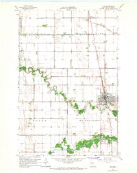 1965 Ada1967 Print · USGSThe Norman County seat of Ada and the surrounding Red River Valley farmland are shown here in the mid-1960s, just as modern irrigation and aviation were shaping the prairie. Genealogists and local historians can locate Petri Cem, the rural outpost of Hadler, and the Great Northern rail lines that fueled this agricultural hub.
 - 1965 Map of Ulen NW, 1967 Print
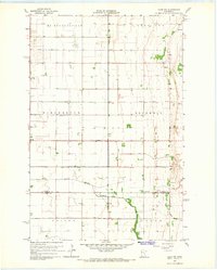 1965 Ulen NW1967 Print · USGSNorman County agriculture was in full bloom in the mid-sixties, defined by a vast network of drainage ditches and the growth of the village of Borup. Genealogists can locate family landmarks like Jevnaker Ch and the South Branch Wild Rice River.
 - 1966 Map of Flom, 1963 Print
 1966 Flom1963 Print · USGSThe rural borderlands of Norman, Clay, and Becker counties are captured here in the mid-1960s. Genealogists and local historians can trace family roots through sites like Wild Rice Ch, Bethlehem Cem, and the old Townhall.2 unique versions available
 - 1966 Map of Grand Forks
 1966 Grand Forks1966 Print · USGSThe Red River Valley in the mid-sixties shows a landscape shaped by rail-line commerce and complex water management. Genealogists and historians can trace rail-side towns like Emerado and Hunter or locate rural landmarks like the Pleasant View Church.
 - 1966 Map of Felton NW, 1967 Print
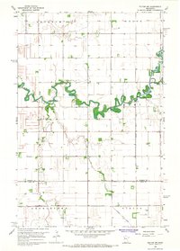 1966 Felton NW1967 Print · USGSThe Red River Valley prairie of Norman and Clay Counties is shown in the mid-1960s as a highly engineered agricultural landscape. Genealogists can trace rural landmarks like Landstad Ch, St Marys Cem, and the winding Wild Rice River.
 - 1966 Map of Borup, 1967 Print
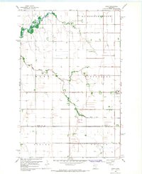 1966 Borup1967 Print · USGSBorup and the surrounding Red River Valley townships are shown in the mid-1960s as a landscape of precision agriculture and rail transport. Researchers can trace the Great Northern tracks and find local landmarks like Winchester Cem or the winding Wild Rice River.
Showing maps 1-25 of 136
Top cities of Norman County
- Ada historical maps
- Twin Valley historical maps
- Halstad historical maps
- Hendrum historical maps
- Shelly historical maps
- Gary historical maps
See more
Frequently asked questions
- What are the different types of historical maps available for Norman County?
- What is the oldest map of Norman County?
- Where can I purchase historical maps of Norman County for my home or office?
- Where can I download high-res historical maps of Norman County?
- Are there historical topographic maps available for Norman County?
- Is there historical aerial imagery available for Norman County?
- Where are historical maps of Norman County sourced from?