Old Maps of Little Falls, Minnesota
Explore 16 old maps of Little Falls, spanning from 1948 to today. These high-resolution historic maps reveal how streets, neighborhoods, landmarks, and natural features evolved over time — perfect for genealogy, metal detecting, research, and local history exploration.
What you can do with these maps:
- See how Little Falls changed over time: Compare historical maps to modern-day views to trace roads, homesites, rail lines & more.
- View detailed metadata: Each map includes creators, publishers, year, scale, and archive source.
- Overlay maps with satellite & LiDAR: Visualize the past alongside modern tools to explore terrain & human change.
- Trusted historical sources: Maps sourced from the USGS, Library of Congress, and other archives.
- Access maps your way: View online, download high-res files, or order prints for personal or research use.
Start exploring old maps of Little Falls to uncover forgotten places, hidden landmarks, and the deep history beneath your feet.
Little Falls, MN maps
(16)- 1948 Map of Belle Prairie, 1961 Print
 1948 Belle Prairie1961 Print · USGSCovers Little Falls, including Belle Prairie, Randall, and other nearby areas
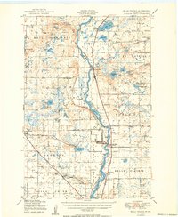
 - 1948 Map of Little Falls, 1973 Print
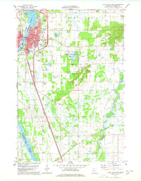
 1948 Little Falls1973 Print · USGSCovers Little Falls, including Rice, Royalton, and other nearby areas
 - 1950 Map of Belle Prairie
 1950 Belle Prairie1950 Print · USGSCovers Little Falls, including Belle Prairie, Randall, and other nearby areas3 unique versions available
 - 1950 Map of Little Falls
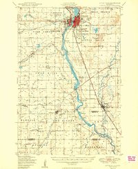 1950 Little Falls1950 Print · USGSCovers Little Falls, including Rice, Royalton, and other nearby areas2 unique versions available
 - 1953 Map of Brainerd, 1966 Print
 1953 Brainerd1966 Print · USGSCovers Little Falls, including Brainerd, Detroit Lakes, and other nearby areas3 unique versions available
 - 1953 Map of Saint Cloud, 1968 Print
 1953 Saint Cloud1968 Print · USGSCovers Little Falls, including St. Cloud, Saint Cloud, and other nearby areas3 unique versions available
 - 1956 Map of Belle Prairie, 1958 Print
 1956 Belle Prairie1958 Print · USGSCovers Little Falls, including Belle Prairie, Camp Ripley Junction, and other nearby areas2 unique versions available
 - 1957 Map of Brainerd
 1957 Brainerd1957 Print · USGSCovers Little Falls, including Brainerd, Detroit Lakes, and other nearby areas
 - 1957 Map of Saint Cloud
 1957 Saint Cloud1957 Print · USGSCovers Little Falls, including St. Cloud, Saint Cloud, and other nearby areas
 - 1958 Map of Saint Cloud
 1958 Saint Cloud1958 Print · USGSCovers Little Falls, including St. Cloud, Saint Cloud, and other nearby areas
 - 1958 Map of Brainerd
 1958 Brainerd1958 Print · USGSCovers Little Falls, including Brainerd, Detroit Lakes, and other nearby areas
 - 1965 Map of Brainerd
 1965 Brainerd1965 Print · USGSCovers Little Falls, including Brainerd, Detroit Lakes, and other nearby areas
 - 1978 Map of Little Falls West
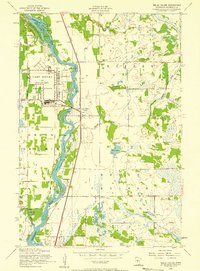
 1978 Little Falls West1978 Print · USGSCovers Little Falls, including Flensburg, Sobieski, and other nearby areas2 unique versions available
 - 1978 Map of Little Falls East
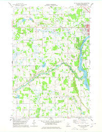
 1978 Little Falls East1978 Print · USGSCovers Little Falls, including Gregory, Maple Leaf Court, and other nearby areas2 unique versions available
 - 1986 Map of St. Cloud
 1986 St. Cloud1986 Print · USGSCovers Little Falls, including St. Cloud, Saint Cloud, and other nearby areas2 unique versions available
 - 1986 Map of Brainerd
 1986 Brainerd1986 Print · USGSCovers Little Falls, including Brainerd, Baxter, and other nearby areas2 unique versions available
End of results
Showing maps 1-16 of 16
Top cities near Little Falls
- Rice historical maps
- Belle Prairie historical maps
- Royalton historical maps
- Cushing historical maps
- Randall historical maps
- Upsala historical maps
See more
Top neighborhoods of Little Falls
- Maple Leaf Court historical maps
- Suburban Mobile Home Park historical maps
- Belle Prairie historical maps
Frequently asked questions
- What are the different types of historical maps available for Little Falls?
- What is the oldest map of Little Falls?
- Where can I purchase historical maps of Little Falls for my home or office?
- Where can I download high-res historical maps of Little Falls?
- Are there historical topographic maps available for Little Falls?
- Is there historical aerial imagery available for Little Falls?
- Where are historical maps of Little Falls sourced from?