1960s Maps of Slayton, Minnesota
Explore 4 historic maps of Slayton from the 1960s. These maps offer a rare glimpse into what life looked like during the 1960s — showing old roads, neighborhoods, homes, and landmarks that have changed or disappeared over time.
Whether you're researching your family's past, planning a metal detecting trip, or studying how Slayton's landscape evolved across the 1960s, these high-resolution maps are a powerful tool for exploring the history of this region.
- Focus on a specific era: All maps on this page are from the 1960s, giving you a focused view of this time period.
- See what’s changed: Compare century-old streets, trails, and buildings to today's modern landscape using overlays and satellite layers.
- Research with precision: Use these maps for genealogy, historical research, land use analysis, or educational projects.
- View, download, or print: Maps are fully viewable online in high resolution, and can be downloaded or printed for your own records.
Start exploring Slayton's history through authentic maps from the 1960s. This is your window into the past.
Slayton, MN maps
(4)- 1967 Map of New Ulm
 1967 New Ulm1967 Print · USGSSouthern Minnesota in the mid-fifties is captured here as a landscape of river-valley missions and busy prairie rail towns. Researchers can trace the Yellow Medicine Trail and locate historic sites like the Morton Indian Mission and Milford State Monument.
 - 1967 Map of Slayton, 1968 Print
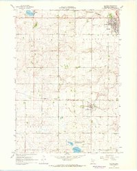 1967 Slayton1968 Print · USGSMurray County at the height of the 1960s shows a landscape defined by the intersection of the Chicago and North Western and the Milwaukee Road. Genealogists can locate family landmarks like St Columba Cem, West Sch, and the village of Hadley.
 - 1967 Map of Hadley, 1968 Print
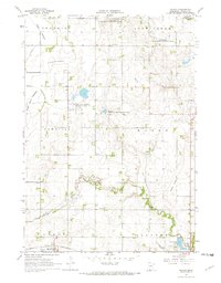 1967 Hadley1968 Print · USGSMurray County prairie life in the late sixties is centered on the rail village of Hadley and the surrounding townships. Researchers can trace family roots at Highland Home Cem, locate the local Townhall, or follow the old Chicago and North Western rail line.3 unique versions available
 - 1967 Map of Currie, 1969 Print
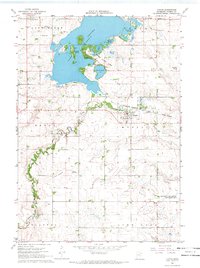 1967 Currie1969 Print · USGSThe headwaters of the Des Moines River and the bustling shores of Lake Shetek are captured here in the late sixties. Genealogists and historians can trace the early layout of Currie, locate Bethany Cem, and explore the development of Lake Shetek State Park.2 unique versions available
End of results
Showing maps 1-4 of 4
Top cities near Slayton
- Fulda historical maps
- Wilmont historical maps
- Chandler historical maps
- Lake Wilson historical maps
- Currie historical maps
- Iona historical maps
See more
Frequently asked questions
- What are the different types of historical maps available for Slayton?
- What is the oldest map of Slayton?
- Where can I purchase historical maps of Slayton for my home or office?
- Where can I download high-res historical maps of Slayton?
- Are there historical topographic maps available for Slayton?
- Is there historical aerial imagery available for Slayton?
- Where are historical maps of Slayton sourced from?