1900s (20th Century) Maps of Red Lake Falls, Minnesota
Explore 8 historic maps of Red Lake Falls from the 1900s (20th Century). These maps offer a rare glimpse into what life looked like during the 1900s — showing old roads, neighborhoods, homes, and landmarks that have changed or disappeared over time.
Whether you're researching your family's past, planning a metal detecting trip, or studying how Red Lake Falls's landscape evolved across the 1900s, these high-resolution maps are a powerful tool for exploring the history of this region.
- Focus on a specific era: All maps on this page are from the 1900s, giving you a focused view of this time period.
- See what’s changed: Compare century-old streets, trails, and buildings to today's modern landscape using overlays and satellite layers.
- Research with precision: Use these maps for genealogy, historical research, land use analysis, or educational projects.
- View, download, or print: Maps are fully viewable online in high resolution, and can be downloaded or printed for your own records.
Start exploring Red Lake Falls's history through authentic maps from the 1900s. This is your window into the past.
Red Lake Falls, MN maps
(8)- 1918 Map of Red Lake Falls
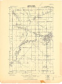 1918 Red Lake Falls1918 Print · USGSRed Lake County and eastern Polk County are captured here during the first World War as the regional rail network neared its peak. Researchers can trace the early footprints of Red Lake Falls, the winding Red Lake River, and smaller stops like Huot and Gentilly.
 - 1952 Map of Red Lake Falls, 1954 Print
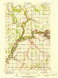 1952 Red Lake Falls1954 Print · USGSRed Lake Falls and the surrounding fertile prairies are shown here in the early fifties, just as the local rail-and-river economy was shifting. Genealogists can trace family footprints through numerous rural landmarks like Evangelical Ch, Marcoux Corners, and the Prairie Queen Sch.
 - 1952 Map of Grand Forks, 1967 Print
 1952 Grand Forks1967 Print · USGSThe Red River Valley in the early fifties is shown here at the height of its rail-and-river agricultural economy. Researchers can locate small-town landmarks like the Pleasant View School, the Immanuel Lutheran Church, and trace the path of the Soo Line Railroad.3 unique versions available
 - 1956 Map of Grand Forks
 1956 Grand Forks1956 Print · USGSThe Red River Valley in the mid-fifties is captured here as a thriving corridor of grain elevators and rail-linked towns along the North Dakota and Minnesota border. Researchers can trace historic church sites like Immanuel Lutheran Church, vanished rail stops at Tilde Junction, and the boundaries of the White Earth Indian Reservation.
 - 1966 Map of Grand Forks
 1966 Grand Forks1966 Print · USGSThe Red River Valley in the mid-sixties shows a landscape shaped by rail-line commerce and complex water management. Genealogists and historians can trace rail-side towns like Emerado and Hunter or locate rural landmarks like the Pleasant View Church.
 - 1982 Map of Marcoux Corners
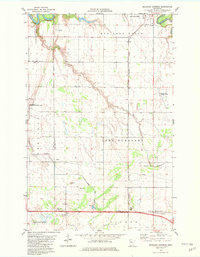 1982 Marcoux Corners1982 Print · USGSRed Lake and Polk counties are captured here in the early eighties, showcasing a landscape shaped by river confluences and the Burlington Northern railroad. Researchers can trace rural life through sites like Cyr Cem, Marcoux Corners, and Kertsonville.
 - 1982 Map of Red Lake Falls
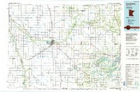
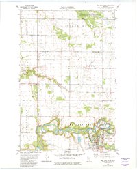 1982 Red Lake Falls1982 Print · USGSRed Lake Falls and the surrounding prairie were captured in the early eighties at the confluence of two major rivers. Researchers can trace the town's layout including Washington Sch or find outlying landmarks like Immanuel Cem and Wylie.
 - 1984 Map of Crookston, 1985 Print
 1984 Crookston1985 Print · USGSNorthwest Minnesota at the peak of the mid-eighties reveals a landscape of fertile valley plains and conservation lands tied together by rail. Genealogists and historians can trace the local rail networks of the Soo Line Railroad and Burlington Northern Railroad through regional hubs like Crookston and Red Lake Falls.2 unique versions available
End of results
Showing maps 1-8 of 8
Top cities near Red Lake Falls
- Thief River Falls historical maps
- Gentilly historical maps
- Plummer historical maps
- Mentor historical maps
- Terrebonne historical maps
- Wylie historical maps
Top neighborhoods of Red Lake Falls
Frequently asked questions
- What are the different types of historical maps available for Red Lake Falls?
- What is the oldest map of Red Lake Falls?
- Where can I purchase historical maps of Red Lake Falls for my home or office?
- Where can I download high-res historical maps of Red Lake Falls?
- Are there historical topographic maps available for Red Lake Falls?
- Is there historical aerial imagery available for Red Lake Falls?
- Where are historical maps of Red Lake Falls sourced from?