1980s Maps of Bird Island, Minnesota
Explore 3 historic maps of Bird Island from the 1980s. These maps offer a rare glimpse into what life looked like during the 1980s — showing old roads, neighborhoods, homes, and landmarks that have changed or disappeared over time.
Whether you're researching your family's past, planning a metal detecting trip, or studying how Bird Island's landscape evolved across the 1980s, these high-resolution maps are a powerful tool for exploring the history of this region.
- Focus on a specific era: All maps on this page are from the 1980s, giving you a focused view of this time period.
- See what’s changed: Compare century-old streets, trails, and buildings to today's modern landscape using overlays and satellite layers.
- Research with precision: Use these maps for genealogy, historical research, land use analysis, or educational projects.
- View, download, or print: Maps are fully viewable online in high resolution, and can be downloaded or printed for your own records.
Start exploring Bird Island's history through authentic maps from the 1980s. This is your window into the past.
Bird Island, MN maps
(3)- 1982 Map of Olivia SE, 1983 Print
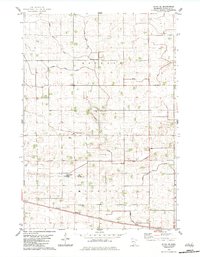 1982 Olivia SE1983 Print · USGSRenville County in the early eighties is a landscape of productive prairie and sophisticated water engineering. Genealogists and local historians can trace the Chicago Milwaukee St Paul and Pacific rail line, St Johns Ch, and the Elim Moravian Cem.
 - 1982 Map of Olivia, 1983 Print
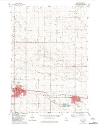 1982 Olivia1983 Print · USGSRenville County farmland was well-established by the early eighties, centered on the corridor between Olivia and Bird Island. You can trace family history through sites like Bird Island Cem, St Aloysius Sch, and the local Courthouse.
 - 1986 Map of Glencoe
 1986 Glencoe1986 Print · USGSThe south-central Minnesota prairie and its glacial lake basins are captured here in the mid-1980s, showcasing a landscape of intensive farming and conservation. Genealogists can locate family-named landmarks and trace the rail lines of the Soo Line and Chicago and North Western through towns like Gaylord, Olivia, and Hutchinson.2 unique versions available
End of results
Showing maps 1-3 of 3
Top cities near Bird Island
- Redwood Falls historical maps
- Olivia historical maps
- Hector historical maps
- Cosmos historical maps
- Roseland historical maps
- Roseland historical maps
See more
Frequently asked questions
- What are the different types of historical maps available for Bird Island?
- What is the oldest map of Bird Island?
- Where can I purchase historical maps of Bird Island for my home or office?
- Where can I download high-res historical maps of Bird Island?
- Are there historical topographic maps available for Bird Island?
- Is there historical aerial imagery available for Bird Island?
- Where are historical maps of Bird Island sourced from?