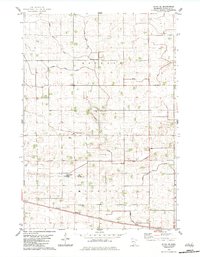
1982 Map of Olivia SE
USGS Topo · Published 1983About this map
Osceola and Melville townships define this agricultural landscape in Renville County, where the geometric precision of the land survey meets an extensive network of water management. The terrain is crisscrossed by several drainage systems, including Judicial Ditch No 2 and Judicial Ditch No 67, which feed into the meandering course of Buffalo Creek. This highly engineered environment supports a rural community centered around small spiritual and civic hubs, such as the United Church of Hope and the Elim Moravian Cem.
Find a feature on this map
19 named features on this map. Tap any name to fly to it.
Don’t see what you’re looking for? This feature index may not catch every label — zoom into the map to look around manually.
Map Details
Editions of this 1982 Olivia SE Map
This is the sole edition of this map. No revisions or reprints were ever made.
Other maps of this area

1952 · Morton
USGS Topo · 1:62,500

1953 · New Ulm
USGS Topo · 1:250,000

1957 · New Ulm
USGS Topo · 1:250,000

1957 · Olivia
USGS Topo · 1:62,500

1958 · New Ulm
USGS Topo · 1:250,000

1964 · Hector
USGS Topo · 1:24,000

1967 · New Ulm
USGS Topo · 1:250,000

1967 · Churchill
USGS Topo · 1:24,000
1967 · Cosmos
USGS Topo · 1:24,000
1982 · Lake Lillian
USGS Topo · 1:24,000