
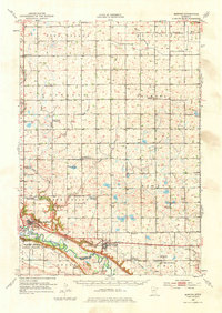
1952 Map of Morton
USGS Topo · Published 1954About this map
The Minnesota River valley carves a dramatic path through the southern edge of this Renville County landscape, where the Lower Sioux Indian Community is situated near several granite quarries. This 1952 survey highlights a rural geography transitioning through the mid-century, evidenced by the numerous specialized educational sites like School No 101 and several decommissioned locations such as School No 13 (Abandoned). The importance of the regional rail network is clear with the Minneapolis and St Louis line following the river course through Morton and Franklin.
Find a feature on this map
52 named features on this map. Tap any name to fly to it.
Don’t see what you’re looking for? This feature index may not catch every label — zoom into the map to look around manually.
Map Details
Editions of this 1952 Morton Map
2 editions found
Other maps of this area

1952 · Redwood Falls
USGS Topo · 1:62,500

1953 · Morgan
USGS Topo · 1:62,500

1953 · New Ulm
USGS Topo · 1:250,000

1957 · New Ulm
USGS Topo · 1:250,000

1957 · Olivia
USGS Topo · 1:62,500

1958 · New Ulm
USGS Topo · 1:250,000

1964 · Fairfax
USGS Topo · 1:24,000

1964 · Sleepy Eye NW
USGS Topo · 1:24,000

1964 · Hector
USGS Topo · 1:24,000

1965 · Danube
USGS Topo · 1:24,000