Old Maps of Faribault, Minnesota
Explore 17 old maps of Faribault, spanning from 1953 to today. These high-resolution historic maps reveal how streets, neighborhoods, landmarks, and natural features evolved over time — perfect for genealogy, metal detecting, research, and local history exploration.
What you can do with these maps:
- See how Faribault changed over time: Compare historical maps to modern-day views to trace roads, homesites, rail lines & more.
- View detailed metadata: Each map includes creators, publishers, year, scale, and archive source.
- Overlay maps with satellite & LiDAR: Visualize the past alongside modern tools to explore terrain & human change.
- Trusted historical sources: Maps sourced from the USGS, Library of Congress, and other archives.
- Access maps your way: View online, download high-res files, or order prints for personal or research use.
Start exploring old maps of Faribault to uncover forgotten places, hidden landmarks, and the deep history beneath your feet.
Faribault, MN maps
(17)- 1953 Map of Saint Paul, 1964 Print
 1953 Saint Paul1964 Print · USGSThe Twin Cities and the Mississippi River valley are captured here at a mid-century turning point. Trace the early growth of Minneapolis and Saint Paul alongside landmarks like Lake Minnetonka and the St Croix River.4 unique versions available
 - 1959 Map of Saint Paul
 1959 Saint Paul1959 Print · USGSThe Twin Cities and southeastern Minnesota appear here in the late fifties, showing the peak of the rail era and post-war suburban growth. Genealogists can trace family footprints near Lake Minnetonka, the Univ Of Minn Rosemount Research Center, or the growing neighborhoods of Richfield.2 unique versions available
 - 1960 Map of Faribault, 1961 Print
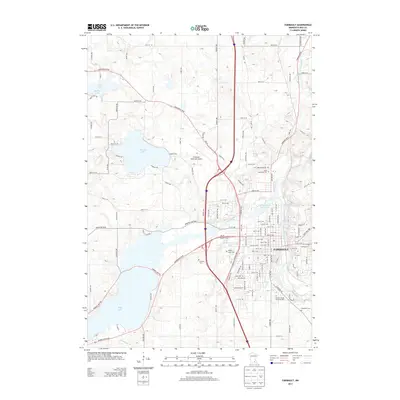
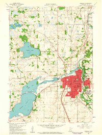 1960 Faribault1961 Print · USGSFaribault at the start of the 1960s is a dense hub of institutional life and rail commerce at the edge of Minnesota's lake country. Genealogists and historians can locate specific school districts and landmarks like the Minnesota Sch for the Deaf, Shattuck Sch, and Calvary Cemetery.
 - 1960 Map of Cannon City, 1961 Print
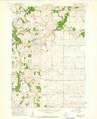 1960 Cannon City1961 Print · USGSRice County farmland and small crossroads settlements are captured here in the early sixties. Researchers can trace the rail corridors of the Chicago and North Western or locate local landmarks like Crystal Lake and the Wide Awake Sch.2 unique versions available
 - 1985 Map of Faribault, 1986 Print
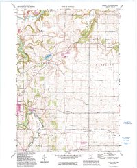
 1985 Faribault1986 Print · USGSThe Minnesota River valley and the glacial lake country of Rice and Le Sueur counties are shown here in the mid-1980s. Researchers can trace the academic grounds of St Olaf College or find old crossroads like Trondhjem and Little Chicago.2 unique versions available
 - 1991 Map of Cannon City, 1995 Print
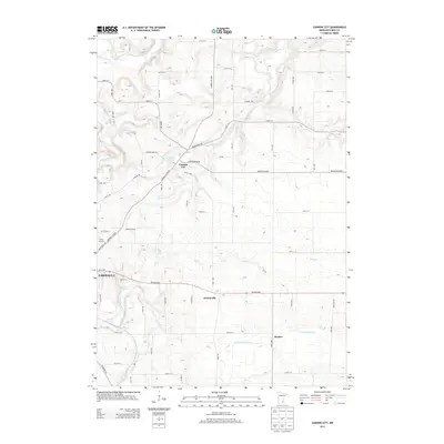
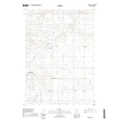
 1991 Cannon City1995 Print · USGSRice County's agricultural landscape is captured here in the early nineties, showing the convergence of the Cannon and Straight Rivers. Genealogists can locate rural school sites like Wide Awake Sch and small settlements including Prairieville and Ruskin.
 - 1991 Map of Faribault, 1995 Print
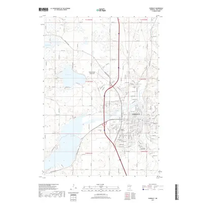
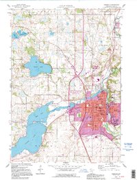 1991 Faribault1995 Print · USGSThe Rice County seat at the start of the nineties reveals a unique landscape of specialized institutions and riverfront industry. Genealogists can trace several regional burial sites like Maple Lawn Cemetery and locate historic campuses including the Minnesota Sch for the Deaf.
 - 2010 Map of Faribault, 2010 Print
 2010 Faribault2010 Print · USGSCovers Faribault, including Rice County, United States, and other nearby areas
 - 2010 Map of Cannon City, 2010 Print
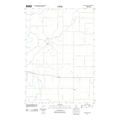 2010 Cannon City2010 Print · USGSCovers Faribault, including Cannon City, Prairieville, and other nearby areas
 - 2013 Map of Faribault, 2013 Print
 2013 Faribault2013 Print · USGSCovers Faribault, including Rice County, United States, and other nearby areas
 - 2013 Map of Cannon City, 2013 Print
 2013 Cannon City2013 Print · USGSCovers Faribault, including Cannon City, Prairieville, and other nearby areas
 - 2016 Map of Faribault, 2016 Print
 2016 Faribault2016 Print · USGSCovers Faribault, including Rice County, United States, and other nearby areas
 - 2016 Map of Cannon City, 2016 Print
 2016 Cannon City2016 Print · USGSCovers Faribault, including Cannon City, Prairieville, and other nearby areas
 - 2019 Map of Faribault, 2019 Print
 2019 Faribault2019 Print · USGSCovers Faribault, including Rice County, United States, and other nearby areas
 - 2019 Map of Cannon City, 2019 Print
 2019 Cannon City2019 Print · USGSCovers Faribault, including Cannon City, Prairieville, and other nearby areas
 - 2022 Map of Cannon City, 2022 Print
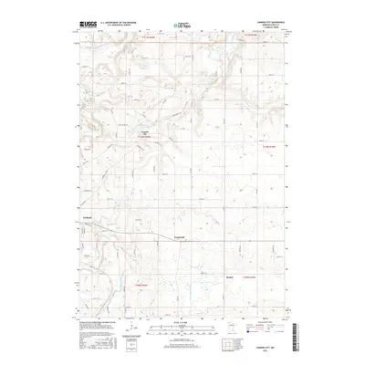
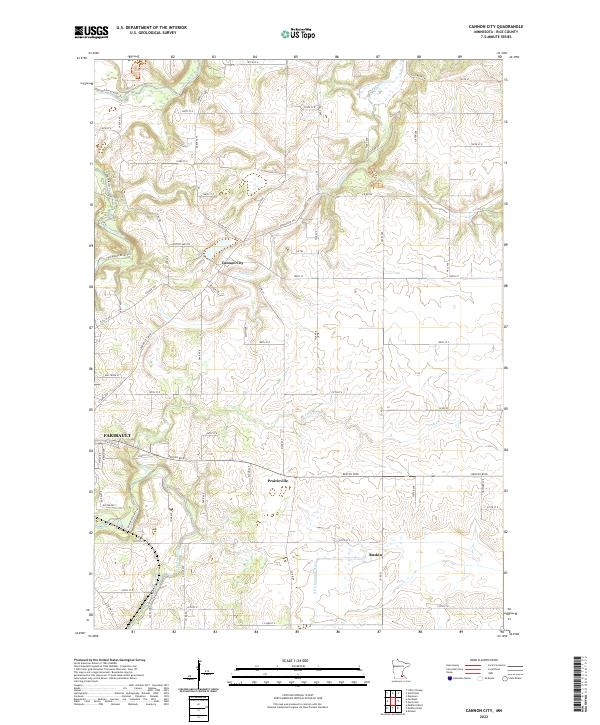 2022 Cannon City2022 Print · USGSRice County agricultural lands and the northern reaches of the regional hub of Faribault are shown here in the early twenty-first century. Genealogists and local historians can trace the rural landscape between Cannon City and Prairieville along the Straight River.
 - 2022 Map of Faribault, 2022 Print
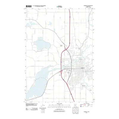
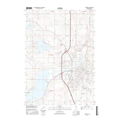
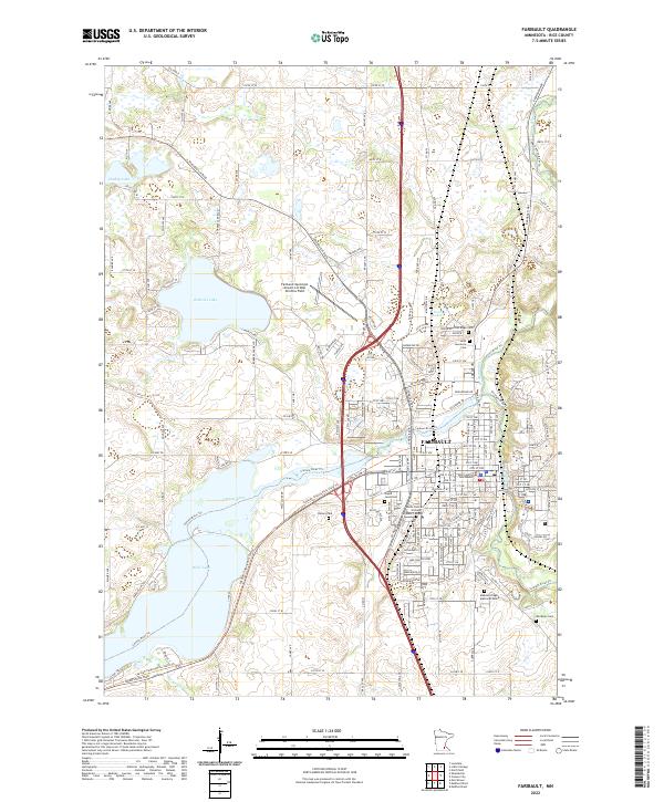 2022 Faribault2022 Print · USGSFaribault and its surrounding lakes are documented here in the early twenty-first century as the city continues its role as a Rice County anchor. Researchers can trace local heritage through the many sites of memory, including Rice County Courthouse, Calvary Cem, and Woodman Cem.
End of results
Showing maps 1-17 of 17
Top cities near Faribault
- Owatonna historical maps
- Northfield historical maps
- Waseca historical maps
- Lonsdale historical maps
- Webster historical maps
- Warsaw historical maps
See more
Frequently asked questions
- What are the different types of historical maps available for Faribault?
- What is the oldest map of Faribault?
- Where can I purchase historical maps of Faribault for my home or office?
- Where can I download high-res historical maps of Faribault?
- Are there historical topographic maps available for Faribault?
- Is there historical aerial imagery available for Faribault?
- Where are historical maps of Faribault sourced from?