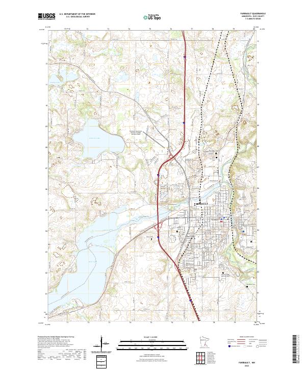
2022 Map of Faribault
USGS Topo · Published 2022About this map
Faribault sits at the confluence of the Cannon River and Straight River, serving as a significant regional hub for Rice County. This contemporary survey details the city's established street grid and civic core, anchored by the Rice County Courthouse. The surrounding landscape is defined by the post-glacial geography of southern Minnesota, featuring prominent water bodies such as Roberds Lake, Dudley Lake, and Wells Lake. The map illustrates the integration of modern infrastructure with the natural terrain, including the Faribault Municipal Airport-Liz Wall Strohfus Field and the South Central College Faribault Campus. Genealogists will find several burial grounds meticulously marked, including Oak Ridge Cem, Saint Lawrence Cem, and Maple Lawn Cem, which reflect the community's long-standing history. The extensive Cannon River Trail network indicates the importance of the river corridor for both drainage and recreation in this part of the state.
Find a feature on this map
108 named features on this map. Tap any name to fly to it.
Don’t see what you’re looking for? This feature index may not catch every label — zoom into the map to look around manually.
Map Details
Editions of this 2022 Faribault Map
This is the sole edition of this map. No revisions or reprints were ever made.
Other maps of this area

1953 · Saint Paul
USGS Topo · 1:250,000

1959 · Saint Paul
USGS Topo · 1:250,000

1960 · Faribault
USGS Topo · 1:24,000

1960 · Northfield
USGS Topo · 1:24,000

1960 · Cannon City
USGS Topo · 1:24,000

1960 · Shieldsville
USGS Topo · 1:24,000

1960 · Lonsdale
USGS Topo · 1:24,000

1960 · Little Chicago
USGS Topo · 1:24,000

1962 · Medford East
USGS Topo · 1:24,000

1962 · Morristown
USGS Topo · 1:24,000