Loading...
Loading map...1960 Map of Faribault
USGS Topo · Published 1961About this map
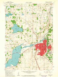
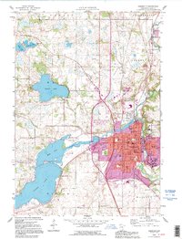
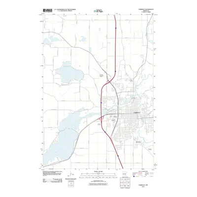
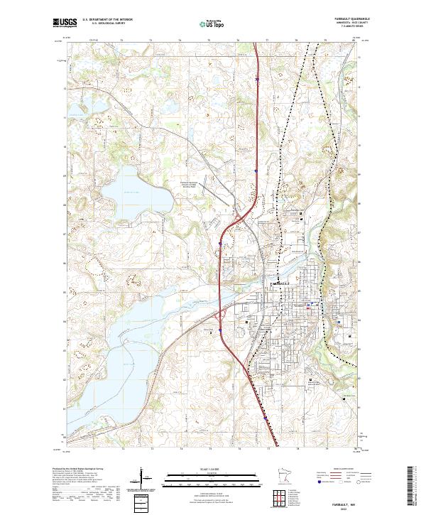
Faribault serves as the focal point of this 1960 survey, situated at the confluence of the Cannon River and a complex network of rail lines. The city’s identity as a regional center for education and public institutions is strikingly evident, with concentrated campuses for the Minnesota Sch for the Deaf, Braille Sch, and the storied Shattuck Sch. These institutions, alongside the massive State Hospital complex, anchor the eastern side of the city.
Find a feature on this map
61 named features on this map. Tap any name to fly to it.
Don’t see what you’re looking for? This feature index may not catch every label — zoom into the map to look around manually.
Map Details
Date Portrayed1960
Date Published1961
PublisherU.S. Geological Survey
Map TypeTopographic
Scale1:24,000
Physical Dimensions21.53 x 27.23 inches
Editions of this 1960 Faribault Map
This is the sole edition of this map. No revisions or reprints were ever made.
Historical Maps of Faribault Through Time
8 maps found
Featured Locations
Source Details
SourceU.S. Geological Survey
CopyrightPublic Domain