1950s Maps of Breitung Township, Minnesota
Explore 7 historic maps of Breitung Township from the 1950s. These maps offer a rare glimpse into what life looked like during the 1950s — showing old roads, neighborhoods, homes, and landmarks that have changed or disappeared over time.
Whether you're researching your family's past, planning a metal detecting trip, or studying how Breitung Township's landscape evolved across the 1950s, these high-resolution maps are a powerful tool for exploring the history of this region.
- Focus on a specific era: All maps on this page are from the 1950s, giving you a focused view of this time period.
- See what’s changed: Compare century-old streets, trails, and buildings to today's modern landscape using overlays and satellite layers.
- Research with precision: Use these maps for genealogy, historical research, land use analysis, or educational projects.
- View, download, or print: Maps are fully viewable online in high resolution, and can be downloaded or printed for your own records.
Start exploring Breitung Township's history through authentic maps from the 1950s. This is your window into the past.
Breitung Township, MN maps
(7)- 1954 Map of Hibbing, 1966 Print
 1954 Hibbing1966 Print · USGSNorthern Minnesota's Iron Range thrives during the mid-1960s, showing the industrial landscape between the Mesabi Range and the Mississippi River. Genealogists and historians can trace the rail lines of the Great Northern RR through mining hubs like Hibbing and Virginia.3 unique versions available
 - 1956 Map of Sioux Pine Island, 1958 Print
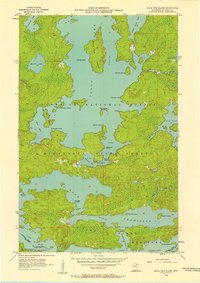 1956 Sioux Pine Island1958 Print · USGSThe lake country of St. Louis County is captured here in the mid-fifties, showing a pristine landscape of water and forest before modern development. You can trace historic travel routes like the Canfield Portage and locate named landmarks like Sioux Pine Island or the Five Sisters Islands.5 unique versions available
 - 1956 Map of Tower, 1958 Print
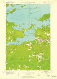 1956 Tower1958 Print · USGSVermilion Lake and the southern edge of the Iron Range are captured here in the mid-fifties, centered on the historic rail hub of Tower. Genealogists and historians can trace the Duluth Missabe and Iron Range line as it serves the North American Mine and the small settlement of Peyla.4 unique versions available
 - 1956 Map of Chad Lake, 1958 Print
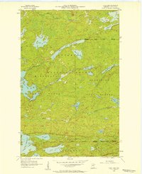 1956 Chad Lake1958 Print · USGSSt. Louis County is captured in the mid-1950s as a dense wilderness of interconnected waterways and state forests. Researchers can trace the pristine shorelines of Lake Vermilion and Bass Lake or locate interior landmarks like Indian Point and Rice Bay.3 unique versions available
 - 1956 Map of Soudan, 1958 Print
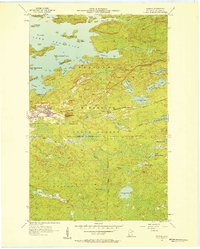 1956 Soudan1958 Print · USGSThe eastern Vermilion Iron Range comes into focus during the mid-fifties, showing the industrial core of the Soudan mining district. Genealogists and industrial historians can trace the Duluth Missabe and Iron Range railroad through Murray or locate the Soudan Mine and La Rue Mines.5 unique versions available
 - 1957 Map of Hibbing
 1957 Hibbing1957 Print · USGSNorthern Minnesota's Iron Range is shown at its industrial peak in the mid-fifties, dominated by the massive iron pits and rail corridors of the Mesabi Range. Researchers can trace the rail networks of the Duluth Missabe and Iron Range and locate mining hubs like Hibbing, Virginia, and Bovey.
 - 1958 Map of Hibbing
 1958 Hibbing1958 Print · USGSThe Mesabi Iron Range reached its mid-century height during this era, defining the landscape between Grand Rapids and Virginia. Genealogists and historians can trace the mining-town networks of Hibbing and Chisholm or locate numerous iron mines and rail spurs.
End of results
Showing maps 1-7 of 7
Top cities near Breitung Township
- Hoyt Lakes historical maps
- Babbitt historical maps
- Embarrass historical maps
- Tower historical maps
- Eagles Nest historical maps
Top neighborhoods of Breitung Township
Frequently asked questions
- What are the different types of historical maps available for Breitung Township?
- What is the oldest map of Breitung Township?
- Where can I purchase historical maps of Breitung Township for my home or office?
- Where can I download high-res historical maps of Breitung Township?
- Are there historical topographic maps available for Breitung Township?
- Is there historical aerial imagery available for Breitung Township?
- Where are historical maps of Breitung Township sourced from?