Old Maps of Grand Lake Township, Minnesota for Hiking & Exploration
Hike through history with 20 historic maps of Grand Lake Township. Explore old trails, ghost towns, and forgotten backroads — perfect for outdoor adventurers and local explorers.
- Rediscover forgotten places: Map out old mining camps, roads, and footpaths that no longer exist on modern maps.
- Layer with modern tools: Combine with LiDAR or satellite views to plan hikes through historical terrain.
- Made for exploration: Popular among hikers, overlanders, and local history lovers.
Use these maps to find adventure and explore the hidden past of Grand Lake Township.
Grand Lake Township, MN maps
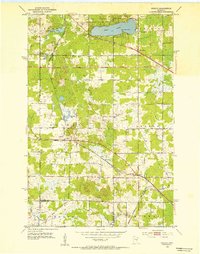
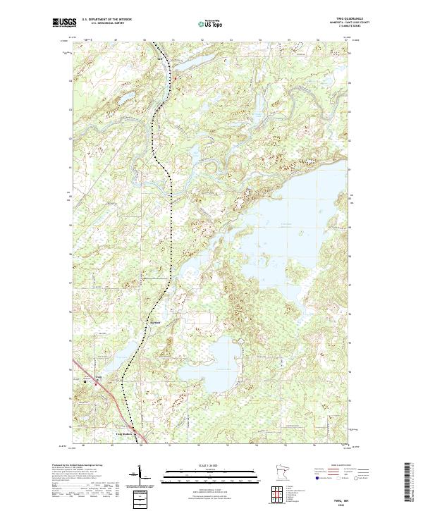
(20)- 1953 Map of Twig, 1954 Print
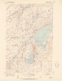 1953 Twig1954 Print · USGSSt. Louis County is captured here in the early fifties, showing a landscape defined by the expansive Fish Lake Reservoir and state forest lands. Researchers can trace local history through the Duluth Winnipeg and Pacific rail line and sites like the Grand Lake Cem and Caribou Lake Sch.6 unique versions available
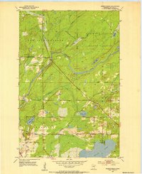
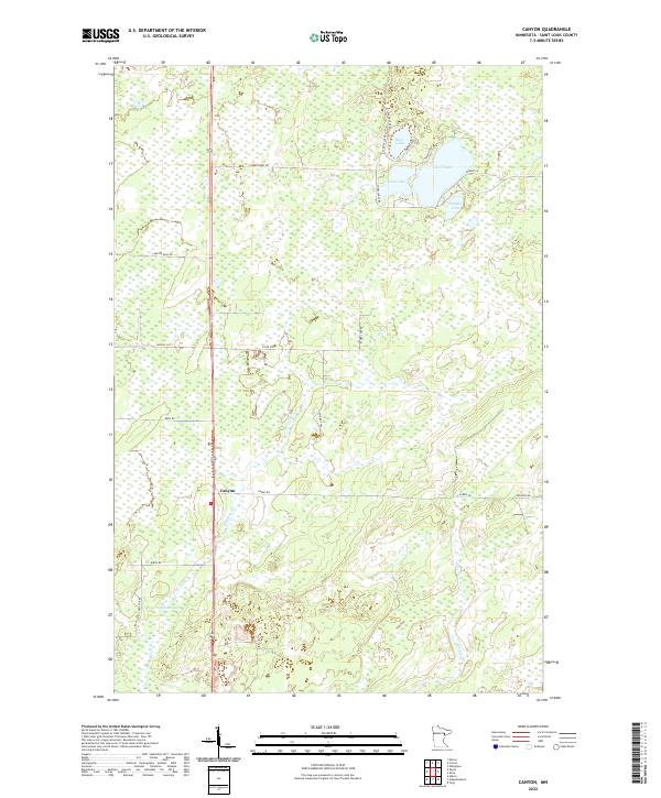
 - 1953 Map of Canyon, 1954 Print
 1953 Canyon1954 Print · USGSThe rural woodlands of St. Louis County are captured here in the early 1950s, showing the settlement of Canyon amidst the Cloquet Valley State Forest. Local researchers can locate the Town Hall, trace the course of Hellwig Creek, and identify family plots at the Cem.3 unique versions available
 - 1953 Map of Shaw, 1954 Print
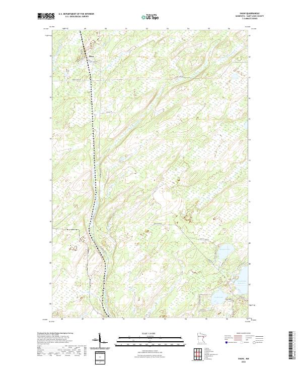
 1953 Shaw1954 Print · USGSSt. Louis County timberlands and rail corridors are documented here in the early fifties as the region supported local industry. Genealogists and historians can trace the Duluth Winnipeg and Pacific tracks past Shaw or locate family sites near Cooks Lake and Morgan Lake.4 unique versions available
 - 1953 Map of Saginaw, 1955 Print
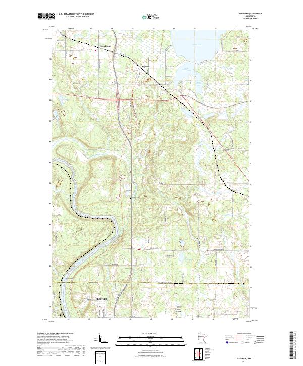
 1953 Saginaw1955 Print · USGSSt. Louis County is defined by its industrial rail corridors and the winding St. Louis River during the early 1950s. Genealogists and historians can trace the Fond Du Lac Indian Reservation boundary and find local landmarks like Holy Family Cem and Saginaw.4 unique versions available
 - 1953 Map of Adolph, 1955 Print
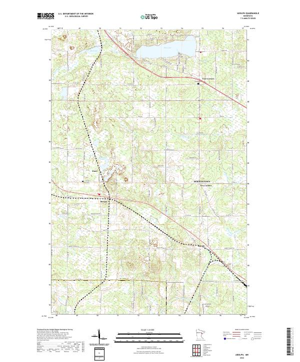
 1953 Adolph1955 Print · USGSSt. Louis County is captured here in the early fifties, showing a landscape defined by industrial rail lines and lakefront settlements. Genealogists and rail historians can trace the Duluth Missabe and Iron Range line through Adolph and Munger, or locate Canosia Cem and the Pike Lake Sch.5 unique versions available
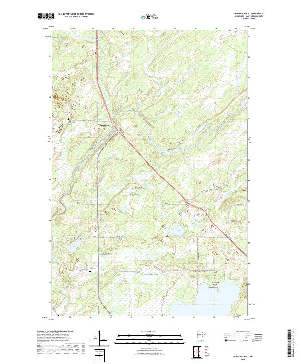
 - 1953 Map of Independence, 1955 Print
 1953 Independence1955 Print · USGSSt. Louis County timberland and small settlements are captured here in the early fifties during a period of rural stability. Genealogists and historians can trace family locations near Independence, St Johns Cem, and the old Railroad Grade.6 unique versions available
 - 1953 Map of Duluth, 1964 Print
 1953 Duluth1964 Print · USGSNortheastern Minnesota and northwestern Wisconsin are shown here during a period of industrial maturity and expanding conservation. Genealogists and historians can trace rail-connected towns like McGrath and Wahkon, or locate heritage sites within the Fond du Lac Indian Reservation.2 unique versions available
 - 1954 Map of Hibbing, 1966 Print
 1954 Hibbing1966 Print · USGSNorthern Minnesota's Iron Range thrives during the mid-1960s, showing the industrial landscape between the Mesabi Range and the Mississippi River. Genealogists and historians can trace the rail lines of the Great Northern RR through mining hubs like Hibbing and Virginia.3 unique versions available
 - 1957 Map of Hibbing
 1957 Hibbing1957 Print · USGSNorthern Minnesota's Iron Range is shown at its industrial peak in the mid-fifties, dominated by the massive iron pits and rail corridors of the Mesabi Range. Researchers can trace the rail networks of the Duluth Missabe and Iron Range and locate mining hubs like Hibbing, Virginia, and Bovey.
 - 1958 Map of Hibbing
 1958 Hibbing1958 Print · USGSThe Mesabi Iron Range reached its mid-century height during this era, defining the landscape between Grand Rapids and Virginia. Genealogists and historians can trace the mining-town networks of Hibbing and Chisholm or locate numerous iron mines and rail spurs.
 - 1958 Map of Duluth
 1958 Duluth1958 Print · USGSNortheastern Minnesota and the Wisconsin borderlands are shown in detail during the late 1950s, centered on the bustling rail yards and ports of Duluth. You can trace the historic routes of the Soo Line and Duluth Missabe & Iron Range through small towns like McGrath, Bruno, and Wrenshall.
 - 1964 Map of Hibbing
 1964 Hibbing1964 Print · USGSNorthern Minnesota’s iron-rich corridor is captured here during a peak era of mid-century industrial activity. Researchers can trace the rail-to-mine connections through Mesabi Range towns like Hibbing and Virginia or locate lakefront settlements near Pokegama Lake.
 - 1977 Map of Hibbing, 1994 Print
 1977 Hibbing1994 Print · USGSThe Iron Range of northern Minnesota comes into sharp focus during the late seventies, detailing the massive mining works and rail networks of St. Louis County. Researchers can trace family roots in Hibbing, Chisholm, and Virginia, or locate old post offices like Leoneth and Iron.
 - 1980 Map of Duluth
 1980 Duluth1980 Print · USGSThe Twin Ports of the early 1980s showcase a landscape defined by heavy rail lines and Lake Superior shipping. Trace the iron-ore routes through Proctor or locate family sites near Sunrise Memorial Cem and Floodwood.
 - 2022 Map of Independence, 2022 Print
 2022 Independence2022 Print · USGSThe St. Louis County woods south of Independence are defined by their deep connection to the water in the early twenty-first century. Researchers can trace family sites at New Independence Cem or follow the historic Old Railroad Grade past Beaver Lake.
 - 2022 Map of Canyon, 2022 Print
 2022 Canyon2022 Print · USGSCanyon and the surrounding St. Louis County lake country are documented here in the early twenty-first century. Local historians can trace the rural road network and lakefront access points near Leora Lake, Moose Lake, and the namesake settlement of Canyon.
 - 2022 Map of Shaw, 2022 Print
 2022 Shaw2022 Print · USGSNorthern Minnesota's lake and river country is captured here in the early twenty-first century near the settlement of Shaw. Researchers can trace the winding Us-Kab-Wan-Ka River and find local landmarks like Morgan Lake, Cooks Lake, and Island Lake Reservoir.
 - 2022 Map of Saginaw, 2022 Print
 2022 Saginaw2022 Print · USGSThe St. Louis River valley and the lake country north of Cloquet are captured here in the early 2020s. Researchers can trace local history through the Brevator Cem, the Country Haven Airport, and the path of the Cloquet-Saginaw State Trl.
 - 2022 Map of Adolph, 2022 Print
 2022 Adolph2022 Print · USGSSouthern St. Louis County remains a landscape of wetlands and quiet crossroads in the early 2020s. Researchers can trace local genealogy and property lines near Canosia Cem or follow historical road alignments through Adolph and Munger.
 - 2022 Map of Twig, 2022 Print
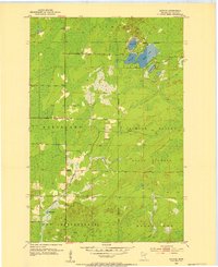
 2022 Twig2022 Print · USGSSaint Louis County is mapped here in the early twenty-first century as a landscape of timber, trails, and expansive water. Researchers can locate family sites near Twig, trace the Old Railroad Grade, or find records at Grand Lake Cem.
End of results
Showing maps 1-20 of 20
Top cities near Grand Lake Township
- Duluth historical maps
- Superior historical maps
- Cloquet historical maps
- Hermantown historical maps
- Proctor historical maps
- Grand Lake historical maps
See more
Top neighborhoods of Grand Lake Township
- Bartlett historical maps
- Taft historical maps
- Twig historical maps
- Twig Station historical maps
- Harnell Park historical maps
Frequently asked questions
- What are the different types of historical maps available for Grand Lake Township?
- What is the oldest map of Grand Lake Township?
- Where can I purchase historical maps of Grand Lake Township for my home or office?
- Where can I download high-res historical maps of Grand Lake Township?
- Are there historical topographic maps available for Grand Lake Township?
- Is there historical aerial imagery available for Grand Lake Township?
- Where are historical maps of Grand Lake Township sourced from?