Old Maps of Burntside Lake, Morse Township for Hiking & Exploration
Hike through history with 11 historic maps of Burntside Lake. Explore old trails, ghost towns, and forgotten backroads — perfect for outdoor adventurers and local explorers.
- Rediscover forgotten places: Map out old mining camps, roads, and footpaths that no longer exist on modern maps.
- Layer with modern tools: Combine with LiDAR or satellite views to plan hikes through historical terrain.
- Made for exploration: Popular among hikers, overlanders, and local history lovers.
Use these maps to find adventure and explore the hidden past of Burntside Lake.
Burntside Lake, Morse Township maps
(11)- 1954 Map of Hibbing, 1966 Print
 1954 Hibbing1966 Print · USGSNorthern Minnesota's Iron Range thrives during the mid-1960s, showing the industrial landscape between the Mesabi Range and the Mississippi River. Genealogists and historians can trace the rail lines of the Great Northern RR through mining hubs like Hibbing and Virginia.3 unique versions available
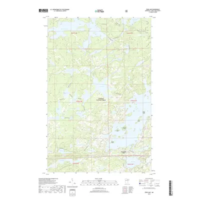
 - 1956 Map of Crab Lake, 1958 Print
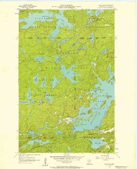 1956 Crab Lake1958 Print · USGSThe Iron Range lake country of the mid-1950s is captured here in detail, showing a wilderness of water and forest. Researchers can trace the convoluted shorelines of Burntside Lake and Crab Lake or locate islands like Pine Island and Shellman Island.3 unique versions available
 - 1957 Map of Hibbing
 1957 Hibbing1957 Print · USGSNorthern Minnesota's Iron Range is shown at its industrial peak in the mid-fifties, dominated by the massive iron pits and rail corridors of the Mesabi Range. Researchers can trace the rail networks of the Duluth Missabe and Iron Range and locate mining hubs like Hibbing, Virginia, and Bovey.
 - 1958 Map of Hibbing
 1958 Hibbing1958 Print · USGSThe Mesabi Iron Range reached its mid-century height during this era, defining the landscape between Grand Rapids and Virginia. Genealogists and historians can trace the mining-town networks of Hibbing and Chisholm or locate numerous iron mines and rail spurs.
 - 1964 Map of Hibbing
 1964 Hibbing1964 Print · USGSNorthern Minnesota’s iron-rich corridor is captured here during a peak era of mid-century industrial activity. Researchers can trace the rail-to-mine connections through Mesabi Range towns like Hibbing and Virginia or locate lakefront settlements near Pokegama Lake.
 - 1994 Map of Vermillion Lake
 1994 Vermillion Lake1994 Print · USGSThe Mesabi Iron Range meets the North Woods in the 1990s, showcasing the heavy industrial footprint of the Duluth Missabe & Iron Range RR. Trace the sprawling works of the Mines near Virginia or the intricate island shorelines of Vermilion Lake.
 - 2011 Map of Crab Lake, 2011 Print
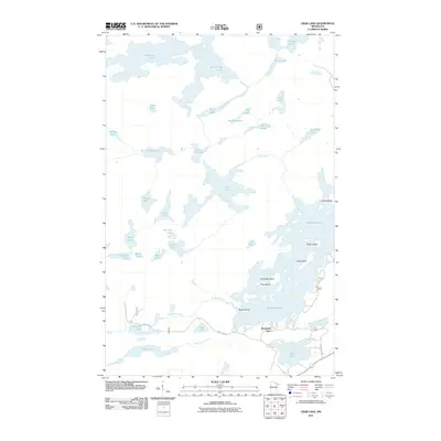 2011 Crab Lake2011 Print · USGSCovers Burntside Lake, including Eagles Nest Township, Slim Lake, and other nearby areas
 - 2013 Map of Crab Lake, 2013 Print
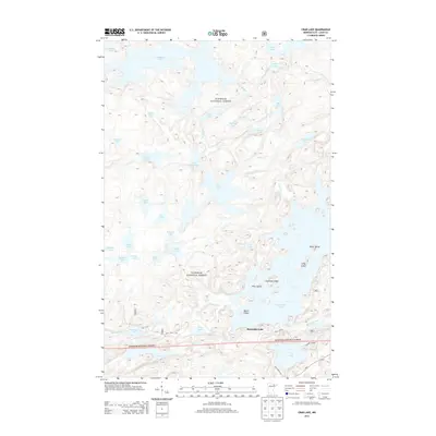 2013 Crab Lake2013 Print · USGSCovers Burntside Lake, including Eagles Nest Township, Slim Lake, and other nearby areas
 - 2016 Map of Crab Lake, 2016 Print
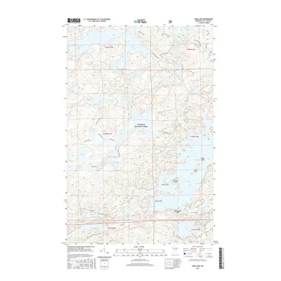 2016 Crab Lake2016 Print · USGSCovers Burntside Lake, including Eagles Nest Township, Slim Lake, and other nearby areas
 - 2019 Map of Crab Lake, 2019 Print
 2019 Crab Lake2019 Print · USGSCovers Burntside Lake, including Eagles Nest Township, Slim Lake, and other nearby areas
 - 2022 Map of Crab Lake, 2022 Print
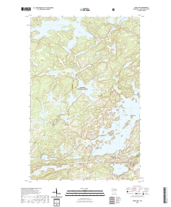 2022 Crab Lake2022 Print · USGSThe northern wilderness of Saint Louis County is mapped here in recent detail, focusing on the intricate island chains of Burntside Lake. Trace the network of backcountry paths like Cummings Trl or locate local landmarks such as Snellman Island and School Section Bay.
End of results
Showing maps 1-11 of 11
Top cities near Burntside Lake
Frequently asked questions
- What are the different types of historical maps available for Burntside Lake?
- What is the oldest map of Burntside Lake?
- Where can I purchase historical maps of Burntside Lake for my home or office?
- Where can I download high-res historical maps of Burntside Lake?
- Are there historical topographic maps available for Burntside Lake?
- Is there historical aerial imagery available for Burntside Lake?
- Where are historical maps of Burntside Lake sourced from?