2020s Maps of Mountain Iron, Minnesota
Explore 6 historic maps of Mountain Iron from the 2020s. These maps offer a rare glimpse into what life looked like during the 2020s — showing old roads, neighborhoods, homes, and landmarks that have changed or disappeared over time.
Whether you're researching your family's past, planning a metal detecting trip, or studying how Mountain Iron's landscape evolved across the 2020s, these high-resolution maps are a powerful tool for exploring the history of this region.
- Focus on a specific era: All maps on this page are from the 2020s, giving you a focused view of this time period.
- See what’s changed: Compare century-old streets, trails, and buildings to today's modern landscape using overlays and satellite layers.
- Research with precision: Use these maps for genealogy, historical research, land use analysis, or educational projects.
- View, download, or print: Maps are fully viewable online in high resolution, and can be downloaded or printed for your own records.
Start exploring Mountain Iron's history through authentic maps from the 2020s. This is your window into the past.
Mountain Iron, MN maps
(6)- 2022 Map of Britt, 2022 Print
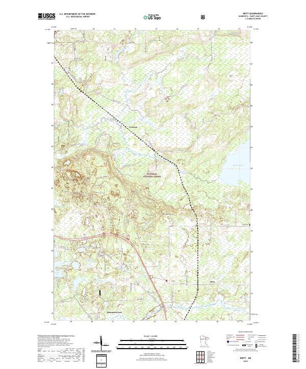 2022 Britt2022 Print · USGSThe Iron Range region in the early 2020s shows a landscape where timber trails and recreational paths intersect with small settlements and glacial lakes. Genealogists and researchers can locate Sandy Cem, the community of Britt, and the expansive waters of Big Rice Lake.
 - 2022 Map of Kirk, 2022 Print
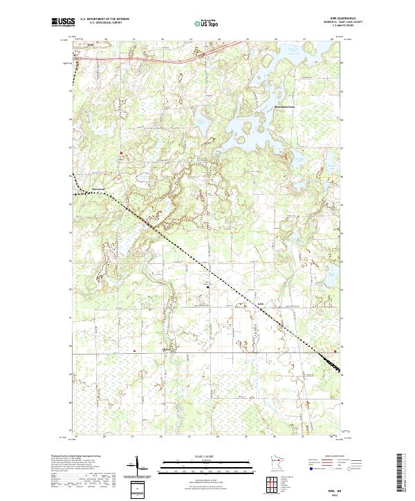 2022 Kirk2022 Print · USGSSt. Louis County is captured here in the early 2020s, showing the intersection of Mesabi Range settlements and the sprawling wetlands of the northern woods. Researchers can locate family landmarks such as the Cherry-Clinton Cem and the rural communities of Cherry and Kirk.
 - 2022 Map of Virginia, 2022 Print
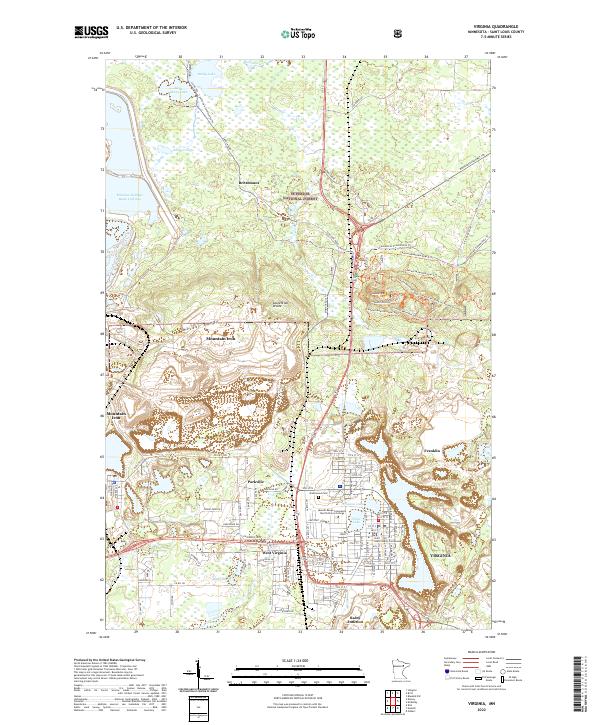 2022 Virginia2022 Print · USGSThe Mesabi Range iron-mining heartland is shown in detail during the early 2020s, showing the intersection of heavy industry and northern forest. Researchers can trace the civic layout of Virginia near the Saint Louis County Courthouse or locate smaller locales like Parkville and Rainy Junction.
 - 2022 Map of Idington, 2022 Print
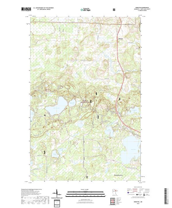 2022 Idington2022 Print · USGSSt. Louis County is mapped here in the early 2020s, revealing a landscape where the Superior National Forest meets the northern Iron Range. Family and local historians can trace the roads around Idington, locate the Idington Cem, and explore the shores of Lake Fourteen and Lake Leander.
 - 2022 Map of Eveleth, 2022 Print
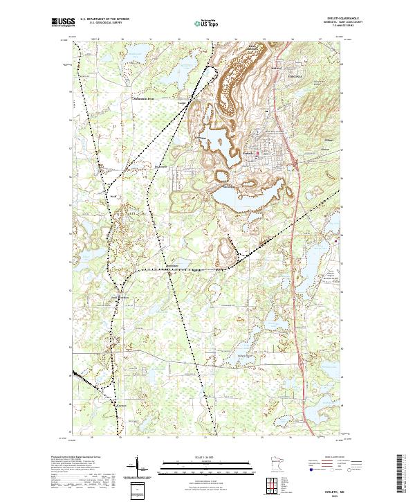 2022 Eveleth2022 Print · USGSThe Iron Range of St. Louis County is captured here in the early twenty-first century, showing the enduring mining and transport legacy of the Mesabi Range. Researchers can trace the development of settlements like Leonidas, Rainy Junction, and Iron Junction alongside the Laurentian Divide.
 - 2022 Map of Kinney, 2022 Print
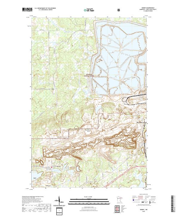 2022 Kinney2022 Print · USGSIron Range mining and small-town settlements define this part of St. Louis County in the early twenty-first century. Researchers can trace the industrial footprint of U S Steel and find historic locations like Kinney, Buhl, and Lucknow near the Laurentian Divide.
End of results
Showing maps 1-6 of 6
Top cities near Mountain Iron
- Hibbing historical maps
- Virginia historical maps
- Chisholm historical maps
- Eveleth historical maps
- Gilbert historical maps
- Midway historical maps
See more
Top neighborhoods of Mountain Iron
- Brittmount historical maps
- Hopper historical maps
- Parkville historical maps
- West Virginia historical maps
Frequently asked questions
- What are the different types of historical maps available for Mountain Iron?
- What is the oldest map of Mountain Iron?
- Where can I purchase historical maps of Mountain Iron for my home or office?
- Where can I download high-res historical maps of Mountain Iron?
- Are there historical topographic maps available for Mountain Iron?
- Is there historical aerial imagery available for Mountain Iron?
- Where are historical maps of Mountain Iron sourced from?