Old Maps of Sherwood, Minnesota for Academic Research
Study the evolution of Sherwood with 11 high-resolution historic maps. Whether you're teaching, researching, or modeling changes in land use, these maps provide essential visual documentation of urban, environmental, and geographic change.
- Analyze long-term change: Track patterns in development, transportation, and natural features.
- Ideal for environmental or urban studies: Support academic projects with primary historical map data.
- Use in the classroom or lab: Educators and researchers rely on these maps to bring historical context to life.
These maps are a powerful tool for teaching, research, and visualizing how Sherwood has changed over the decades.
Sherwood, MN maps
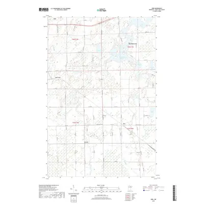
(11)- 1951 Map of Kirk, 1952 Print
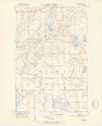 1951 Kirk1952 Print · USGSThe Iron Range of northern Minnesota was a hub of heavy rail and rural community life in the early fifties. Genealogists and historians can trace the local landscape through landmarks like School No 964, Bethel Cem, and the tracks of the Great Northern railroad.7 unique versions available
 - 1954 Map of Hibbing, 1966 Print
 1954 Hibbing1966 Print · USGSNorthern Minnesota's Iron Range thrives during the mid-1960s, showing the industrial landscape between the Mesabi Range and the Mississippi River. Genealogists and historians can trace the rail lines of the Great Northern RR through mining hubs like Hibbing and Virginia.3 unique versions available
 - 1957 Map of Hibbing
 1957 Hibbing1957 Print · USGSNorthern Minnesota's Iron Range is shown at its industrial peak in the mid-fifties, dominated by the massive iron pits and rail corridors of the Mesabi Range. Researchers can trace the rail networks of the Duluth Missabe and Iron Range and locate mining hubs like Hibbing, Virginia, and Bovey.
 - 1958 Map of Hibbing
 1958 Hibbing1958 Print · USGSThe Mesabi Iron Range reached its mid-century height during this era, defining the landscape between Grand Rapids and Virginia. Genealogists and historians can trace the mining-town networks of Hibbing and Chisholm or locate numerous iron mines and rail spurs.
 - 1964 Map of Hibbing
 1964 Hibbing1964 Print · USGSNorthern Minnesota’s iron-rich corridor is captured here during a peak era of mid-century industrial activity. Researchers can trace the rail-to-mine connections through Mesabi Range towns like Hibbing and Virginia or locate lakefront settlements near Pokegama Lake.
 - 1977 Map of Hibbing, 1994 Print
 1977 Hibbing1994 Print · USGSThe Iron Range of northern Minnesota comes into sharp focus during the late seventies, detailing the massive mining works and rail networks of St. Louis County. Researchers can trace family roots in Hibbing, Chisholm, and Virginia, or locate old post offices like Leoneth and Iron.
 - 2010 Map of Kirk, 2010 Print
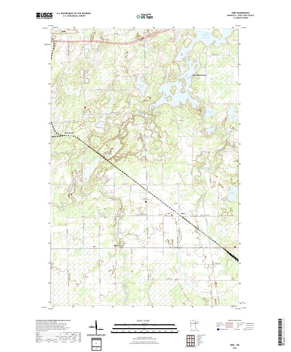
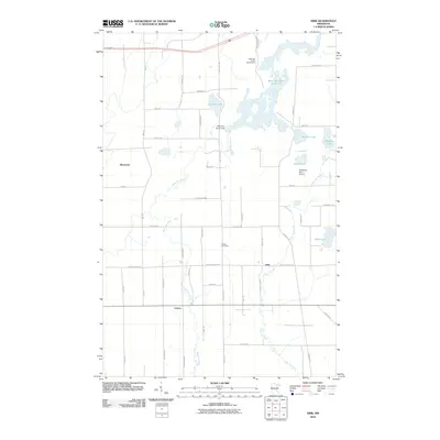 2010 Kirk2010 Print · USGSCovers Sherwood, including Mountain Iron, Buhl, and other nearby areas
 - 2013 Map of Kirk, 2013 Print
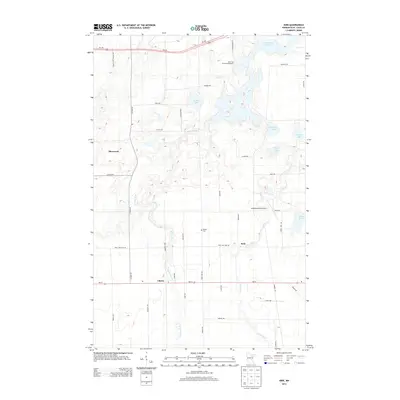 2013 Kirk2013 Print · USGSCovers Sherwood, including Mountain Iron, Buhl, and other nearby areas
 - 2016 Map of Kirk, 2016 Print
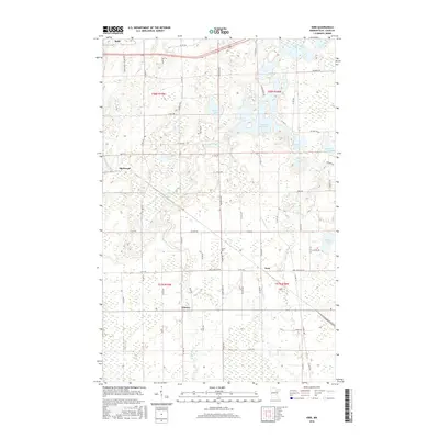 2016 Kirk2016 Print · USGSCovers Sherwood, including Mountain Iron, Buhl, and other nearby areas
 - 2019 Map of Kirk, 2019 Print
 2019 Kirk2019 Print · USGSCovers Sherwood, including Mountain Iron, Buhl, and other nearby areas
 - 2022 Map of Kirk, 2022 Print
 2022 Kirk2022 Print · USGSSt. Louis County is captured here in the early 2020s, showing the intersection of Mesabi Range settlements and the sprawling wetlands of the northern woods. Researchers can locate family landmarks such as the Cherry-Clinton Cem and the rural communities of Cherry and Kirk.
End of results
Showing maps 1-11 of 11
Top cities near Sherwood
- Hibbing historical maps
- Virginia historical maps
- Chisholm historical maps
- Eveleth historical maps
- Mountain Iron historical maps
- Midway historical maps
See more
Frequently asked questions
- What are the different types of historical maps available for Sherwood?
- What is the oldest map of Sherwood?
- Where can I purchase historical maps of Sherwood for my home or office?
- Where can I download high-res historical maps of Sherwood?
- Are there historical topographic maps available for Sherwood?
- Is there historical aerial imagery available for Sherwood?
- Where are historical maps of Sherwood sourced from?