1900s (20th Century) Maps of New Munich, Minnesota
Explore 8 historic maps of New Munich from the 1900s (20th Century). These maps offer a rare glimpse into what life looked like during the 1900s — showing old roads, neighborhoods, homes, and landmarks that have changed or disappeared over time.
Whether you're researching your family's past, planning a metal detecting trip, or studying how New Munich's landscape evolved across the 1900s, these high-resolution maps are a powerful tool for exploring the history of this region.
- Focus on a specific era: All maps on this page are from the 1900s, giving you a focused view of this time period.
- See what’s changed: Compare century-old streets, trails, and buildings to today's modern landscape using overlays and satellite layers.
- Research with precision: Use these maps for genealogy, historical research, land use analysis, or educational projects.
- View, download, or print: Maps are fully viewable online in high resolution, and can be downloaded or printed for your own records.
Start exploring New Munich's history through authentic maps from the 1900s. This is your window into the past.
New Munich, MN maps
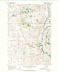
(8)- 1953 Map of Saint Cloud, 1968 Print
 1953 Saint Cloud1968 Print · USGSCentral Minnesota's lake country and the Mississippi River valley are caught in a period of steady mid-century growth. Researchers can trace historic rail lines, old granite works, and local landmarks like St. Johns University, Camp Ripley, and the shores of Lake Minnewaska.3 unique versions available
 - 1957 Map of Saint Cloud
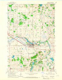
 1957 Saint Cloud1957 Print · USGSCentral Minnesota's lake country and rail corridors are meticulously detailed in the mid-1950s. Genealogists and researchers can trace the growth of towns like Alexandria, Willmar, and Saint Cloud along the Great Northern railroad line.
 - 1958 Map of Saint Cloud
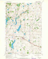
 1958 Saint Cloud1958 Print · USGSCentral Minnesota in the mid-1950s shows a landscape of growing regional hubs and hundreds of glacial lakes connected by an extensive rail network. Genealogists and historians can trace the early footprints of Saint Cloud, Alexandria, and Willmar along the Great Northern Railway.
 - 1965 Map of Greenwald, 1966 Print
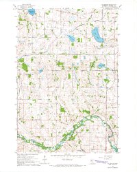
 1965 Greenwald1966 Print · USGSStearns County farmland was well-established by the mid-sixties, centered on rail transport and river drainage. Genealogists and local researchers can trace family lands near Greenwald, Spring Hill, and several historic school sites like School No 2013.
 - 1965 Map of Melrose, 1966 Print
 1965 Melrose1966 Print · USGSMelrose and its surrounding townships are captured in the mid-1960s as the regional rail and river network supported a thriving agricultural community. Genealogists can locate family landmarks like St Marys Cem, Oak Hill Cem, and rural schoolhouses including School No 2047.3 unique versions available
 - 1965 Map of Freeport, 1966 Print
 1965 Freeport1966 Print · USGSStearns County in the mid-sixties is a landscape of prairie lakes and developing rail corridors centered on the village of Freeport. Genealogists can locate family landmarks like Ebenezer Cem, the Immaculate Conception Ch, and rural schoolhouses including School No 1991.3 unique versions available
 - 1965 Map of St Martin, 1966 Print
 1965 St Martin1966 Print · USGSMid-century Stearns County is captured here as a landscape of river-bend villages and rural school districts. Researchers can trace the legacy of family farms near St Martin, identify old church sites like Immanuel Cem, and locate former schoolhouses such as School No 2017.
 - 1986 Map of St. Cloud
 1986 St. Cloud1986 Print · USGSCentral Minnesota in the mid-1980s reveals a landscape where river industry and growing highway corridors meet traditional farming communities. Researchers can trace the layout of small-town landmarks like St Wendel Ch and St Anna Cem or follow the path of the Sauk River as it winds toward the Mississippi.2 unique versions available
End of results
Showing maps 1-8 of 8
Top cities near New Munich
- Sauk Centre historical maps
- Melrose historical maps
- Albany historical maps
- Richmond historical maps
- Farming historical maps
- Freeport historical maps
See more
Frequently asked questions
- What are the different types of historical maps available for New Munich?
- What is the oldest map of New Munich?
- Where can I purchase historical maps of New Munich for my home or office?
- Where can I download high-res historical maps of New Munich?
- Are there historical topographic maps available for New Munich?
- Is there historical aerial imagery available for New Munich?
- Where are historical maps of New Munich sourced from?