Old Maps of Hancock, Minnesota for Metal Detecting
Plan your next treasure hunt with 18 historic maps of Hancock. Find old homesites, ghost towns, trails, and gathering spots that may be lost to time — perfect for identifying promising metal detecting locations.
- Locate forgotten sites: Uncover places like long-lost settlements, abandoned rail lines, or gathering spots.
- Plan better hunts: Use map overlays combined with LiDAR or satellite views to narrow in on historically rich areas.
- Made for detectorists: Thousands of hobbyists use these maps to discover relics, coins, and hidden history.
Use these historic maps to boost your research and find new opportunities beneath the surface of Hancock.
Hancock, MN maps
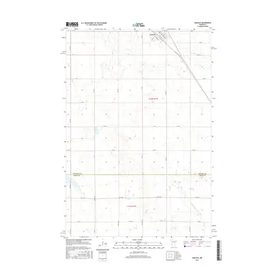
(18)- 1912 Map of Morris
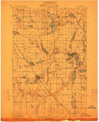 1912 Morris1912 Print · USGSThe rail hub of Morris and the surrounding Stevens County prairie are captured here at the height of the steam era. Genealogists and historians can trace dozens of early rural schoolhouses, the North Star Mill, and pioneer worship sites like Scandia Church.3 unique versions available
 - 1953 Map of Saint Cloud, 1968 Print
 1953 Saint Cloud1968 Print · USGSCentral Minnesota's lake country and the Mississippi River valley are caught in a period of steady mid-century growth. Researchers can trace historic rail lines, old granite works, and local landmarks like St. Johns University, Camp Ripley, and the shores of Lake Minnewaska.3 unique versions available
 - 1957 Map of Saint Cloud
 1957 Saint Cloud1957 Print · USGSCentral Minnesota's lake country and rail corridors are meticulously detailed in the mid-1950s. Genealogists and researchers can trace the growth of towns like Alexandria, Willmar, and Saint Cloud along the Great Northern railroad line.
 - 1958 Map of Saint Cloud
 1958 Saint Cloud1958 Print · USGSCentral Minnesota in the mid-1950s shows a landscape of growing regional hubs and hundreds of glacial lakes connected by an extensive rail network. Genealogists and historians can trace the early footprints of Saint Cloud, Alexandria, and Willmar along the Great Northern Railway.
 - 1968 Map of Hancock, 1970 Print
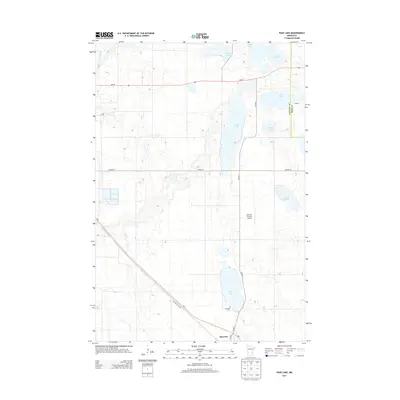
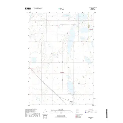
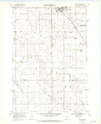 1968 Hancock1970 Print · USGSHancock and the surrounding Stevens County prairies are documented here in the late sixties as the region balanced farming with conservation. Researchers can trace the Great Northern rail line and locate community landmarks like Bethel Ch, Byrne Lake, and the local Townhall.
 - 1973 Map of Page Lake, 1975 Print
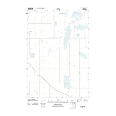
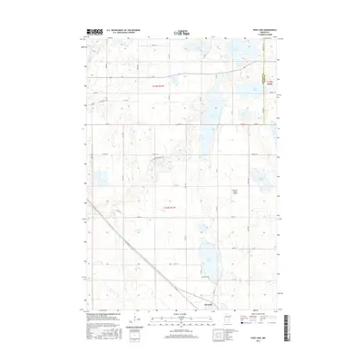
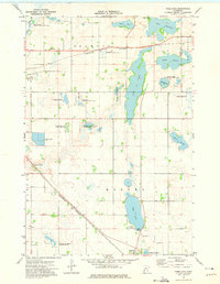 1973 Page Lake1975 Print · USGSHancock and the surrounding glacial prairies of Stevens County are captured here in the early 1970s. Trace the diagonal route of the Burlington Northern past local landmarks like Page Lake and the Lakeside Cem.
 - 1986 Map of Willmar
 1986 Willmar1986 Print · USGSWest-central Minnesota in the mid-eighties was a landscape of rail-dependent prairie towns and extensive waterfowl conservation areas. Researchers can trace the path of the Burlington Northern through Kerkhoven or explore the lake-dotted terrain of Sibley State Park.2 unique versions available
 - 1986 Map of Lake Minnewaska
 1986 Lake Minnewaska1986 Print · USGSWest-central Minnesota's lake country is captured here in the mid-eighties, showing a landscape of intense glacial activity and growing regional hubs. Genealogists and researchers can trace the rail lines of the Soo Line and Burlington Northern through towns like Glenwood, Starbuck, and Osakis.2 unique versions available
 - 2010 Map of Page Lake, 2010 Print
 2010 Page Lake2010 Print · USGSCovers Hancock, including Stevens County, Pope County, and other nearby areas
 - 2010 Map of Hancock, 2010 Print
 2010 Hancock2010 Print · USGSCovers Hancock, including Stevens County, Swift County, and other nearby areas
 - 2013 Map of Hancock, 2013 Print
 2013 Hancock2013 Print · USGSCovers Hancock, including Stevens County, Swift County, and other nearby areas
 - 2013 Map of Page Lake, 2013 Print
 2013 Page Lake2013 Print · USGSCovers Hancock, including Stevens County, Pope County, and other nearby areas
 - 2016 Map of Page Lake, 2016 Print
 2016 Page Lake2016 Print · USGSCovers Hancock, including Stevens County, Pope County, and other nearby areas
 - 2016 Map of Hancock, 2016 Print
 2016 Hancock2016 Print · USGSCovers Hancock, including Stevens County, Swift County, and other nearby areas
 - 2019 Map of Hancock, 2019 Print
 2019 Hancock2019 Print · USGSCovers Hancock, including Stevens County, Swift County, and other nearby areas
 - 2019 Map of Page Lake, 2019 Print
 2019 Page Lake2019 Print · USGSCovers Hancock, including Stevens County, Pope County, and other nearby areas
 - 2022 Map of Hancock, 2022 Print
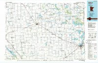
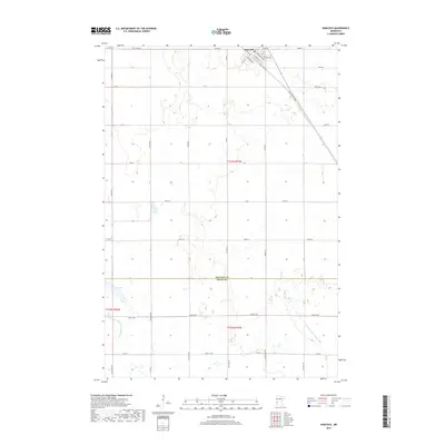
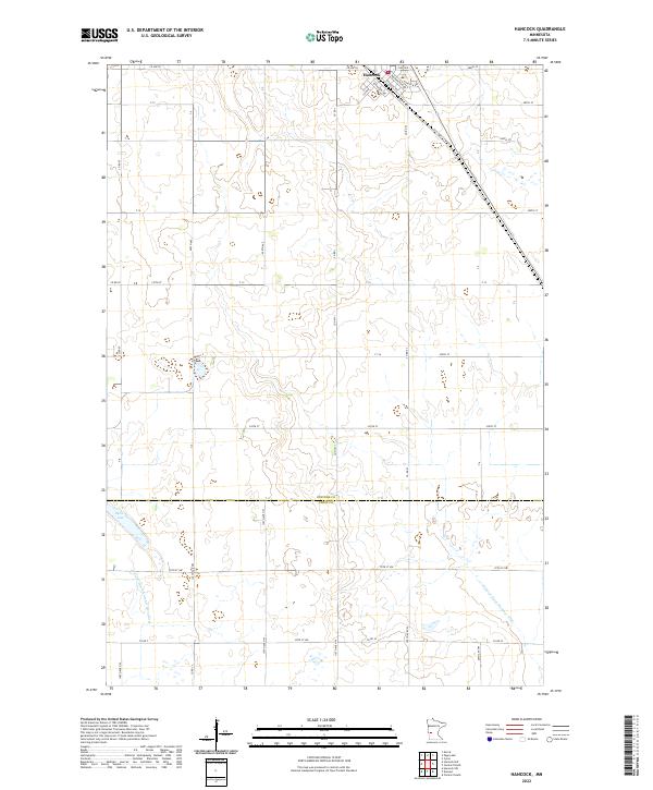 2022 Hancock2022 Print · USGSThe township of Hancock and the surrounding prairie are captured here in the early 2020s, showing the intersection of Stevens and Swift counties. Genealogists can trace town lots along Atlantic Ave and Pacific Ave or find the rural reaches of Byrne Lake.
 - 2022 Map of Page Lake, 2022 Print
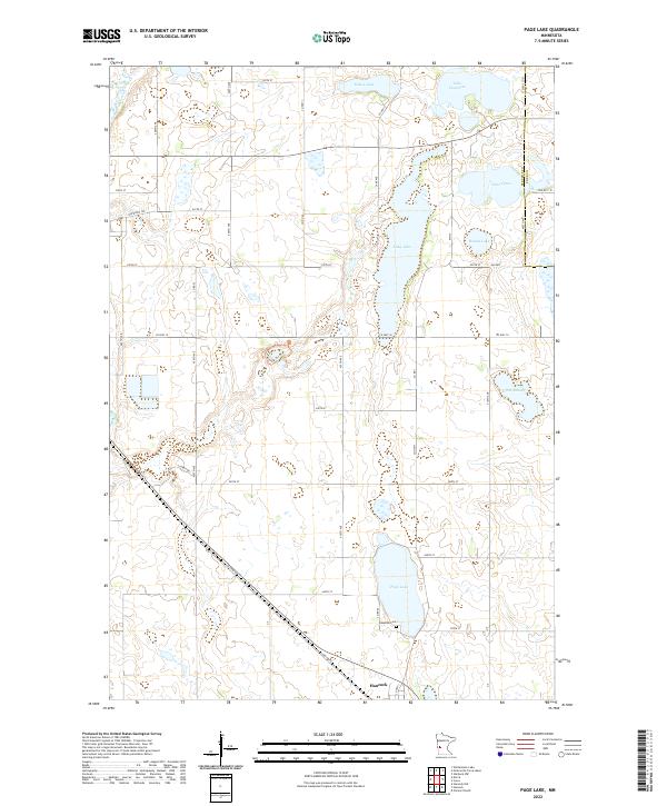 2022 Page Lake2022 Print · USGSThe lakeside community of Hancock and its surrounding wetlands are shown in great detail during the early 2020s. Researchers can trace local heritage at Lakeside Cem or follow the route of OLD HWY 9 past Page Lake and Long Lake.
End of results
Showing maps 1-18 of 18
Top cities near Hancock
- Morris historical maps
- Benson historical maps
- Cyrus historical maps
- Donnelly historical maps
- Clontarf historical maps
- Fairfield historical maps
See more
Frequently asked questions
- What are the different types of historical maps available for Hancock?
- What is the oldest map of Hancock?
- Where can I purchase historical maps of Hancock for my home or office?
- Where can I download high-res historical maps of Hancock?
- Are there historical topographic maps available for Hancock?
- Is there historical aerial imagery available for Hancock?
- Where are historical maps of Hancock sourced from?