Old Maps of Swift County, Minnesota for Hiking & Exploration
Hike through history with 139 historic maps of Swift County. Explore old trails, ghost towns, and forgotten backroads — perfect for outdoor adventurers and local explorers.
- Rediscover forgotten places: Map out old mining camps, roads, and footpaths that no longer exist on modern maps.
- Layer with modern tools: Combine with LiDAR or satellite views to plan hikes through historical terrain.
- Made for exploration: Popular among hikers, overlanders, and local history lovers.
Use these maps to find adventure and explore the hidden past of Swift County.
Swift County, MN maps
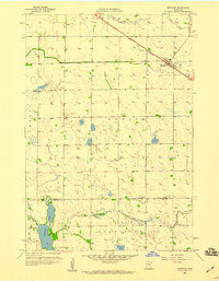
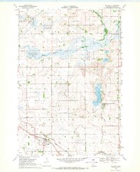
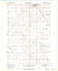
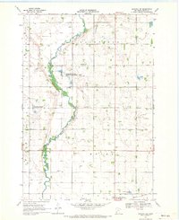
(139)- 1953 Map of Milbank, 1958 Print
 1953 Milbank1958 Print · USGSThe tri-state border region of South Dakota, North Dakota, and Minnesota is shown here during the early fifties, a landscape defined by glacial lakes and the Sisseton Indian Reservation. Researchers can trace the legacy of the western railroads, locating old stops along the Great Northern and settlements like Milbank, Webster, and Sisseton.3 unique versions available
 - 1953 Map of Saint Cloud, 1968 Print
 1953 Saint Cloud1968 Print · USGSCentral Minnesota's lake country and the Mississippi River valley are caught in a period of steady mid-century growth. Researchers can trace historic rail lines, old granite works, and local landmarks like St. Johns University, Camp Ripley, and the shores of Lake Minnewaska.3 unique versions available
 - 1957 Map of Saint Cloud
 1957 Saint Cloud1957 Print · USGSCentral Minnesota's lake country and rail corridors are meticulously detailed in the mid-1950s. Genealogists and researchers can trace the growth of towns like Alexandria, Willmar, and Saint Cloud along the Great Northern railroad line.
 - 1958 Map of Milbank
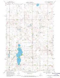
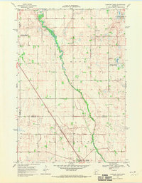
 1958 Milbank1958 Print · USGSThe northern Great Plains in the late fifties show a landscape of glacial lakes and reservation lands shaped by the Great Northern railroad. Genealogists and local historians can trace the grid of settlements from Britton to Milbank and locate landmarks like Enemy Swim Lake and the Sisseton Indian Reservation.
 - 1958 Map of Saint Cloud
 1958 Saint Cloud1958 Print · USGSCentral Minnesota in the mid-1950s shows a landscape of growing regional hubs and hundreds of glacial lakes connected by an extensive rail network. Genealogists and historians can trace the early footprints of Saint Cloud, Alexandria, and Willmar along the Great Northern Railway.
 - 1958 Map of Murdock, 1959 Print
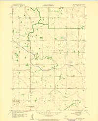
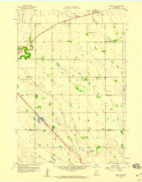
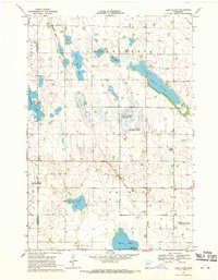
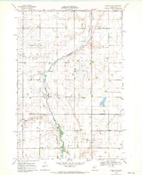
 1958 Murdock1959 Print · USGSThe town of Murdock and the surrounding Minnesota prairie are captured here in the late fifties as the regional rail economy thrived. Genealogists and local historians can trace the early layout of Murdock, the location of Calvary Cemetery, and the wetlands surrounding Shakopee Lake.3 unique versions available
 - 1958 Map of Gracelock NE, 1959 Print
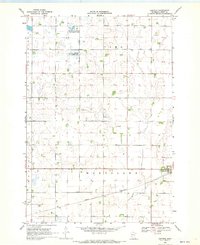
 1958 Gracelock NE1959 Print · USGSThe rural border of Swift and Chippewa Counties is captured here in the late fifties, showcasing a landscape dense with small township schoolhouses. Genealogists and local historians can trace legacy sites like St Johns Ch or any of several local landmarks like School No 2197 and School No 306.3 unique versions available
 - 1958 Map of Big Bend City, 1959 Print
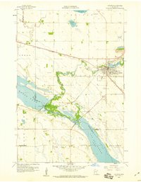
 1958 Big Bend City1959 Print · USGSThe rural border of Swift and Chippewa Counties comes alive in this late 1950s survey of the river valley. Genealogists can locate family landmarks across the townships, from West Bank Ch to numerous schoolhouses like School No 2234.2 unique versions available
 - 1958 Map of Kerkhoven, 1959 Print
 1958 Kerkhoven1959 Print · USGSKerkhoven and the surrounding Minnesota prairie appear here in the late fifties, centered on the Great Northern rail corridor. Genealogists and local historians can locate early landmarks like Hillside Cem, West Salem Cem, and the waters of School Lake.3 unique versions available
 - 1958 Map of Milan NW, 1959 Print
 1958 Milan NW1959 Print · USGSThe rural prairie of Swift County comes into focus in the late fifties, showcasing a landscape of section-line roads and active rail corridors. Genealogists and local historians can locate early landmarks like St Josephs Cem, School No 2225, and the village of Holloway.
 - 1958 Map of Appleton, 1960 Print
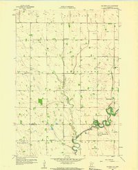
 1958 Appleton1960 Print · USGSAppleton and the surrounding prairies of Swift County are documented here in the late fifties, where the river systems dominate the terrain. Genealogists and local historians can trace family-named sites like Appleton Cem, the Minnesota Valley Ch, and the old rail lines of the Great Northern.2 unique versions available
 - 1958 Map of Pennock, 1960 Print
 1958 Pennock1960 Print · USGSKandiyohi County was defined by its prairie wetlands and the steel of the mid-century rail era. You can trace the development of small-town life through locations like Pennock, the rural Town Hall, and local landmarks like Mamré Lund Ch or School No 780.2 unique versions available
 - 1958 Map of Gracelock NW, 1960 Print
 1958 Gracelock NW1960 Print · USGSAgricultural life in Swift County is captured here in the late fifties, a time when small rural schools still dotted every few miles of the prairie. Genealogists can trace family footprints near Trinity Ch, the Big Bend Cem, and numerous numbered sites like School No 2201.2 unique versions available
 - 1968 Map of De Graff, 1970 Print
 1968 De Graff1970 Print · USGSDe Graff and the surrounding Kildare township are captured here in the late sixties, showing a landscape defined by the Great Northern rail line and prairie wetlands. Genealogists can locate St Bridget Cem, Bethesda Ch, and rural gravel pits scattered across the Chippewa River basin.
 - 1968 Map of Dry Wood Lake, 1970 Print
 1968 Dry Wood Lake1970 Print · USGSThe Stevens and Swift County borderlands are preserved here in the late sixties, a landscape defined by glacial lakes and wildlife conservation. Genealogists and researchers can trace rural community hubs like Trinity Ch Cem, St Agnes Ch, and the shores of Dry Wood Lake.
 - 1968 Map of Lake Oliver, 1970 Print
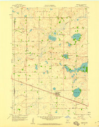
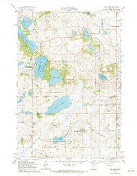
 1968 Lake Oliver1970 Print · USGSSwift and Big Stone Counties are shown here in the late sixties, a landscape defined by glacial lakes and dedicated wildlife management. Genealogists and local historians can locate Immanuel Ch, Waldrum Cem, and the old Townhall among the prairie potholes.
 - 1968 Map of Danvers, 1970 Print
 1968 Danvers1970 Print · USGSDanvers and the surrounding prairie of Swift County are captured here in the late sixties as the region's agricultural character remained firmly intact. Researchers can trace the Great Northern rail corridor and identify early conservation tracts like the National Wildlife Management Area.
 - 1968 Map of Hancock, 1970 Print
 1968 Hancock1970 Print · USGSHancock and the surrounding Stevens County prairies are documented here in the late sixties as the region balanced farming with conservation. Researchers can trace the Great Northern rail line and locate community landmarks like Bethel Ch, Byrne Lake, and the local Townhall.
 - 1968 Map of Lake Hassel, 1970 Print
 1968 Lake Hassel1970 Print · USGSThe rural borderlands of Pope and Swift counties are shown in the late sixties, a landscape of prairie potholes and township grids. Genealogists can locate family landmarks like the Ellerson-Mortenson Cem, East Zion Ch, and the local Townhall.
 - 1968 Map of Benson, 1970 Print
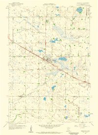
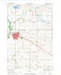 1968 Benson1970 Print · USGSBenson was a thriving rail hub in Swift County during the late sixties, centered on the Great Northern Railroad. Researchers can trace local genealogy and civic life through landmarks like St Francis Cem, School No 2191, and the Courthouse.
 - 1968 Map of Lake Simon, 1970 Print
 1968 Lake Simon1970 Print · USGSCentral Minnesota's glacial prairie pothole region is captured here in the late sixties, showcasing a landscape defined by water and wildlife management. Local historians can trace family roots at the Lake Johanna Church, Cem West, and the rural Townhall.2 unique versions available
 - 1968 Map of Hancock SW, 1970 Print
 1968 Hancock SW1970 Print · USGSNear the Stevens and Swift county line in the late sixties, the village of Holloway stands as a rail hub along the Great Northern. Local historians can trace several pioneer burial grounds like Smith-Kepner Cem and Immanuel Cem near the winding Pomme De Terre River.2 unique versions available
 - 1968 Map of Clontarf North, 1970 Print
 1968 Clontarf North1970 Print · USGSPope and Swift Counties were defined by rail-side settlements and prairie wetlands in the late sixties. Genealogists and local historians can trace the foundations of Clontarf along the Great Northern tracks and locate family sites near St Malachy Cem.
 - 1968 Map of Hancock NW, 1970 Print
 1968 Hancock NW1970 Print · USGSStevens and Swift Counties are captured in the late sixties, showing a landscape defined by the Pomme De Terre River and rural townships. Genealogists can locate family landmarks like Zion Cem, the Apostolic Ch, and the settlement of Fairfield.2 unique versions available
 - 1968 Map of Swift Falls, 1970 Print
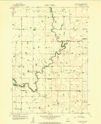
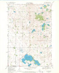
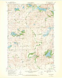 1968 Swift Falls1970 Print · USGSIn the late sixties, the Swift Falls area was a mosaic of glacial lakes and prairie wetlands preserved by several wildlife management areas. Genealogists and historians can trace local landmarks like School No 2241, an Old Railroad Grade, and the Cem near Swift Falls.
Showing maps 1-25 of 139
Top cities of Swift County
- Benson historical maps
- Appleton historical maps
- Kerkhoven historical maps
- Murdock historical maps
- Clontarf historical maps
- Fairfield historical maps
See more
Frequently asked questions
- What are the different types of historical maps available for Swift County?
- What is the oldest map of Swift County?
- Where can I purchase historical maps of Swift County for my home or office?
- Where can I download high-res historical maps of Swift County?
- Are there historical topographic maps available for Swift County?
- Is there historical aerial imagery available for Swift County?
- Where are historical maps of Swift County sourced from?