1970s Maps of Watonwan County, Minnesota
Explore 6 historic maps of Watonwan County from the 1970s. These maps offer a rare glimpse into what life looked like during the 1970s — showing old roads, neighborhoods, homes, and landmarks that have changed or disappeared over time.
Whether you're researching your family's past, planning a metal detecting trip, or studying how Watonwan County's landscape evolved across the 1970s, these high-resolution maps are a powerful tool for exploring the history of this region.
- Focus on a specific era: All maps on this page are from the 1970s, giving you a focused view of this time period.
- See what’s changed: Compare century-old streets, trails, and buildings to today's modern landscape using overlays and satellite layers.
- Research with precision: Use these maps for genealogy, historical research, land use analysis, or educational projects.
- View, download, or print: Maps are fully viewable online in high resolution, and can be downloaded or printed for your own records.
Start exploring Watonwan County's history through authentic maps from the 1970s. This is your window into the past.
Watonwan County, MN maps
(6)- 1970 Map of St James SE, 1972 Print
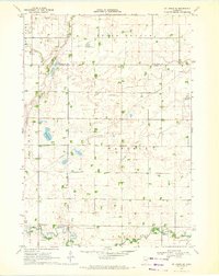 1970 St James SE1972 Print · USGSMartin County agriculture and rural life take center stage in the early seventies, showing a landscape defined by prairie drainage and small townships. Researchers can locate the North Star Cem, the Waverly Ch, and various water bodies like Round Lake and Fox Lake.
 - 1970 Map of Butterfield, 1972 Print
 1970 Butterfield1972 Print · USGSButterfield and the surrounding farm country are captured here in the early 1970s as the rail-and-river economy persisted. Genealogists and local historians can locate the Mennonite Cem, trace the Chicago and North Western rail line, or explore the shores of Sulem Lake.
 - 1970 Map of St James West, 1972 Print
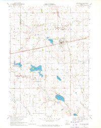
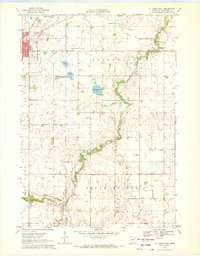
 1970 St James West1972 Print · USGSWatonwan County's agricultural and rail heartland is captured here in the early seventies, centered on the growing community of St James. Genealogists and local historians can trace rural roots through landmarks like Kansas Lake Ch, the settlement of Echols, and the prominent Chicago and North Western rail line.2 unique versions available
 - 1970 Map of Trimont, 1972 Print
 1970 Trimont1972 Print · USGSThe rail-and-water landscape of Martin and Watonwan Counties is captured here in the early seventies. Genealogists and local historians can trace family roots through the grain-and-rail economy of Trimont, the small-town streets of Odin, and the Cedar Lake Cem.
 - 1970 Map of Mountain Lake SE, 1972 Print
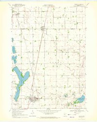
 1970 Mountain Lake SE1972 Print · USGSSouthern Minnesota farm country is captured here in the early seventies as a network of creek-fed townships across four county lines. Genealogists and local historians can trace legacy landmarks like St Olaf Ch Cem, Cedar Hill Cem, and the waters of Fish Lake.
 - 1970 Map of St James East, 1972 Print
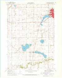
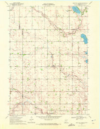
 1970 St James East1972 Print · USGSWatonwan County in the early seventies shows a landscape of steady agricultural management and growing civic infrastructure. Genealogists and local historians can trace the Chicago and North Western rail corridor and find family landmarks like Mt Hope Cem or the village of South Branch.
End of results
Showing maps 1-6 of 6
Top cities of Watonwan County
- Madelia historical maps
- Butterfield historical maps
- South Branch historical maps
- Lewisville historical maps
- Darfur historical maps
- Odin historical maps
See more
Frequently asked questions
- What are the different types of historical maps available for Watonwan County?
- What is the oldest map of Watonwan County?
- Where can I purchase historical maps of Watonwan County for my home or office?
- Where can I download high-res historical maps of Watonwan County?
- Are there historical topographic maps available for Watonwan County?
- Is there historical aerial imagery available for Watonwan County?
- Where are historical maps of Watonwan County sourced from?