Old Maps of Watonwan County, Minnesota for Genealogy
Trace your family roots with 99 historic maps of Watonwan County. These high-res maps reveal old neighborhoods, homesites, landmarks, and streets — helping you uncover where your ancestors lived and how the area evolved over time.
- Explore historic neighborhoods: Identify where your relatives may have lived in the 1800s or 1900s.
- Compare maps over time: Trace the changes in streets, buildings, and landmarks for multi-generational research.
- Perfect for genealogy & ancestry research: Used by family historians and researchers to map out lineage and migration.
These maps are an incredible resource for exploring your personal connection to Watonwan County's past.
Watonwan County, MN maps
(99)- 1953 Map of New Ulm, 1968 Print
 1953 New Ulm1968 Print · USGSSouthern Minnesota in the mid-1950s is defined by its deep river valleys and the expanding reach of the Great Northern and Chicago and North Western railroads. Researchers can trace rural lineages through landmarks like the Milford State Monument, St. John's Ch, and the Upper Sioux Indian Res.3 unique versions available
 - 1954 Map of Fairmont, 1967 Print
 1954 Fairmont1967 Print · USGSThe prairie landscape of southern Minnesota and northern Iowa comes alive in this mid-century survey of the Coteau des Prairies. Genealogists and historians can trace the rail-connected growth of Fairmont and Blue Earth or locate family roots near St Kilian Ch and Union Slough National Wildlife Refuge.3 unique versions available
 - 1957 Map of New Ulm
 1957 New Ulm1957 Print · USGSCentral Minnesota in the mid-fifties remains a landscape of river-valley commerce and prairie agriculture defined by its historic mission sites and rail towns. Genealogists and local historians can trace the development of New Ulm and Montevideo, or locate specific landmarks like the Milford State Monument and Minnesota Falls.
 - 1958 Map of New Ulm
 1958 New Ulm1958 Print · USGSSouth-central Minnesota’s river valleys and prairie towns are captured here in the mid-fifties, during the height of the region's rail-and-river economy. Genealogists and historians can trace the legacy of the Upper Sioux Indian Mission or locate early rail stops along the Chicago and North Western Ry in towns like Redwood Falls and Glencoe.
 - 1958 Map of Fairmont
 1958 Fairmont1958 Print · USGSThe borderlands of southern Minnesota and northern Iowa come alive in the mid-1950s, showing a landscape defined by glacial lakes and rail-line commerce. Researchers can trace historic landmarks like Lakeside Laboratory, Gridley Station, and the Bancroft Wildlife Refuge across the prairie.
 - 1965 Map of Madelia, 1966 Print
 1965 Madelia1966 Print · USGSMadelia and the surrounding prairie were reaching a peak of agricultural development in the mid-sixties. Trace the paths of the Chicago and North Western rail line and discover local landmarks like Linden Church, Fedje Lake, and the Riverside Dam along the Watonwan River.
 - 1965 Map of Perth, 1966 Print
 1965 Perth1966 Print · USGSThe Watonwan River valley and surrounding prairie townships are captured here in the mid-1960s. Genealogists and local historians can trace the rural landscape through the North Lincoln Cem, the town of Perth, and the Lincoln Ch along the Chicago and North Western line.
 - 1967 Map of New Ulm
 1967 New Ulm1967 Print · USGSSouthern Minnesota in the mid-fifties is captured here as a landscape of river-valley missions and busy prairie rail towns. Researchers can trace the Yellow Medicine Trail and locate historic sites like the Morton Indian Mission and Milford State Monument.
 - 1967 Map of Truman, 1968 Print
 1967 Truman1968 Print · USGSIn the mid-1960s, the agricultural landscape around Truman was a busy corridor for the Chicago and North Western railway. Genealogists can trace family history through several rural cemeteries, including Ridge Lawn and Westford, while others may locate the historic Horicon Church.
 - 1967 Map of Truman SE, 1968 Print
 1967 Truman SE1968 Print · USGSMartin County and its neighbors show a highly managed agricultural landscape in the late sixties, shaped by an extensive system of judicial ditches. Genealogists and local historians can locate Nashville Center, trace family roots at Brainard Ch, and find the local Townhall.
 - 1967 Map of Willow Creek, 1968 Print
 1967 Willow Creek1968 Print · USGSSouthern Minnesota farmland at the edge of Blue Earth County is meticulously mapped here just as the mid-century agricultural landscape reached its peak. Researchers can trace rural life through sites like Willow Creek, the North St Johns Cemetery, and several old schoolhouses including School No 98.
 - 1967 Map of Lewisville, 1968 Print
 1967 Lewisville1968 Print · USGSThe Watonwan County prairie in the mid-sixties centered on the rail-side community of Lewisville. Genealogists and local researchers can trace the locations of rural schoolhouses like Lone Star Sch and the quiet grounds of Antrim Cem.
 - 1967 Map of Godahl, 1968 Print
 1967 Godahl1968 Print · USGSThe prairie landscape of southern Minnesota is captured here in the late sixties, where the Brown and Watonwan County border meets. Genealogists and local historians can trace the rural communities of Godahl and Sveadahl or locate the Albion Ch and East Sveadahl Ch.
 - 1967 Map of Darfur, 1968 Print
 1967 Darfur1968 Print · USGSThe rural landscape around Darfur in the late sixties reveals a community built on the rail and river networks of Southern Minnesota. Genealogists can locate family landmarks such as Bethlehem Cem, St Johns Cem, and School No 2492.
 - 1967 Map of La Salle, 1969 Print
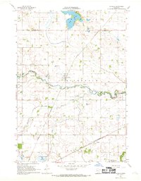 1967 La Salle1969 Print · USGSWatonwan County's agricultural heartland is documented here in the late sixties as the Chicago and North Western railway connected small prairie towns. Genealogists can locate family landmarks like Rosendale Ch and Grogan or trace the winding course of the Watonwan River.2 unique versions available
 - 1970 Map of St James SE, 1972 Print
 1970 St James SE1972 Print · USGSMartin County agriculture and rural life take center stage in the early seventies, showing a landscape defined by prairie drainage and small townships. Researchers can locate the North Star Cem, the Waverly Ch, and various water bodies like Round Lake and Fox Lake.
 - 1970 Map of Butterfield, 1972 Print
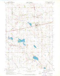 1970 Butterfield1972 Print · USGSButterfield and the surrounding farm country are captured here in the early 1970s as the rail-and-river economy persisted. Genealogists and local historians can locate the Mennonite Cem, trace the Chicago and North Western rail line, or explore the shores of Sulem Lake.
 - 1970 Map of St James West, 1972 Print
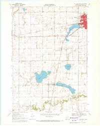 1970 St James West1972 Print · USGSWatonwan County's agricultural and rail heartland is captured here in the early seventies, centered on the growing community of St James. Genealogists and local historians can trace rural roots through landmarks like Kansas Lake Ch, the settlement of Echols, and the prominent Chicago and North Western rail line.2 unique versions available
 - 1970 Map of Trimont, 1972 Print
 1970 Trimont1972 Print · USGSThe rail-and-water landscape of Martin and Watonwan Counties is captured here in the early seventies. Genealogists and local historians can trace family roots through the grain-and-rail economy of Trimont, the small-town streets of Odin, and the Cedar Lake Cem.
 - 1970 Map of Mountain Lake SE, 1972 Print
 1970 Mountain Lake SE1972 Print · USGSSouthern Minnesota farm country is captured here in the early seventies as a network of creek-fed townships across four county lines. Genealogists and local historians can trace legacy landmarks like St Olaf Ch Cem, Cedar Hill Cem, and the waters of Fish Lake.
 - 1970 Map of St James East, 1972 Print
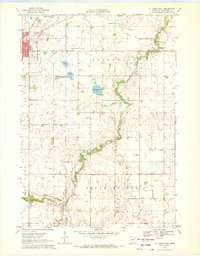 1970 St James East1972 Print · USGSWatonwan County in the early seventies shows a landscape of steady agricultural management and growing civic infrastructure. Genealogists and local historians can trace the Chicago and North Western rail corridor and find family landmarks like Mt Hope Cem or the village of South Branch.
 - 1985 Map of Fairmont, 1991 Print
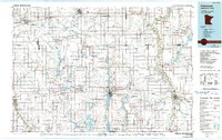 1985 Fairmont1991 Print · USGSSouthern Minnesota in the mid-eighties shows a robust network of prairie towns and rail-connected agricultural hubs. Genealogists can trace family footprints across Rolling Green and Manyaska or locate old homesteads near Fox Lake and the Chicago & North Western line.
 - 1986 Map of New Ulm
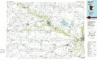 1986 New Ulm1986 Print · USGSSouthern Minnesota's river valleys and prairie townships are captured here in the mid-1980s, showcasing a landscape defined by agriculture and transit. Researchers can trace the Chicago and North Western rail lines through historic grain-stop towns like Sleepy Eye, Hanska, and Good Thunder.
 - 1991 Map of New Ulm
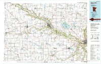 1991 New Ulm1991 Print · USGSThe Minnesota River valley serves as the backbone for this late-century look at the agricultural heartland between New Ulm and Mankato. Researchers can trace the layout of traditional prairie towns like Sleepy Eye and Madelia or explore recreation sites at Fort Ridgely State Park.
 - 2010 Map of Truman, 2010 Print
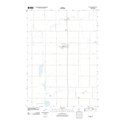 2010 Truman2010 Print · USGSMartin County agriculture and small-town life are preserved in this contemporary survey of the region surrounding Truman. Genealogists and local researchers can trace family plots across several sites, including Saint Paul Cemetery, True Farm Cemetery, and Horicon Cemetery.
Showing maps 1-25 of 99
Top cities of Watonwan County
- Madelia historical maps
- Butterfield historical maps
- South Branch historical maps
- Lewisville historical maps
- Darfur historical maps
- Odin historical maps
See more
Frequently asked questions
- What are the different types of historical maps available for Watonwan County?
- What is the oldest map of Watonwan County?
- Where can I purchase historical maps of Watonwan County for my home or office?
- Where can I download high-res historical maps of Watonwan County?
- Are there historical topographic maps available for Watonwan County?
- Is there historical aerial imagery available for Watonwan County?
- Where are historical maps of Watonwan County sourced from?