Old Maps of Winona, Minnesota
Explore 19 old maps of Winona, spanning from 1929 to today. These high-resolution historic maps reveal how streets, neighborhoods, landmarks, and natural features evolved over time — perfect for genealogy, metal detecting, research, and local history exploration.
What you can do with these maps:
- See how Winona changed over time: Compare historical maps to modern-day views to trace roads, homesites, rail lines & more.
- View detailed metadata: Each map includes creators, publishers, year, scale, and archive source.
- Overlay maps with satellite & LiDAR: Visualize the past alongside modern tools to explore terrain & human change.
- Trusted historical sources: Maps sourced from the USGS, Library of Congress, and other archives.
- Access maps your way: View online, download high-res files, or order prints for personal or research use.
Start exploring old maps of Winona to uncover forgotten places, hidden landmarks, and the deep history beneath your feet.
Winona, MN maps
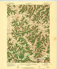
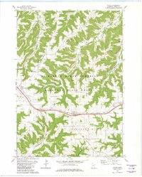
(19)- 1929 Map of Fountain City
 1929 Fountain City1929 Print · USGSCovers Winona, including Arcadia, Goodview, and other nearby areas2 unique versions available
 - 1934 Map of Winona, 1955 Print
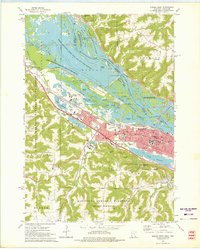
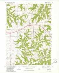
 1934 Winona1955 Print · USGSCovers Winona, including Arcadia, Goodview, and other nearby areas2 unique versions available
 - 1937 Map of Winona
 1937 Winona1937 Print · USGSCovers Winona, including Arcadia, Goodview, and other nearby areas3 unique versions available
 - 1953 Map of Eau Claire, 1965 Print
 1953 Eau Claire1965 Print · USGSCovers Winona, including Eau Claire, Marshfield, and other nearby areas4 unique versions available
 - 1958 Map of Eau Claire
 1958 Eau Claire1958 Print · USGSCovers Winona, including Eau Claire, Marshfield, and other nearby areas
 - 1958 Map of Houston, 1959 Print
 1958 Houston1959 Print · USGSCovers Winona, including Rushford, Wilson, and other nearby areas2 unique versions available
 - 1958 Map of La Crosse, 1979 Print
 1958 La Crosse1979 Print · USGSCovers Winona, including La Crosse, Onalaska, and other nearby areas2 unique versions available
 - 1961 Map of La Crosse
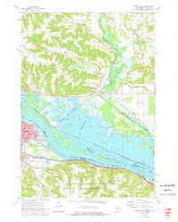
 1961 La Crosse1961 Print · USGSCovers Winona, including La Crosse, Onalaska, and other nearby areas
 - 1964 Map of Eau Claire
 1964 Eau Claire1964 Print · USGSCovers Winona, including Eau Claire, Marshfield, and other nearby areas
 - 1965 Map of La Crosse
 1965 La Crosse1965 Print · USGSCovers Winona, including La Crosse, Onalaska, and other nearby areas
 - 1972 Map of Winona West, 1975 Print
 1972 Winona West1975 Print · USGSCovers Winona, including Goodview, Fountain City, and other nearby areas3 unique versions available
 - 1972 Map of Winona East, 1975 Print
 1972 Winona East1975 Print · USGSCovers Winona, including Homer, Dodge, and other nearby areas3 unique versions available
 - 1972 Map of Fountain City, 1975 Print
 1972 Fountain City1975 Print · USGSCovers Winona, including Fountain City, Glencoe, and other nearby areas
 - 1976 Map of La Crosse
 1976 La Crosse1976 Print · USGSCovers Winona, including La Crosse, Onalaska, and other nearby areas
 - 1980 Map of Witoka
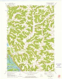
 1980 Witoka1980 Print · USGSCovers Winona, including Ridgeway, Witoka, and other nearby areas2 unique versions available
 - 1980 Map of Wilson
 1980 Wilson1980 Print · USGSCovers Winona, including Wilson, Hart, and other nearby areas2 unique versions available
 - 1984 Map of La Crosse, 1985 Print
 1984 La Crosse1985 Print · USGSCovers Winona, including La Crosse, Onalaska, and other nearby areas
 - 1985 Map of Winona
 1985 Winona1985 Print · USGSCovers Winona, including Holmen, Arcadia, and other nearby areas2 unique versions available
 - 1990 Map of La Crosse, 1991 Print
 1990 La Crosse1991 Print · USGSCovers Winona, including La Crosse, Onalaska, and other nearby areas
End of results
Showing maps 1-19 of 19
Top cities near Winona
- Arcadia historical maps
- Goodview historical maps
- Trempealeau historical maps
- Lewiston historical maps
- Homer historical maps
- Wilson historical maps
See more
Top neighborhoods of Winona
Frequently asked questions
- What are the different types of historical maps available for Winona?
- What is the oldest map of Winona?
- Where can I purchase historical maps of Winona for my home or office?
- Where can I download high-res historical maps of Winona?
- Are there historical topographic maps available for Winona?
- Is there historical aerial imagery available for Winona?
- Where are historical maps of Winona sourced from?