Old Maps of Otsego, Minnesota for Academic Research
Study the evolution of Otsego with 36 high-resolution historic maps. Whether you're teaching, researching, or modeling changes in land use, these maps provide essential visual documentation of urban, environmental, and geographic change.
- Analyze long-term change: Track patterns in development, transportation, and natural features.
- Ideal for environmental or urban studies: Support academic projects with primary historical map data.
- Use in the classroom or lab: Educators and researchers rely on these maps to bring historical context to life.
These maps are a powerful tool for teaching, research, and visualizing how Otsego has changed over the decades.
Otsego, MN maps
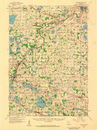
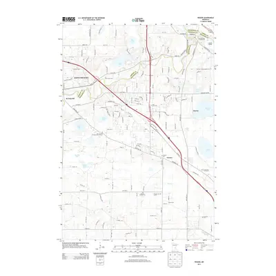
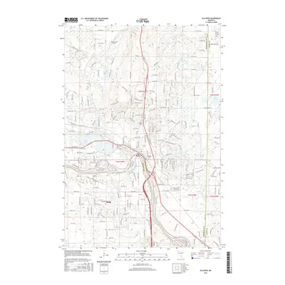
(36)- 1909 Map of Rockford
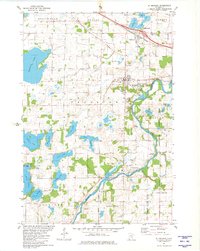
 1909 Rockford1909 Print · USGSWright and Hennepin counties are shown here in the first decade of the twentieth century as the railroads transformed rural Minnesota. Genealogists can locate family-named features like Berning Mill, Salem Church, and early schools in Burschville or Hassan.2 unique versions available
 - 1953 Map of Stillwater, 1980 Print
 1953 Stillwater1980 Print · USGSThe Twin Cities and the St. Croix Valley are captured in this mid-century survey as the interstate era began to transform the Upper Midwest. Genealogists and historians can trace the rail-and-river geography of Stillwater, locate landmarks in Anoka, or explore the sprawling St Croix State Park.
 - 1955 Map of Stillwater, 1965 Print
 1955 Stillwater1965 Print · USGSThe Upper St. Croix Valley and the growing Twin Cities area are shown here during the mid-fifties, before the interstate era transformed the regional commute. You can trace the lines of the Northern Pacific RR through towns like Rush City or locate the Saint Croix Indian Reservation.
 - 1958 Map of Stillwater
 1958 Stillwater1958 Print · USGSThe Upper Mississippi and St. Croix River valleys appear in the mid-fifties as the Twin Cities expanded north. Genealogists can locate family landmarks like Oak Park Cem, Saint Michael Church, and the Soo Line RR rail corridors.2 unique versions available
 - 1958 Map of Rockford, 1959 Print
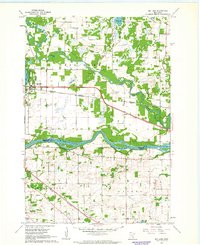
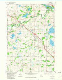
 1958 Rockford1959 Print · USGSWright and Hennepin counties are shown here in the late fifties, during a period of steady rural growth and agricultural stability. Researchers can trace ancestral roots at Berning Mill, find small country schoolhouses like Oakdale School, or locate parish centers such as St Michael Church.2 unique versions available
 - 1961 Map of Big Lake, 1963 Print
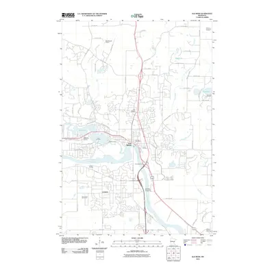
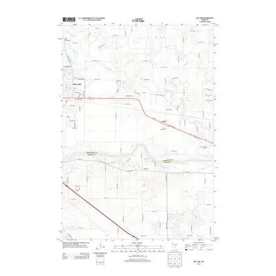
 1961 Big Lake1963 Print · USGSSherburne County and the upper Mississippi corridor are shown here in the early sixties as a network of rail and river commerce. Genealogists and local historians can trace the town of Big Lake, the settlement of Bailey, and the old Great Northern rail lines.2 unique versions available
 - 1961 Map of Elk River, 1963 Print
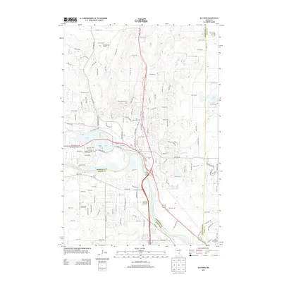
 1961 Elk River1963 Print · USGSElk River and the banks of the Mississippi River are captured here in the early sixties as the region's rail and water network defined local life. Genealogists and local historians can trace landmarks like St Andrews Cem, St Johns Sch, and the riverside powerplant.3 unique versions available
 - 1961 Map of Elk River, 1965 Print
 1961 Elk River1965 Print · USGSThe Elk River and Mississippi River valleys in the early 1960s showcase a landscape of shifting industry and conservation. Local researchers can trace family sites at Orrock Cem, find Zimmerman's post office, and locate the Sand Dunes Lookout Tower.
 - 1965 Map of Stillwater
 1965 Stillwater1965 Print · USGSThe Twin Cities and the St. Croix Valley are mapped here during a period of significant post-war growth and industrial transit. Genealogists and historians can trace rail lines like the Northern Pacific RR through towns such as Rush City, Amery, and Balsam Lake.
 - 1975 Map of Stillwater
 1975 Stillwater1975 Print · USGSThe Twin Cities and the St. Croix Valley are captured in the mid-seventies, showing the urban growth of Minneapolis and St Paul. Researchers can trace old rail corridors of the Northern Pacific RR and locate tribal lands at the Mille Lacs Indian Reservation.2 unique versions available
 - 1981 Map of St Michael
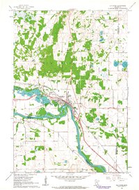
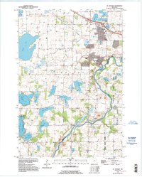
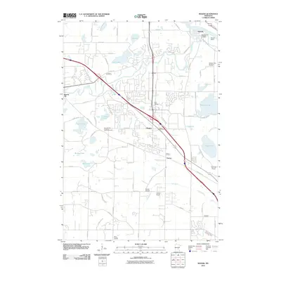
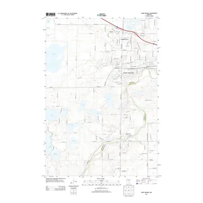
 1981 St Michael1981 Print · USGSIn the early 1980s, the growing communities of St Michael and Albertville were still defined by their local institutions and lakeside geography. Genealogists and historians can trace family locations through St Albert Cem, St Michael Cem, and the historic Berning Mill along the Crow River.
 - 1981 Map of Rogers
 1981 Rogers1981 Print · USGSNorth of Minneapolis in the early eighties, this area shows the transition from rural farming to industrial and suburban growth. Genealogists can trace family names at St Walburga Cem, St John the Baptist Cem, and the historic St John Ch.2 unique versions available
 - 1985 Map of Anoka
 1985 Anoka1985 Print · USGSThe northern Twin Cities suburbs and the Mississippi River valley are captured here in the mid-eighties as suburban growth began to meet rural conservation lands. Trace the expansion of Anoka and Blaine, or locate family landmarks near the Rum River and Buffalo Lake.
 - 1991 Map of Anoka, 1992 Print
 1991 Anoka1992 Print · USGSThe northern Twin Cities suburbs and the upper Mississippi River valley are captured here in the early nineties during a period of rapid suburban expansion. Trace the rail corridors of the Burlington Northern Railroad or explore the boundaries of the Sherburne National Wildlife Refuge and Lake Maria State Park.
 - 1991 Map of Big Lake, 1995 Print
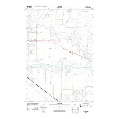
 1991 Big Lake1995 Print · USGSSherburne and Wright counties meet along the Mississippi River in this early 1990s survey of central Minnesota. Genealogists and local historians can trace the lakeside developments of Big Lake and Monticello or locate rural landmarks like the Cem at Bailey.
 - 1991 Map of St Michael, 1995 Print
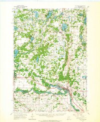
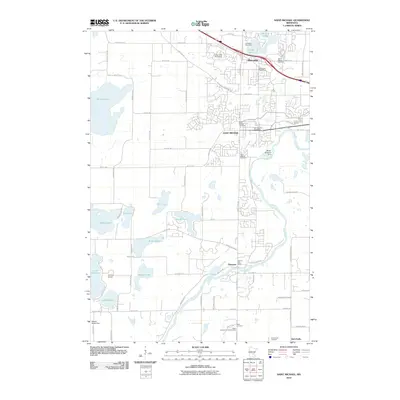
 1991 St Michael1995 Print · USGSWright and Hennepin counties meet at the bend of the Crow River in the early nineties, showing a region transitioning from rural townships to growing suburban centers. Trace local history through landmarks like Berning Mill, St Michael Ch, and the numerous lakes such as Pelican Lake.
 - 2010 Map of Elk River, 2010 Print
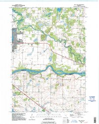
 2010 Elk River2010 Print · USGSCovers Otsego, including Ramsey, Elk River, and other nearby areas
 - 2010 Map of Big Lake, 2010 Print
 2010 Big Lake2010 Print · USGSCovers Otsego, including Elk River, Monticello, and other nearby areas
 - 2010 Map of Rogers, 2010 Print
 2010 Rogers2010 Print · USGSCovers Otsego, including Maple Grove, Ramsey, and other nearby areas
 - 2010 Map of Saint Michael, 2010 Print
 2010 Saint Michael2010 Print · USGSCovers Otsego, including St. Michael, Saint Michael, and other nearby areas
 - 2013 Map of Rogers, 2013 Print
 2013 Rogers2013 Print · USGSCovers Otsego, including Maple Grove, Ramsey, and other nearby areas
 - 2013 Map of Saint Michael, 2013 Print
 2013 Saint Michael2013 Print · USGSCovers Otsego, including St. Michael, Saint Michael, and other nearby areas
 - 2013 Map of Big Lake, 2013 Print
 2013 Big Lake2013 Print · USGSCovers Otsego, including Elk River, Monticello, and other nearby areas
 - 2013 Map of Elk River, 2013 Print
 2013 Elk River2013 Print · USGSCovers Otsego, including Ramsey, Elk River, and other nearby areas
 - 2016 Map of Elk River, 2016 Print
 2016 Elk River2016 Print · USGSCovers Otsego, including Ramsey, Elk River, and other nearby areas
Showing maps 1-25 of 36
Top cities near Otsego
- Brooklyn Park historical maps
- Plymouth historical maps
- Maple Grove historical maps
- Andover historical maps
- Ramsey historical maps
- Champlin historical maps
See more
Top neighborhoods of Otsego
- Highlands of RIver Pointe historical maps
- Riverpointe historical maps
- Harvest Run historical maps
- Riverplace historical maps
- Autumn Woods historical maps
- Prospect Pointe historical maps
See more
Frequently asked questions
- What are the different types of historical maps available for Otsego?
- What is the oldest map of Otsego?
- Where can I purchase historical maps of Otsego for my home or office?
- Where can I download high-res historical maps of Otsego?
- Are there historical topographic maps available for Otsego?
- Is there historical aerial imagery available for Otsego?
- Where are historical maps of Otsego sourced from?