Old Maps of Centerville, Mississippi
Explore 13 old maps of Centerville, spanning from 1940 to today. These high-resolution historic maps reveal how streets, neighborhoods, landmarks, and natural features evolved over time — perfect for genealogy, metal detecting, research, and local history exploration.
What you can do with these maps:
- See how Centerville changed over time: Compare historical maps to modern-day views to trace roads, homesites, rail lines & more.
- View detailed metadata: Each map includes creators, publishers, year, scale, and archive source.
- Overlay maps with satellite & LiDAR: Visualize the past alongside modern tools to explore terrain & human change.
- Trusted historical sources: Maps sourced from the USGS, Library of Congress, and other archives.
- Access maps your way: View online, download high-res files, or order prints for personal or research use.
Start exploring old maps of Centerville to uncover forgotten places, hidden landmarks, and the deep history beneath your feet.
Centerville, MS maps
(13)- 1940 Map of Seven Pines
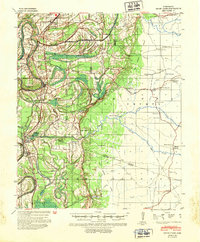 1940 Seven Pines1940 Print · USGSThe Yazoo River Delta and Carroll County hills meet in the 1940s, showing a landscape of river-bend towns and rural schools. Genealogists can locate family landmarks like Matthews Cem, Smith Chapel, and the riverside rail stop at Sidon.
 - 1953 Map of Greenwood, 1966 Print
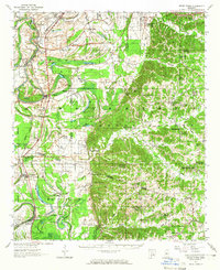
 1953 Greenwood1966 Print · USGSThe Mississippi Delta in the mid-fifties is captured here as a thriving network of river towns, railroads, and oxbow lakes. Researchers can trace the legacy of the Illinois Central Railroad and locate landmarks like the State Penal Farm and Greenville Air Force Base.5 unique versions available
 - 1956 Map of Greenwood
 1956 Greenwood1956 Print · USGSThe Mississippi Delta in the mid-fifties is captured here during a period of significant military and agricultural activity. Researchers can trace the rail lines of the Illinois Central RR, find the Greenville Air Force Base, or locate the State Penal Farm.
 - 1957 Map of Seven Pines, 1965 Print
 1957 Seven Pines1965 Print · USGSThe Yazoo River bottomlands and Carroll County bluffs meet in the late fifties, showing a landscape defined by oxbow lakes and rural railroad towns. Genealogists can trace family names through dozens of upland sites like McMillian Cem and Harmony Ch & Cem.
 - 1958 Map of Seven Pines
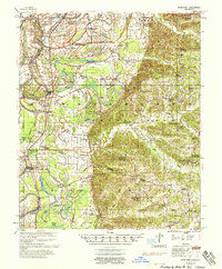 1958 Seven Pines1958 Print · USGSThe Yazoo River Delta meets the Carroll County hills in the late fifties, showcasing a landscape of oxbow lakes and upland ridges. Researchers can locate Indian Mounds, the Greenwood Air Base, and numerous country churches like Shiloh Ch & Cem.
 - 1982 Map of Gravel Hill
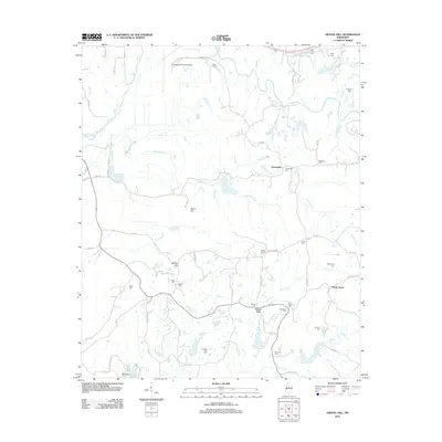
 1982 Gravel Hill1982 Print · USGSCarroll County settlements and family histories are well-preserved in this 1980s map of the hill country. Genealogists can trace family connections at Smith Chapel Cem, Gravel Hill, and the Sharkey Pate Cem.
 - 1984 Map of Indianola, 1985 Print
 1984 Indianola1985 Print · USGSThe Mississippi Delta of the mid-1980s reveals a landscape of fertile bottomlands shaped by the Sunflower River and Yazoo River. Researchers can trace the rail-and-river economy through landmarks like Saints College, the Leflore Cemetery, and the Columbus and Greenville Railway.
 - 1994 Map of Indianola
 1994 Indianola1994 Print · USGSThe Mississippi Delta's rich agricultural heartland is documented here in the mid-1990s, showing a landscape defined by meandering rivers and rail lines. Genealogists and historians can trace family roots in rural settlements like Nitta Yuma and Midnight or locate the sprawling Yazoo National Wildlife Refuge.
 - 2012 Map of Gravel Hill, 2012 Print
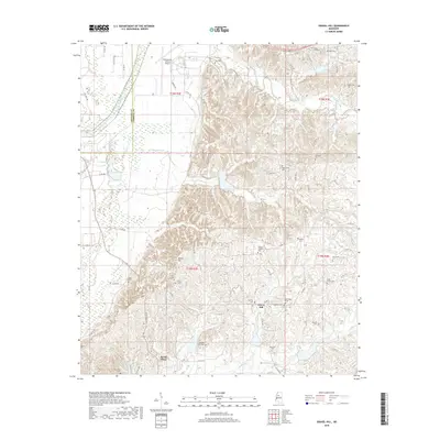
 2012 Gravel Hill2012 Print · USGSCovers Centerville, including Gravel Hill, Shady Grove, and other nearby areas
 - 2015 Map of Gravel Hill, 2015 Print
 2015 Gravel Hill2015 Print · USGSCovers Centerville, including Gravel Hill, Shady Grove, and other nearby areas
 - 2018 Map of Gravel Hill, 2018 Print
 2018 Gravel Hill2018 Print · USGSCovers Centerville, including Gravel Hill, Shady Grove, and other nearby areas
 - 2020 Map of Gravel Hill, 2020 Print
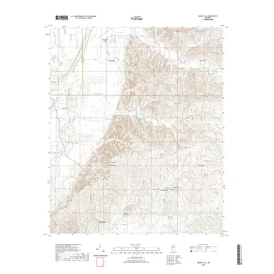 2020 Gravel Hill2020 Print · USGSCovers Centerville, including Gravel Hill, Shady Grove, and other nearby areas
 - 2024 Map of Gravel Hill, 2024 Print
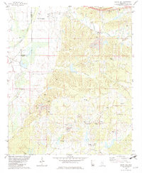
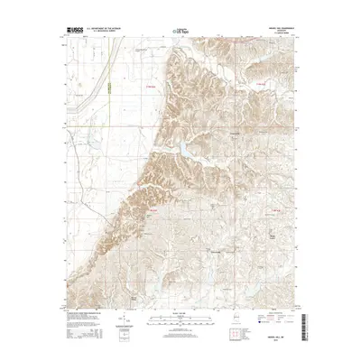
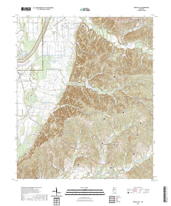 2024 Gravel Hill2024 Print · USGSThe Carroll County hills are documented here in the early twenty-first century, showing a landscape rich with family heritage and rural landmarks. Genealogists can locate numerous burial sites and congregations such as New Shiloh Baptist Cem and Gravel Hill.
End of results
Showing maps 1-13 of 13
Top cities near Centerville
- Greenwood historical maps
- Sidon historical maps
- North Carrollton historical maps
- Cruger historical maps
- Carrollton historical maps
Frequently asked questions
- What are the different types of historical maps available for Centerville?
- What is the oldest map of Centerville?
- Where can I purchase historical maps of Centerville for my home or office?
- Where can I download high-res historical maps of Centerville?
- Are there historical topographic maps available for Centerville?
- Is there historical aerial imagery available for Centerville?
- Where are historical maps of Centerville sourced from?