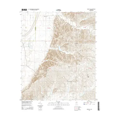
2015 Map of Gravel Hill
USGS Topo · Published 2015About this map
The boundary between Leflore Co and Carroll Co splits a landscape of flat delta plains and rising loess bluffs. This 2015 survey reveals a pattern of rural settlement anchored by historic family and community burying grounds. Significant sites like Sharkey Pate Cem and Smiths Chapel Cem are tucked into the drainages of Merrill Br and Abotcaputa Cr, illustrating the deep-rooted genealogical heritage of this area. The northwestern corner transitions into the flatlands supporting the Greenwood-Leflore Airport, while the eastern portion climbs into the higher elevations of Millers Hill and Steen Hill. These small communities, including Gravel Hill and Seven Pines, remain connected by a dense network of county roads like Fairview Rd and Co Road 169, which follow the contours of the rolling upland terrain.
Find a feature on this map
68 named features on this map. Tap any name to fly to it.
Don’t see what you’re looking for? This feature index may not catch every label — zoom into the map to look around manually.
Map Details
Editions of this 2015 Gravel Hill Map
This is the sole edition of this map. No revisions or reprints were ever made.
Other maps of this area

1936 · Greenwood
USGS Topo · 1:62,500

1940 · Seven Pines
USGS Topo · 1:62,500

1940 · Greenwood
USGS Topo · 1:62,500

1953 · Greenwood
USGS Topo · 1:250,000

1953 · West Point
USGS Topo · 1:250,000

1954 · McCarley
USGS Topo · 1:62,500

1956 · Greenwood
USGS Topo · 1:250,000

1957 · Greenwood
USGS Topo · 1:62,500

1957 · Seven Pines
USGS Topo · 1:62,500

1958 · West Point
USGS Topo · 1:250,000