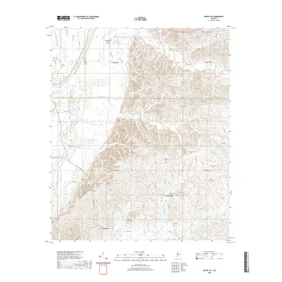
2020 Map of Gravel Hill
USGS Topo · Published 2020About this map
The border of Leflore and Carroll counties runs through this landscape defined by high ridges and numerous small cemeteries. The terrain transitions from the flatter lands near the Greenwood Leflore Airport in the northwest toward the more complex topography of Steen Hill and Miller's Hill. This area is characterized by a high density of small family or community burial grounds, such as Centerville Cem, Goss Cem, and Sharkey Pate Cem, indicating a deeply rooted rural settlement pattern. Numerous seasonal waterways, including Abotcaputa Creek and Merrill Branch, drain the hills into larger systems like Coila Creek to the south. Small crossroads settlements like Seven Pines and Gravel Hill serve as local anchors for a network of county roads that navigate the varying elevations.
Find a feature on this map
81 named features on this map. Tap any name to fly to it.
Don’t see what you’re looking for? This feature index may not catch every label — zoom into the map to look around manually.
Map Details
Editions of this 2020 Gravel Hill Map
This is the sole edition of this map. No revisions or reprints were ever made.
Other maps of this area

1936 · Greenwood
USGS Topo · 1:62,500

1940 · Seven Pines
USGS Topo · 1:62,500

1940 · Greenwood
USGS Topo · 1:62,500

1953 · Greenwood
USGS Topo · 1:250,000

1953 · West Point
USGS Topo · 1:250,000

1954 · McCarley
USGS Topo · 1:62,500

1956 · Greenwood
USGS Topo · 1:250,000

1957 · Greenwood
USGS Topo · 1:62,500

1957 · Seven Pines
USGS Topo · 1:62,500

1958 · West Point
USGS Topo · 1:250,000