Old Maps of Copiah County, Mississippi for Hiking & Exploration
Hike through history with 141 historic maps of Copiah County. Explore old trails, ghost towns, and forgotten backroads — perfect for outdoor adventurers and local explorers.
- Rediscover forgotten places: Map out old mining camps, roads, and footpaths that no longer exist on modern maps.
- Layer with modern tools: Combine with LiDAR or satellite views to plan hikes through historical terrain.
- Made for exploration: Popular among hikers, overlanders, and local history lovers.
Use these maps to find adventure and explore the hidden past of Copiah County.
Copiah County, MS maps
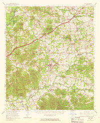
(141)- 1903 Map of Jackson
 1903 Jackson1903 Print · USGSCentral Mississippi at the dawn of the new century shows a landscape transformed by expanding rail lines and river commerce. Genealogists and researchers can trace family roots through early settlements like Pocahontas, Ridgeland, and Clinton or locate the historic Asylum grounds.
 - 1906 Map of Florence, 1965 Print
 1906 Florence1965 Print · USGSThe rural landscapes of Rankin and Hinds Counties are captured here at the start of the century, centered on the growing rail hub of Florence. Genealogists can trace old family locales through numerous landmarks like Hickory Ridge School, Ebenezer Church, and the winding Pearl River.
 - 1908 Map of Florence
 1908 Florence1908 Print · USGSCentral Mississippi at the dawn of the twentieth century shows a landscape of rail-dependent villages and rural schoolhouses. Genealogists can trace family roots through sites like Monterey, Poplar Springs Church, and Steepbank School.2 unique versions available
 - 1937 Map of Terry
 1937 Terry1937 Print · USGSHinds County is captured here in the late thirties, showing a rural landscape defined by the Illinois Central Railroad and its farming hubs. Researchers can trace family roots through numerous small-scale landmarks, including Hester Rosenwald Sch, Morgans Store, and Salmon Cem.3 unique versions available
 - 1943 Map of Terry
 1943 Terry1943 Print · USGSSouthern Hinds County in the late thirties is a landscape of rural crossroads and rail-connected settlements like Terry. Genealogists and historians can locate numerous country schools and churches such as Taylor Grove Sch, Mt Beulah Ch, and the landmark Morgan Store.2 unique versions available
 - 1953 Map of Natchez, 1966 Print
 1953 Natchez1966 Print · USGSSouthwest Mississippi and the Louisiana border country come alive in this mid-century survey of the river valley and forest lands. Researchers can trace the rail lines of the Illinois Central RR and locate rural hubs like Gloster and Ferriday.3 unique versions available
 - 1955 Map of Jackson
 1955 Jackson1955 Print · USGSThe Lower Mississippi Valley at the middle of the century reveals a landscape of deep river meanders and growing rail hubs. Genealogists and historians can trace the mid-century footprints of Vicksburg National Military Park, old river landings at Port Gibson, and the rail corridors of the Illinois Central Railroad.3 unique versions available
 - 1956 Map of Natchez
 1956 Natchez1956 Print · USGSThe Mississippi River borderlands and the Pine Hills come alive in this mid-fifties study of the Natchez region. Genealogists and historians can trace rail-era towns along the Illinois Central RR and explore the oxbows of Lake Bruin and Lake Concordia.
 - 1959 Map of Natchez
 1959 Natchez1959 Print · USGSSouthwestern Mississippi and eastern Louisiana are captured in the late fifties, showing a landscape defined by the winding Mississippi River and the timbered Homochitto National Forest. Researchers can trace the sprawling Illinois Central RR and find rural landmarks like Union Church and Camp Van Dorn (Abandoned).
 - 1961 Map of Jackson
 1961 Jackson1961 Print · USGSThe Lower Mississippi Delta and the state capital area are captured here during the post-war era of infrastructure expansion. Researchers can trace the complex river oxbows and rail lines connecting Vicksburg, Yazoo City, and the Illinois Central Railroad network.
 - 1962 Map of Jackson
 1962 Jackson1962 Print · USGSThe Mississippi Delta and the state capital region are mapped here in the early sixties, showing a landscape defined by the great river and the growing city of JACKSON. Genealogists can trace family roots through numerous landmarks like Cedar Hill Cem, rural stops on the Illinois Central RR, and historic sites like Champion Hill.2 unique versions available
 - 1962 Map of Utica West, 1964 Print
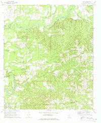
 1962 Utica West1964 Print · USGSThe Old Indian Treaty Boundary still defines the landscape of Hinds and Copiah counties in the early sixties as rural life centered on the Illinois Central railroad. Researchers can trace family history through dozens of rural landmarks like Reedtown, Seven Star Ch, and Fatherree Cem.
 - 1963 Map of Dentville NW, 1964 Print
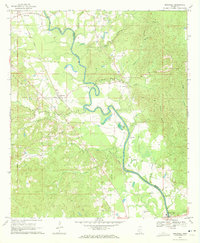
 1963 Dentville NW1964 Print · USGSThe rural borderlands of Claiborne and Copiah Counties are captured here in the early sixties, centered on the winding Bayou Pierre. Genealogists and historians can trace the Old Indian Treaty Boundary and locate numerous family landmarks like Meadows Store, Little Zion Church, and the Bethel Cemeteries.
 - 1963 Map of Dentville, 1964 Print
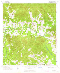 1963 Dentville1964 Print · USGSThe Copiah County countryside near Dentville is captured here in the early sixties, showing a landscape defined by the winding Bayou Pierre. Genealogists and local historians can trace rural roots at Houdtown, Willing, and numerous country churches like Pleasant Hill Ch.3 unique versions available
 - 1963 Map of Crystal Springs, 1964 Print
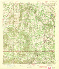
 1963 Crystal Springs1964 Print · USGSMid-century Copiah County comes to life as a hub for sand and gravel extraction and rail transport along the Gulf Mobile and Ohio. Genealogists can locate family landmarks such as Holtzclaw Sch, Poplar Springs Cem, and the Red Barn Ch.2 unique versions available
 - 1963 Map of Smyrna, 1964 Print
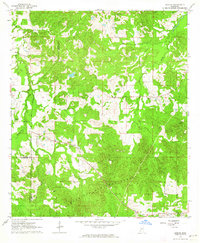
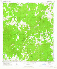 1963 Smyrna1964 Print · USGSRural Copiah County in the early sixties reveals a landscape of tight-knit communities and winding creek valleys. Genealogists and historians can trace family locations near Smyrna, Kaywood Plantation, and numerous country churches like Antioch Ch and New Zion Ch.2 unique versions available
 - 1963 Map of Utica East, 1964 Print
 1963 Utica East1964 Print · USGSHinds and Copiah Counties come alive in the early sixties as a region of winding creeks and rural academic life. Genealogists and local historians can trace family roots at St John Ch Cem, Strawbridge Ch, and the grounds of Utica Junior College.2 unique versions available
 - 1963 Map of Gallman, 1964 Print
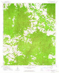
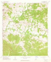
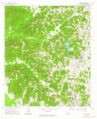 1963 Gallman1964 Print · USGSThe rural landscape of Copiah County is documented here during the early sixties, centered on the railroad community of Gallman. Local historians can trace family roots through the many rural churches and cemeteries, including New Pisgah Ch, Alford Cem, and the waters of Lake Copiah.3 unique versions available
 - 1963 Map of Hazlehurst, 1964 Print
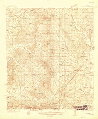
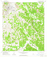
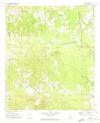
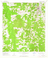 1963 Hazlehurst1964 Print · USGSHazlehurst and the surrounding Copiah County hill country are captured here in the early sixties, centered on the vital Illinois Central rail line. Family historians can trace deep roots through local landmarks like Martinsville, Antioch Ch, and the Pleasant Grove Ch & Cem.2 unique versions available
 - 1963 Map of Barlow, 1964 Print
 1963 Barlow1964 Print · USGSSouthwestern Mississippi's rural interior is captured in the early 1960s, showing a landscape defined by forest and frontier history. Researchers can find old family landmarks and the Old Indian Treaty Boundary alongside Barlow, Hawkins Cem, and Mt Zion Ch.
 - 1963 Map of Shady Grove, 1964 Print
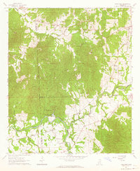
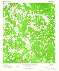 1963 Shady Grove1964 Print · USGSThe rural pine woods of Copiah County are captured here in the early sixties as small farming communities and timberlands defined the area. Genealogists and local historians can trace family-named sites like Russell-Tillman Cem, Shady Grove, and Sardis Ch.2 unique versions available
 - 1965 Map of Utica, 1967 Print
 1965 Utica1967 Print · USGSHinds and Copiah counties in the mid-1960s reveal a landscape of rural schools and rail-side towns. Genealogists can trace family roots through sites like Cayuga Sch, Utica Junior College, and the Seven Star Cem.2 unique versions available
 - 1970 Map of Hopewell, 1972 Print
 1970 Hopewell1972 Print · USGSThe Pearl River valley at the start of the seventies serves as a preserved record of rural life along the Copiah-Simpson county line. Genealogists and local historians can trace the foundations of communities like Gatesville and Reno or locate family sites at Zion Hill Cem and Brushy Creek Ch.2 unique versions available
 - 1971 Map of Schley, 1973 Print
 1971 Schley1973 Print · USGSThe confluence of the Strong and Pearl Rivers defined rural life in Simpson County during the early seventies. Genealogists can locate family landmarks like Armstrong-Buckley Cem and rural centers such as Schley or Bridgeport.2 unique versions available
 - 1971 Map of Oma, 1973 Print
 1971 Oma1973 Print · USGSThe rural borderlands of Lawrence and Copiah Counties are captured here in the early 1970s along the winding Pearl River. Researchers can trace family history through sites like Bahala Chapel Cem, the rail stop at Oma, and the Gulf Mobile and Ohio line.2 unique versions available
Showing maps 1-25 of 141
Top cities of Copiah County
- Crystal Springs historical maps
- Hazlehurst historical maps
- Wesson historical maps
- Georgetown historical maps
- Beauregard historical maps
Frequently asked questions
- What are the different types of historical maps available for Copiah County?
- What is the oldest map of Copiah County?
- Where can I purchase historical maps of Copiah County for my home or office?
- Where can I download high-res historical maps of Copiah County?
- Are there historical topographic maps available for Copiah County?
- Is there historical aerial imagery available for Copiah County?
- Where are historical maps of Copiah County sourced from?